Latest Round Of Winter Weather Settles Into Area
PITTSBURGH (KDKA) – A late-season blast of winter weather has settled into the area and is expected to stick around for the remainder of the day.
By noon, the system was mostly rain in the Pittsburgh area, but counties to the east had already received a few inches of heavy, wet snow.
The system is expected to linger throughout the day today before starting to move out Tuesday morning.
A Winter Storm Warning is in effect until 2 a.m. Tuesday for Armstrong, Butler, Cambria, Clarion, Crawford, Indiana, Jefferson, Lawrence, Mercer, Somerset and Venango counties.
In Allegheny County and the areas just outside, we can expect one to three inches. The northern and eastern counties around Allegheny County could see three to six inches. Areas north of Interstate 80 could see four to eight inches, while the higher elevations to the east can expect to get the most snow with six to 12 inches.
The heaviest snow is expected to fall through the morning hours on Monday.
In addition to the snow, the storm is packing some high winds and we could see gusts up to 30 mph today.
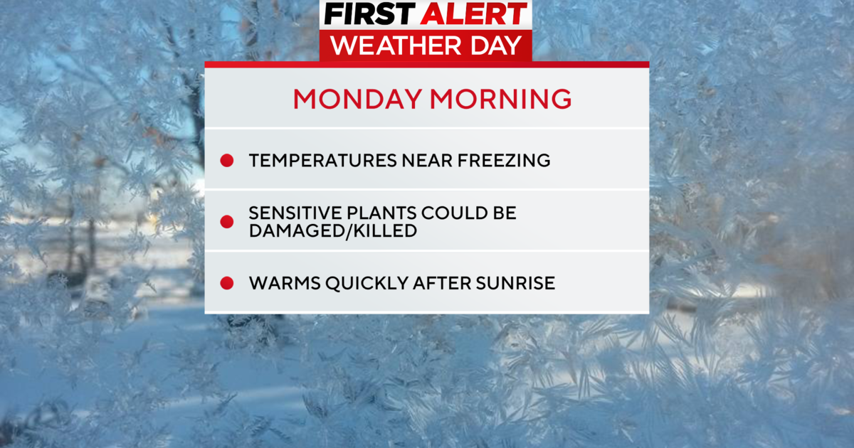
A high of about 41 degrees is expected for Monday with an overnight low of 34 degrees.
The snow is causing some problems for drivers as the speed on the Pennsylvania Turnpike between Donegal and Bradford has been reduced to 45 mph.
The snow has also caused some power outages around the area.
As of 3 p.m. the following outages were reported:
- Indiana County - 4,908 customers
- Westmoreland County - 5,162 customers
- Clearfield County - 1, 150 customers
- Allegheny County - 1,663 customers
Stay With KDKA.com For More Details
RELATED LINKS:
NOAA
National Weather Service
Latest Weather Conditions
Local Radar
Latest Traffic Conditions
Traffic Cams
