Freezing Rain Hits Pittsburgh
PITTSBURGH (KDKA) -- Freezing rain hit Pittsburgh early Saturday morning, and it may take until early afternoon for things to start thawing out.
Freezing rain started around 3 a.m. with just a bit of light snow preceding it. To the north, it's still snow. To the south around Morgantown, plain rain.
LATEST FORECAST:
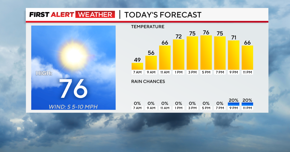
We are in the warm sector of this storm system with temperatures that will continue to rise all day and even up until midnight when we will be near 50 degrees. After that, it's all downhill as a trailing cold front passes and temperatures will start to fall and keep falling all night and through the day Sunday.
PennDOT and Pittsburgh Public Works Crews worked around the clock to try and keep the roads clear.
Even so, there were still a lot of accidents. Including in the Hill District near Centre Avenue and Bryn Mawr Road where a car slid into a pole.
In Squirrel Hill - the front end of an SUV was ripped off in another collision.
The ice also shut down the port authority's T service for several hours Saturday morning after the storm knocked out a power line.
"I don't think it's all that bad. I mean it was bad coming over the Fort Pitt Bridge, it was icy, but it's really not that bad, because it's starting to melt, the weather is warming up," Erin Fennell said.
Duquesne Light reported just before 11:15 a.m. that about 4,500 customers were without power, and crews were making repairs.
As of 2 p.m., about 4,000 customers were still without power. Duquesne Light reported around 5:30 p.m. that 3,200 customers had their power restored, and the majority were expected to be restored by midnight.
A flood advisory is in effect for the Ohio River until Sunday evening.
Join The Conversation On The KDKA Facebook Page
Stay Up To Date, Follow KDKA On Twitter