Ron's Weather Blog: White Christmas Not Likely For Pittsburgh
Every week over the winter weather months I am going to be writing a blog about potential snowfall specifically focused on the upcoming week. On top of that, I would like to look ahead (sometimes way ahead) at what the weather may be like due to what's happening right now in our atmosphere.
PITTSBURGH (KDKA) - After the wild ride over the past seven days, western Pennsylvania deserves a break.
We'll get one this week. In fact, over the next couple of days there are only two chances for precipitation.
The first being a rain/snow mix on Thursday and there will also be another chance for rain over the weekend.
Let's first review where we are so far:
- Total Snow This Month: 5.2" (0.3")
- Total for the Season: 7.3" (0.2")
- Last year snow through (0.3")
Through Wednesday:
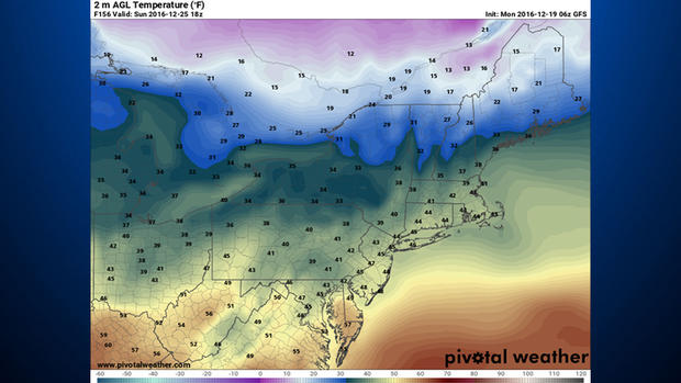
No snow and no rain expected as well. Dry and chilly on Monday and Tuesday with changes arriving on Wednesday. High pressure developing just to the south of our area will put us in a favorable wind flow with winds coming in out of the southwest.
The southwest flow will begin to replace our frigid air mass with one that is milder and more seasonal for this time of the year. The average high for today is 38 degrees with the average low sitting at 24 degrees.
Tuesday should see highs in line with this with Wednesday seeing lows near the seasonal average. From Wednesday on, however, temps will be back to running slightly above the averages for this time of the year. This period will also be dry.
Next snow chance on Thursday night:
Thursday's high temp will near 40 degrees with cloudy skies throughout the day. This will be are best and may be are only chance for snow. High pressure ridge remains in place to our south. This will allow a mid-level low to wrap around the edge of the ridge tracking through southern Quebec and pushing through a weak cold front late Thursday.
At this point, a dusting is possible as it passes with the chance for some light rain developing on the leading edge of the front ahead of any snow that falls.
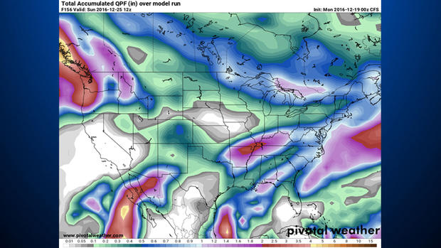
Holiday weekend:
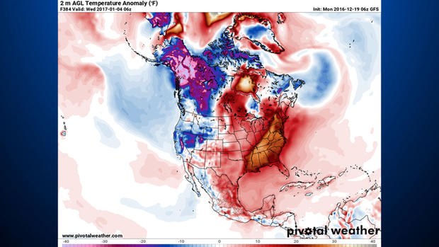
No real agreement between models heading into the Christmas weekend, but at this point we know we can rule out snow with current numbers coming in. What's not so easy to determine is when we will have a chance for rain. Scattered showers remain possible through Saturday afternoon. Also, a large upper low is expected to track either through or just north of area next Monday into next Tuesday. Once again, our snow chance isn't great during this time period.
Rest of the month:
Not a great chance for any big snows next week right now with a fairly warm air mass in place. As of today, the only chance for snow next week would be on the morning of New Year's Eve when temps plummet quickly as a cold front pushes through.
We will continue to monitor. I hope everyone has a Merry Christmas and Happy Holidays as well.
Join The Conversation On The KDKA Facebook Page
Stay Up To Date, Follow KDKA On Twitter