Ron's Weather Blog: Warm Start To November About To Change
Every week over the winter weather months I am going to be writing a blog about potential snowfall specifically focused on the upcoming week. On top of that, I would like to look ahead (sometimes way ahead) at what the weather may be like due to what's happening right now in our atmosphere.
PITTSBURGH (KDKA) - Another warm week is in the books to start the month of November, but things will be changing soon. In fact model data shows that within 10 – 12 days we could be seeing high temps in just the 30s for a day or two.
With that type of cold you have to know that snow is just right around the corner and it appears that we will have a couple of shots of snow this week and likely some more snow chances for next week.
Good morning @7SpringsPA, working on this week's snow blog. Thought you'd like to know you should see some snow this weekend. #kdkawx pic.twitter.com/wxylD3JUfz
— Ron Smiley (@RonSmileyWx) November 7, 2016
Overall this season we haven't seen any snow so far in Pittsburgh. Strictly based on historic averages, we should have already seen 0.7 inches of snow so far this season (From Oct. 1). That is a bit misleading due to some isolated big early season snows that have occurred in Pittsburgh bump up the numbers early on in the season.
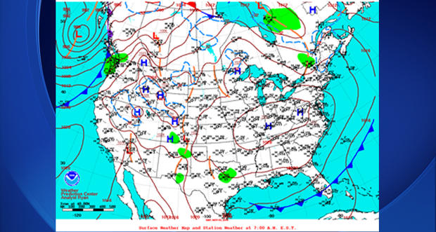
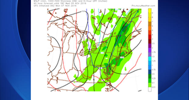
Current Pattern
Currently most of the east side of the U.S. is dominated by a 1028 ridge of high pressure. The center of the high is fairly broad extending from southwestern Pennsylvania over to western Missouri and up to Lake Michigan. The southern extent of the high pushes into Northern Tennessee and Arkansas. For us, we are seeing surface winds light and generally variable.
Not A Good Chance For Snow During Work Week
The ridge will begin to break down and slide south overnight tonight. This will allow a cold front to slide south through the day on Tuesday. For us, the front arrives around midnight Wednesday morning. At this point, it looks like all rain falls on Tuesday, but the 540 thickness snow line pushes into the area just briefly as precipitation is wrapping up on Wednesday morning.
The surface temperature for Pittsburgh at this time will likely be near 50 degrees, so too warm for snow. Places in elevated areas though may see temps in the low 40s and upper 30s and could see some light snow that would melt on roads as soon as it touches down. Overall, we have few concerns for travelers on Wednesday as snow won't impact anyone's morning drive.
Weekend Snow Chance
This weekend could see the first real snow of the season with a light dusting in some elevated areas. Accumulation also cannot be ruled out for the weekend. Temps will be plenty cool enough and moisture will be available to tap into. Temps may struggle to hit the 40s in elevated places with strong gusty winds and light snow possible for a few hours. Overall, elevated areas should see at least a dusting of snow how it stands right now with some light accumulation possible.
Warm & cold air battle it out for the rest of this week before colder air moves in next week according to the GFS model data. #kdkawx pic.twitter.com/tsjKczz2LM
— Ron Smiley (@RonSmileyWx) November 7, 2016
What's To Come
This week may be the final week of consistent and substantially warmer than average temperatures as we are seeing a fairly big change in conditions heading into next week. Notice the tweet I sent tracking the 500mb temp anomaly.
Let's talk about what you are looking at. Any weather map that says "anomaly" in it means that you are comparing this to something else. In this case, and most cases when it comes to weather maps you are comparing it to, the historic or what we call the climatological average. So, while the blues and red mean what you think they mean, it is being compared to what we have seen before. So, the blues that you see moving out the reds is symbolic of temperatures that are colder than normal moving in as warmer than normal temperatures move out.
Basically, what you are seeing is the up and down of temps over the course of the weekend before our first extended cold spell arrives next week.
While not set in stone that it is going to happen, it is something to keep an eye on. If you're wondering, the GFS weather model that derived what you are looking at shows this dip occurring from Nov. 15-20. It's also something that is consistent with what we showed in last week's blog when it comes to weather.
How I look at things: If you have cold air in place, you have a shot at snow. So, we are keeping a close eye on next week when it comes to perhaps the first decent snow of the season.
We will see.
Join The Conversation On The KDKA Facebook Page
Stay Up To Date, Follow KDKA On Twitter