Snowstorm Then Frigid Arctic Air To Hit Northeast
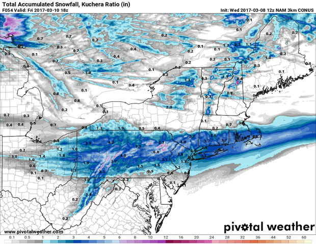
PITTSBURGH (KDKA) -- Winter makes its triumphant return to the Northeast this weekend with up to 7 inches of snow possible through parts of Pennsylvania, New York, Connecticut, and Rhode Island.
Heaviest snow totals should be in central parts of Pennsylvania along with elevated terrain.
The cold weather will be in contrast to the mild weather that has overrun this region since the beginning of February.
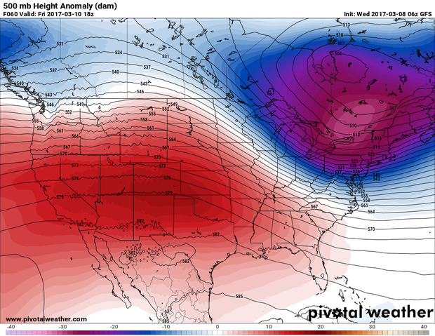
Monthly temperatures in these states ran several degrees warmer than average for the month of February and the beginning of March also started off fairly warm. Things will change starting on Friday as an arctic front straddles the Interstate 70 corridor.
This should act as the dividing line for snow and rain from Thursday to Friday.
As we head into Saturday the arctic front will continue to push south, and a secondary surface low will drop a couple of inches of snow further south in parts of Tennessee, Virginia and North Carolina.
A piece of very frigid deep arctic air will drop down from Quebec plunging the northeast into a winter chill.
In Pittsburgh, Saturday morning lows could dip to single digits with wind chills below zero.
Northern parts of New York and Maine may see temperatures below zero!
At this point, it doesn't look like these chilly temps will lift out of the area very quickly.
All of next week is looking at temperatures near or well below the average for this time of the year.
Winter's grip isn't expected to hold into the first week of spring though, especially with little to no long term snow on the ground.
Join The Conversation On The KDKA Facebook Page
Stay Up To Date, Follow KDKA On Twitter
That snow could have helped set up a boundary against the return of warm air and the power of the spring sun.