Active Weather Pattern To Bring Heavy Rain, Destructive Winds, Flooding & Chance Of Snow
Follow KDKA-TV: Facebook | Twitter
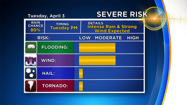
PITTSBURGH (KDKA) -- An active weather pattern is in the works for today and Wednesday with heavy rain, storms, destructive winds and even another snow chance all occurring before Wednesday afternoon.
It's such a jam-packed day, it may be tough to keep up with it all. So here's a look at what you can expect, along with when you can expect it.
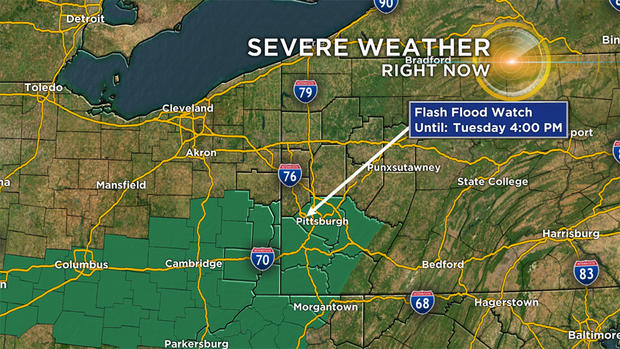
Several counties along I-70 are now under a Flash Flood Watch through 4 p.m. today. This includes parts of Westmoreland and Fayette counties, along with Allegheny County.
WEATHER LINKS:
Delays & Closings | Current Conditions | Local Radar | Traffic Conditions | Weather App | Photos
A fairly consistent rain will continue to fall through at least 2 p.m. today, and likely longer than that. Rain totals of one inch or greater are expected in the watch area. If and when flooding is reported, you will see Flash Flood Warnings issued. It is advised that if you see water on any road that you turn around.
At this point, it looks like many folks will see dry but damp conditions from 5 p.m. through around 11 p.m.
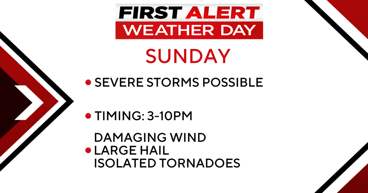
After that, things will change fairly quickly with a squall line moving in from the west. Wind gust along the leading edge of the line of storms could hit 70 mph. Wind speeds of 58 mph or greater will see the National Weather Service issuing a Severe Thunderstorm Warning. Communities along the Ohio state line will likely see a Severe Thunderstorm Watch issued around 7 p.m.
The best way to prepare for tonight's storms is to pick up any trash or debris in your yard.
So tonight's storms will develop along a squall line of strong storms. The actual cold front won't push through until Wednesday morning around 6 a.m. The warmest weather for the rest of the work week will occur overnight until the front passes by.
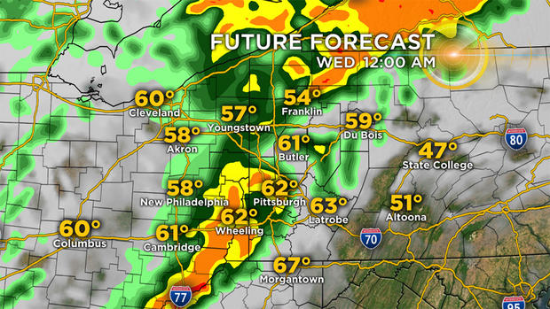
As the front arrives at 6 a.m., temperatures will again plummet, wind speeds will pick up and light rain showers will change over to light snow.
The weather pattern stays fairly active through the end of the week. With highs in the 40s on Thursday.