Pittsburgh Weather: Warm Stretch Continues, But Big Rain Totals Possible
Follow KDKA-TV: Facebook | Twitter
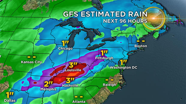
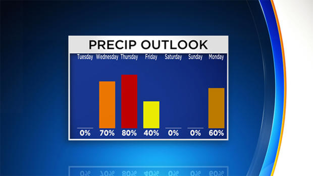
PITTSBURGH (KDKA) -- Big rain totals are still possible from Wednesday through Friday morning, but data has backed off slightly from totals that would likely cause river flooding along with low lying area flooding.
It's certainly good news as we now can focus all of our attention to the round of rain.
When you look at the next round of rain, it's really three rounds all merging into one.
WEATHER LINKS:
Current Conditions | School Delays & Closings | Local Radar | Weather App | Photos
The series of low pressure centers will begin to arrive on Wednesday, maybe as soon as noon, with the last low, and accompanying cold front, pushing through on Friday morning.
By the time the final low clears our area, we could be looking at widespread rain totals of around two inches, over three days. We should be able to handle that even with the saturated ground.
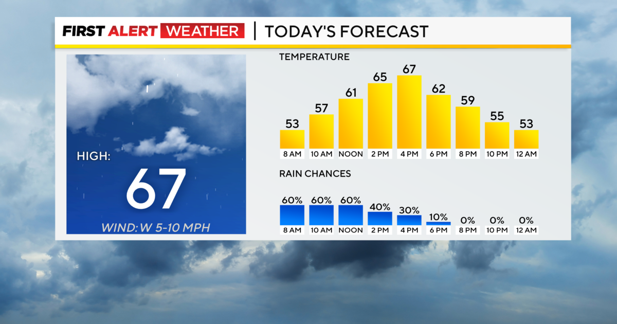
For the remainder of the day, expect temperatures around the half century mark with winds blowing fairly light out of the northwest from 5-10 mph. Today's low will likely be reached at midnight.
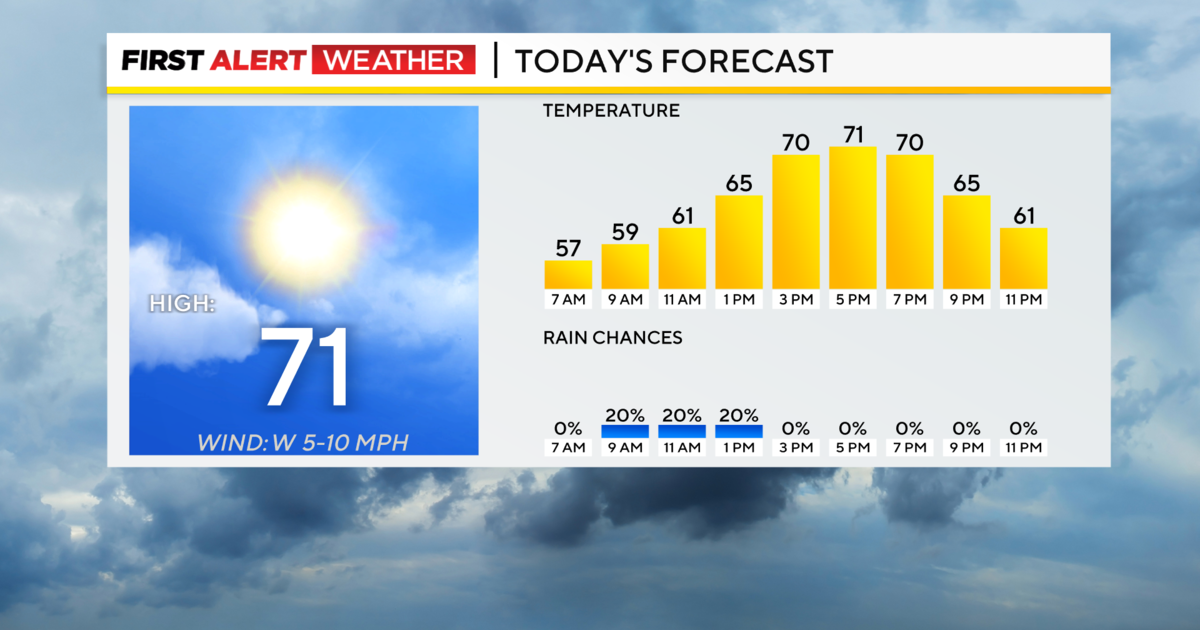
Warmer weather will arrive as rain chances go up. We could see records falling on Thursday as temperatures surge to the mid- to maybe upper-60s.
What about the weekend?
It looks dry with temperatures slightly above average for this time of the year. Saturday highs will be just shy of 40 degrees with temperatures into the 40s on Sunday.
Stay up to date with the KDKA app, which you can download here.