Pittsburgh Weather: Accumulating Snow Could Impact Mid-Week Morning Commute, Freezing Rain Also Expected
Follow KDKA-TV: Facebook | Twitter
PITTSBURGH (KDKA) -- Snow showers have moved in as a broad area of low pressure continues to move to the east.
Snow totals, for most, will be modest at best with most seeing just over a slight dusting overall.
Issues on roads aren't expected to be too bad today.
WEATHER LINKS:
Current Conditions | School Delays & Closings | Local Radar | Weather App | Photos
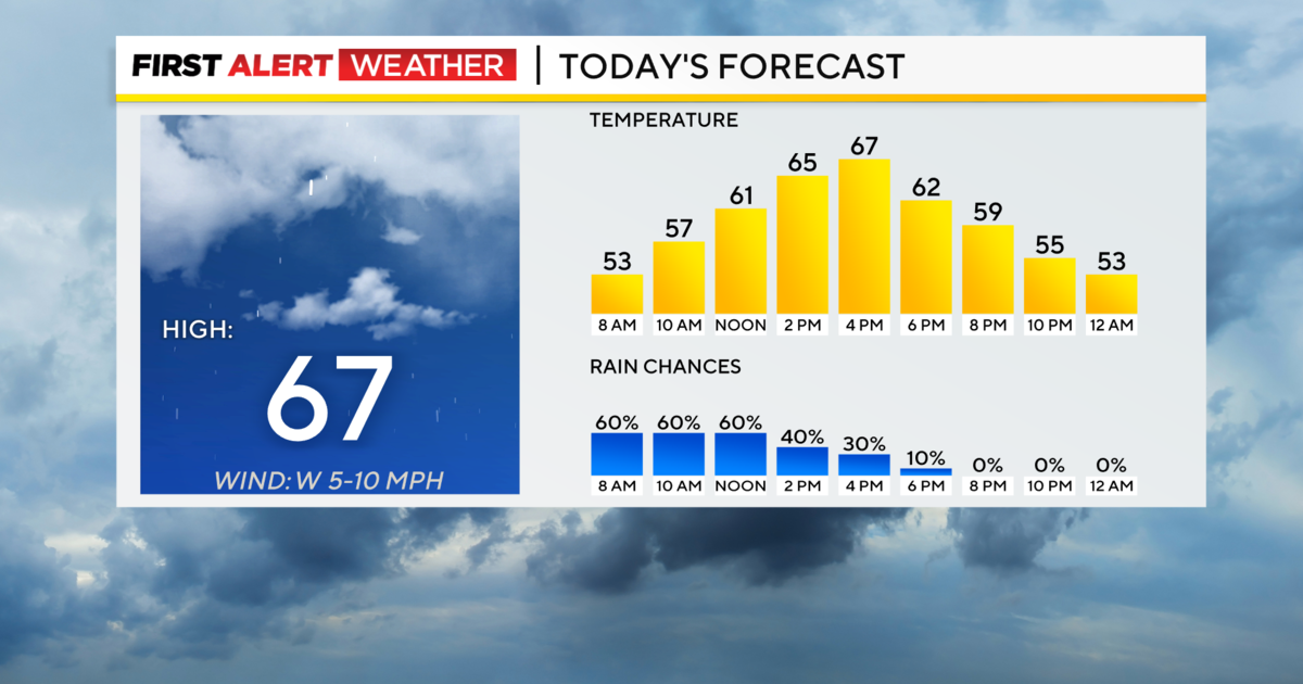
Temperatures will remain in the chilly range though, with afternoon temperatures in the mid- to upper-20s and wind chills in the mid-teens. Wind speeds will be around 15 mph coming in out of the west.
Any snow showers lingering this evening will be wrapping up, as high pressure continues to build into the area.
This will set us up for dry and quiet weather Tuesday, although temperatures will be rather cool.
A warm front starts to lift our way early Wednesday.
At this point, the big concern is on Wednesday morning as accumulating snow showers are expected to begin around 6 a.m. Snow showers, according to this morning's data, will last through around noon with freezing rain and rain expected for the afternoon.
While the snow will quickly accumulate and cause slick conditions, it will be washed away in the afternoon, once the temperatures warm up enough for all rain. In the ridges, there could be a prolonged period of freezing rain, as this systems unfolds. That is already prompting winter storm watches there.
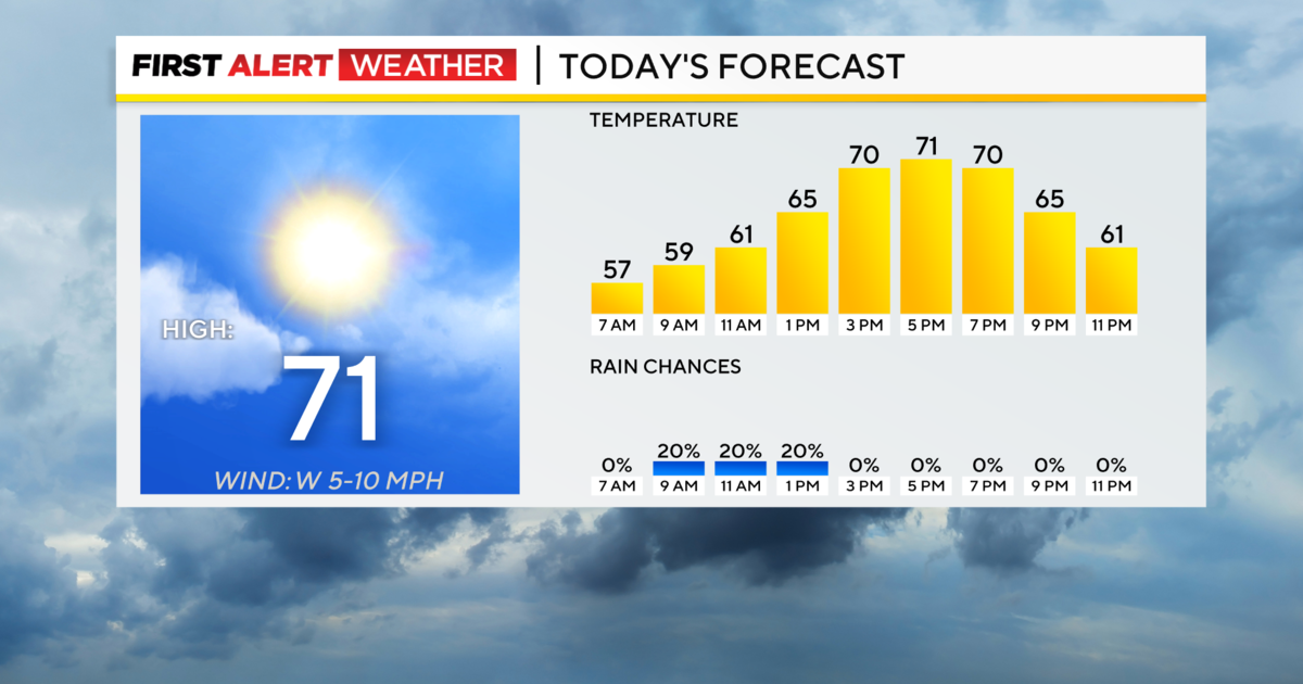
The weekend is looking warmer at least. Highs on Saturday will be in the upper-50s with Sunday's highs nearing 60 degrees.
Stay up to date with the KDKA app, which you can download here.