Pittsburgh Weather: Another Round Of Severe Storms On The Way, Gusty Winds Expected
PITTSBURGH (KDKA) -- Another stormy day is on tap.
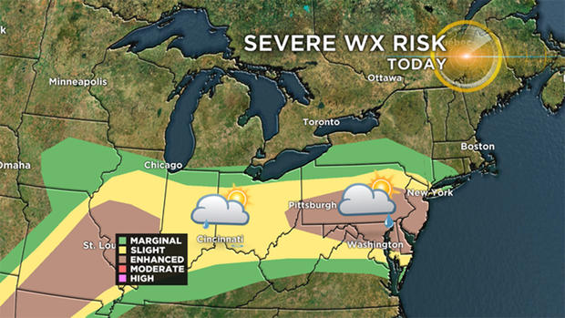
Parts of the area are again under an enhanced risk of severe weather.
A Severe Thunderstorm Watch has been issued for Fayette and Greene counties, as well as parts of West Virginia through 1:15 p.m.
While on the surface things look similar to yesterday, there are some differences.
The latest outlook on the threats for severe storms this afternoon and evening. Torrential downpours will also accompany many of these storms with the potential to produce localized flash flooding. pic.twitter.com/NLrq40TI4V
— NWS Eastern Region (@NWSEastern) May 29, 2019
First, the area for the enhanced risk is slightly south of the location from Tuesday. Also, yesterday's set-up was a large hail set-up. Today's set-up is more of a strong wind gust profile followed by areas that will see large hail along with a heightened risk for tornadoes.
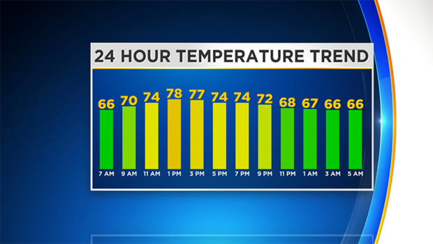
Highs today will be near 80 degrees with winds this afternoon out of the WSW at 7-15 mph.
WEATHER LINKS:
Current Conditions | School Delays & Closings | Local Radar | Weather App | Photos
Some school districts have also issued delays and closures due to the severe weather. Seneca Valley School District is running on a two-hour delay, while Pine-Richand and Riverside-Beaver County school districts are closed.
KDKA's Amy Wadas Reports:
North Allegheny Senior High School is without power. Because of that, students are being sent to the North Allegheny Intermediate School for the day.
ATTENTION PARENTS AND STUDENTS OF NORTH ALLEGHENY SENIOR HS: pic.twitter.com/TPsapCVUAe
— Amy Wadas (@AmyWadas) May 29, 2019
We have another chance for strong storms Thursday across the area before getting a break from severe weather for the weekend. Thursday is already highlighted as being a 'marginal' risk of severe weather with strong winds and large hail possible.
We may get "upgraded" to a slight or enhanced risk of severe weather so will watch closely there. Thursday's high will be in the mid-70s.
Stay up to date with the KDKA app, which you can download here.