Pittsburgh Weather: Downpours Possible As Flash Flood Watch Remains In Effect
PITTSBURGH (KDKA) -- Similar to yesterday, today's best chance for rain has already passed through.
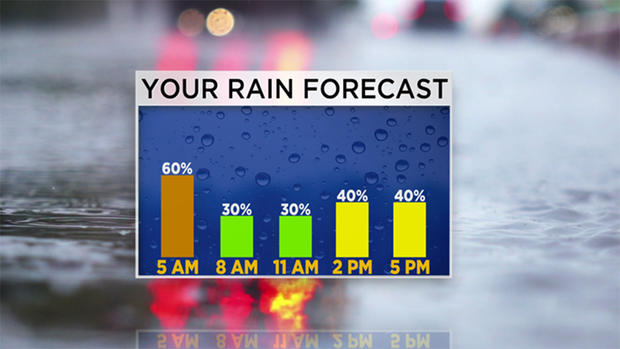
We will have a chance for spot showers and weak storms for the rest of the day, but no sustained rain is expected. Still, we can't rule out a heavy, if somewhat brief, downpour here or there through the day. We have been taken off the severe risk map for the day.
However, a Flash Flood Watch does remain in effect for much of the area through 2 a.m. Wednesday due to saturated ground and additional rain amounts of 1-2 inches possible.
KDKA Meteorologist Ron Smiley has highs hitting the mid- to upper-70s today, with winds coming in out of the west at 4-8 mph.
Wednesday is still looking relatively dry. Smiley cannot completely rule out a passing shower or storm here or there, but the best rain chance will come in after 6 p.m.
Smiley has bumped up Wednesday's rain chance to 40 percent, but may need to bump that up to 60 percent. The best chance for rain on Wednesday comes during the evening hours. This is where solid and steady rain showers could accompany another mid-level low pressure area that is forecast to slide right over us.
WEATHER LINKS:
Current Conditions | School Delays & Closings | Local Radar | Weather App | Photos
Thursday is looking wet with rain chances peaking again early in the morning. We should only see brief passing showers and maybe even a weak storm during the day on Thursday.
At this point Friday, Saturday and Sunday could set up a nice and dry stretch of weather with highs topping 80 degrees on Sunday.
Showers and thunderstorms will stay scattered around the area tonight, and some hit or miss showers hang around Wednesday, too.
Even more rain and thunderstorms are anticipated for Thursday.
A few of these storms could get strong, too, so Thursday will be a time period to watch.
Friday and Saturday are trending dry, with part of Sunday getting thrown in, too. High pressure starts nudging into the area, Friday, bringing that dry weather.
It will take a couple days to move across the region, so that high pressure will hit the "pause button" on the rain for us.
Showers and storms return Sunday afternoon, though, along with warmer temperatures and higher humidity.
Stay up to date with the KDKA app, which you can download here.