Pittsburgh Weather: Second Half Of November Looking Warmer Than First Half
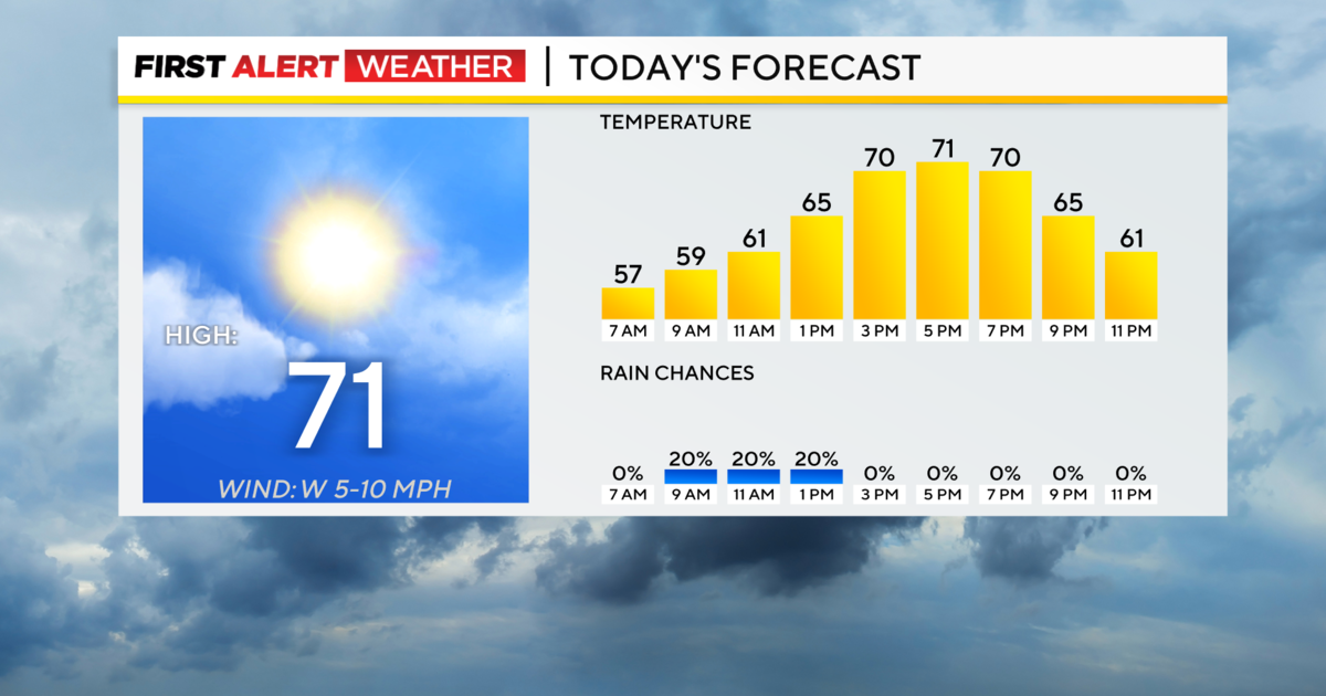
PITTSBURGH (KDKA) -- There will be partly to mostly cloudy skies through today with highs near 50.
It appears the back half of the month of November will be significantly warmer than the first half. Currently, Pittsburgh is running minus 9.2 degrees cooler than the average monthly average temperature. If the month ended today, you'd have to go all the way back to 1976 for the last time the month of November was this cold. It would also be the fifth coldest November on record.
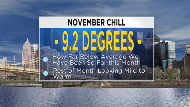
At this point, there is a solid chance that we will be looking at a top 10 coldest November on record, even with temperatures getting back to around the average or warmer for most of the rest of the month.
The weather pattern gets more active over the next couple of days with small rain chances arriving Tuesday night and sticking around through Wednesday morning. The rain chance is small with some data like the RPM showing the area remaining dry.
WEATHER LINKS:
Current Conditions | School Delays & Closings | Local Radar | Weather App | Photos
If you don't see any rain during that window, there is another chance on Thursday night into Friday morning. The best chance comes in as a piece of Gulf energy moves by.
This system comes in from the southwest and should be enshrouded in warm, moist Gulf Coast air. This means rain totals could be decent.
On the system's back half, KDKA Meteorologist Ron Smiley expects to see some light snow showers and flurries. Model data isn't doing a good job of picking this up yet, but Smiley is keeping an eye on it.
Light Up Night on Friday is looking dry and mild.
Stay up to date with the KDKA app, which you can download here.