Pittsburgh Weather: Snow Returns To Area, Wintry Mix Moving In For Weekend
PITTSBURGH (KDKA) -- While we aren't going to see one big dump of snow over the next 48 hours, there will be a chance for significant snowfall across the area.
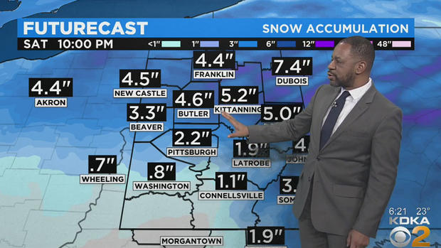
Overall, about an inch to, perhaps, up to two inches of snow should be expected to fall Saturday morning before a wintry mix takes over just after 6 a.m. on Saturday.
KDKA Meteorologist Ron Smiley says places from Allegheny County to the southwest will see less than an inch of snow to start off the day on Saturday, with snow arriving after 1 a.m.
WEATHER LINKS:
Current Conditions | School Delays & Closings | Local Radar | Weather App | Photos
The snow belt -- north I-80, Armstrong and Indiana counties to the Laurels -- could see some potentially large snow totals of more than 3 inches overnight through Saturday at noon.
The biggest totals will be north of I-80 and westward facing slopes of the Laurels where they will likely see more than 6 inches of snow through Saturday afternoon.
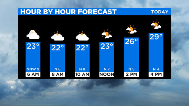
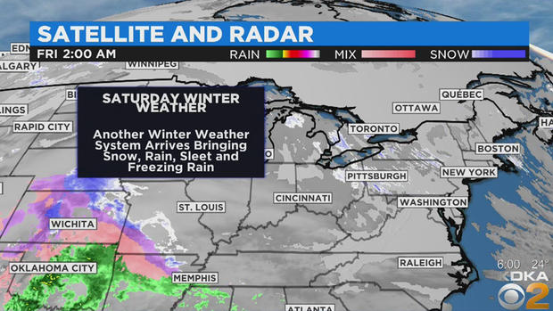
Behind the rain, snow, freezing rain and sleet will be some cold air that will possibly lead to the coldest weather of the season so far.
Stay up to date with the KDKA app, which you can download here.