Pittsburgh Weather: Lake Effect Snow Showers To Leave Dusting Of White Across Region
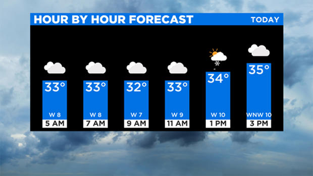
PITTSBURGH (KDKA) -- There is a chance for snow showers today, but you will only see a dusting at best.
Skies will remain cloudy through the day with highs in the mid- to upper-30s. KDKA Meteorologist Ron Smiley says Pittsburgh will hit 37 for the high.
If you are along or south of I-80, your daily highs will struggle to hit 35 and 40s will be possible in Morgantown, West Virginia.
Any snow we see today will be either from Lake Effect snow showers (above I-80) or be lake effect enhanced snow showers. Snow is mainly due to the pesky upper low continuing to slowly churn to the east. It's causing lift that will keep us mostly cloudy today and Tuesday before we finally see a decent amount of sunshine on Wednesday.
WEATHER LINKS:
Current Conditions | School Delays & Closings | Local Radar | Weather App | Photos
Tuesday also has a small chance for snow.
No big warm-ups are expected this week with highs generally around the 40-degree range each and every day through Sunday. Wednesday and Thursday should be dry, but then we will see another small chance for snow and even rain as we head into the upcoming weekend.
Stay up to date with the KDKA app, which you can download here.