Pittsburgh Weather: Winter Weather Advisory In Effect Due To Freezing Rain and Fog Potential
PITTSBURGH (KDKA) -- A winter weather advisory is in effect through 7:00 a.m. due to the potential for freezing rain and fog.

Isolated rain showers and fog could be just enough to cause some slick spots on area roads this morning through 7 a.m.
WEATHER LINKS:
Current Conditions | School Delays & Closings | Local Radar | Weather App | Photos
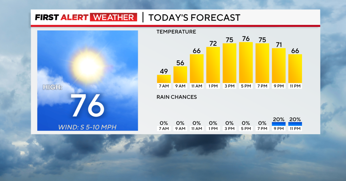
High temperatures today will be in the mid to upper 40s.
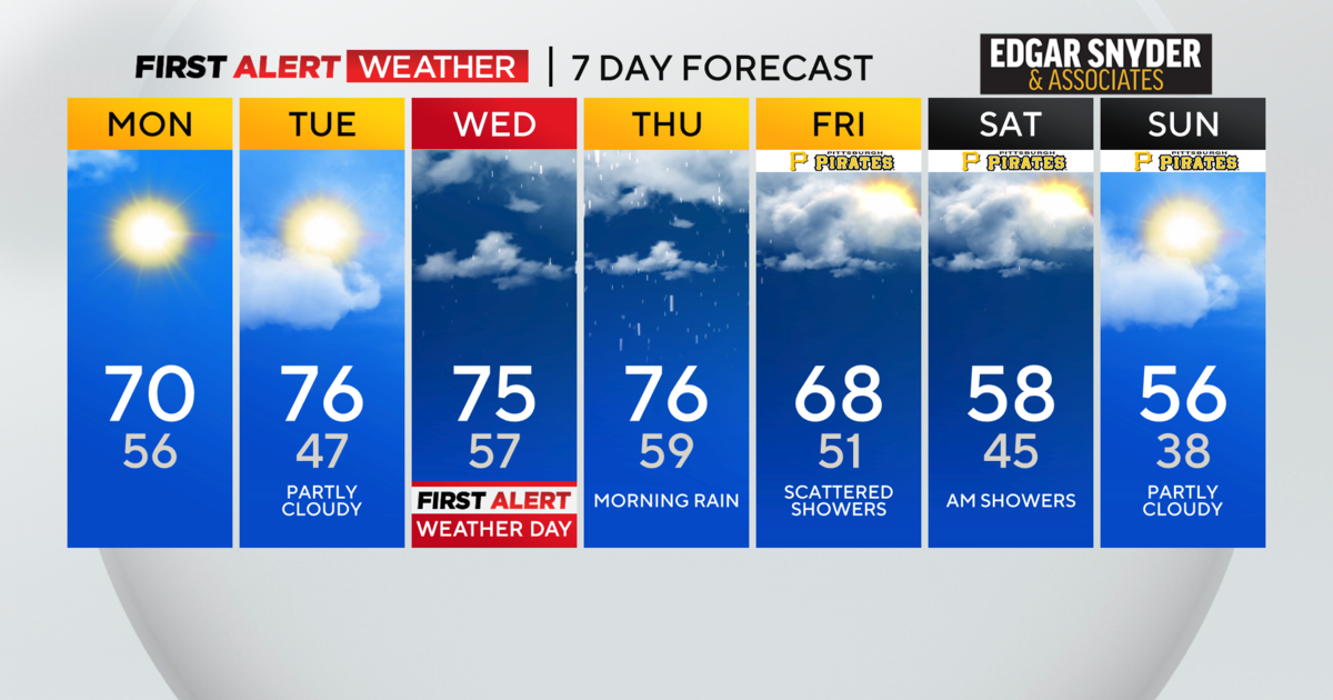
The bigger concern at this point is the snow showers that are heading our way on Friday.
The first question is when the rain will change to snow.
It will be sometime around the morning commute.
This is about the time that temperatures also will hit the 32 degree range, meaning that we will have snow accumulating shortly after it begins to fall.
I have the changeover happening sometime after 6 a.m. but before 8 a.m.
This will obviously lead to issues for the morning commute.
Schools may be delayed due to the snow as well, but due to the timing, buses may be sent out already.
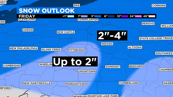
Throughout the day, snow totals of around 2 inches should be expected around the Pittsburgh area.
Locations farther north will have a higher chance of seeing snow totals nearing 4 inches as as you cross over Interstate 80.
Some isolated spots in the Laurel Mountains will likely see upwards of 6 inches of snow.
There will be another accumulating snow chance on Sunday, but that event looks to only bring perhaps a half-inch of snow.
Stay up to date with the KDKA app, which you can download here.
