Heat, Humidity And Cold Front Stir Up Severe Thunderstorms And Tornado, Causing Damage Across Western Pa.
PITTSBURGH (KDKA) - Severe weather moved through western Pennsylvania on Wednesday night.
A tornado warning was issued for parts of Beaver County but canceled around 9:55 p.m.
The NWS confirmed a tornado in Beaver Falls.
All other warnings have expired, but storms are still moving through the area.
A severe thunderstorm watch was issued for 15 Pennsylvanian counties, including Allegheny, Fayette, Greene, Washington, Westmoreland, Armstrong, Butler, Indiana, Beaver, and Lawrence counties.
That watch is in effect until 1 a.m. Thursday. The NWS says threats include hail, wind and the possibility of tornadoes.
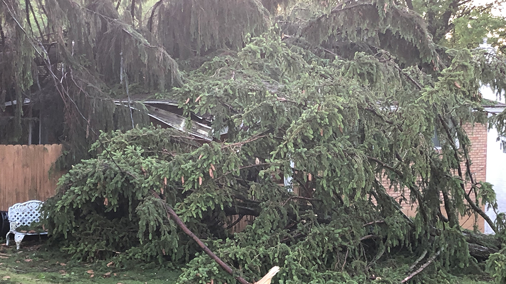
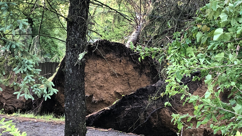
As storms move through our area, Allegheny County is reporting damage. There are several trees and wires down -- some have even fallen onto houses.
A tree also fell on a house in Elizabeth Township. Trees were also uprooted across the area, including near Route 48
Allegheny County said a power grid in the township shut down due to the storm and down wires.
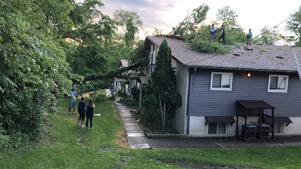
Logan Road Apartments received a scare when a tree fell onto the building. There were no reports of any injuries.
Two of eight apartments had to be evacuated, and the Red Cross has been notified.
The apartment manager said the tree hit the attic space but the damage is still being assessed.
Officials are also asking people to avoid down wires.
KDKA Meteorologist Ray Petelin explains this afternoon our area was in what the Storm Prediction Center refers to as "slight risk." This actually means there is the potential for scattered strong to severe thunderstorms to develop.
On the current timing, the main squall line of storms is expected to arrive around 10 p.m. for western Pa. Most of this activity will be done in our area around midnight.
Damaging winds and hail are the main threats with this line, however, an isolated tornado cannot be ruled out. Meteorologist Ray Petelin stresses that the main threats are damaging winds and hail.
While a spotty shower could linger in the morning, clearing skies will be the trend for Thursday.
This also comes with temperatures that are easier to handle and lower humidity levels. Overall, this will lead to a nicer end to the week. An isolated shower is possible late Friday, and again this weekend.
As of now, it looks like the weekend will come with more sunshine than anything else. Much cooler temperatures will arrive by the weekend, too. Highs look to be below normal, in the low to mid 70s.