Pittsburgh Weather: Severe Thunderstorm Warning Issued As Cold Front Arrives
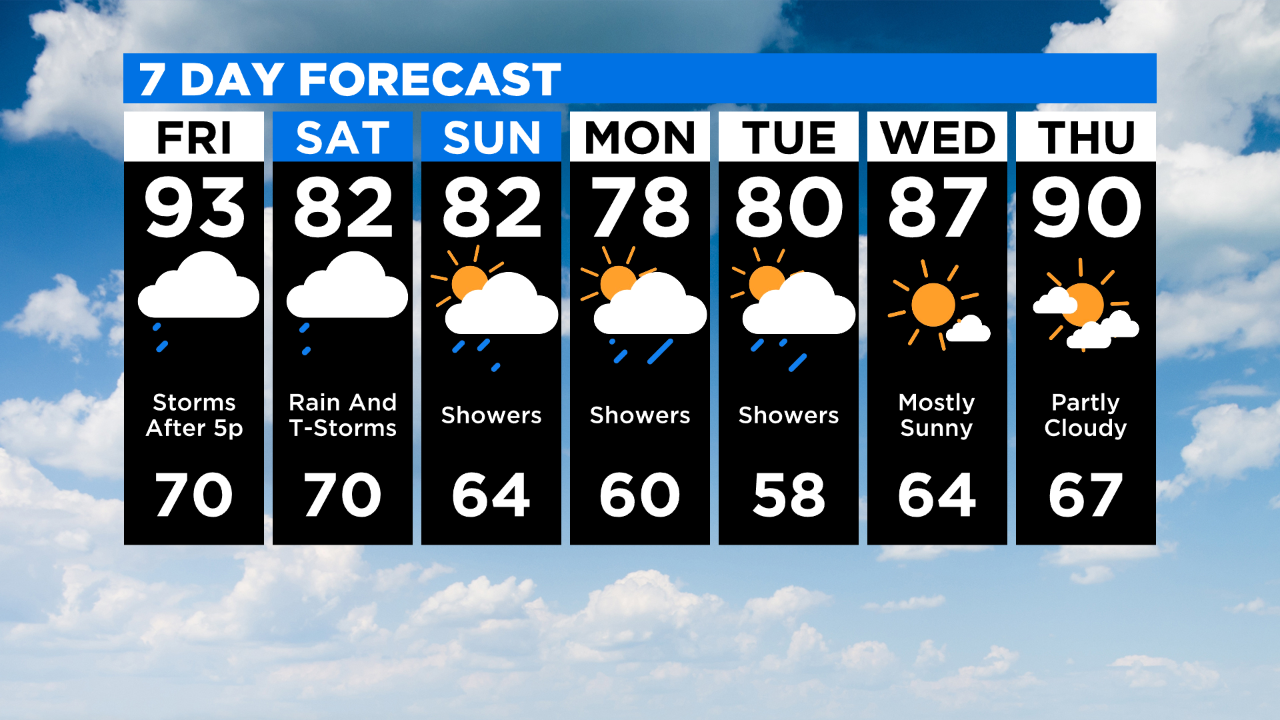
PITTSBURGH (KDKA) - Hot and humid weather is in place once again on Friday with highs in the area in the mid-to-low 90s.
Pittsburgh high will hit 93 degrees with most of the afternoon dry before 5:00 p.m. Storms are expected to turn widespread after 5:00 p.m. as a cold front arrives.
In southwestern Mercer, northern Lawrence and northwestern Butler counties, those storms are starting. The National Weather Service has issued a Severe Thunderstorm Warning in place until 4:30 p.m.
WEATHER LINKS:
Current Conditions | School Delays & Closings | Local Radar | Weather App | Photos
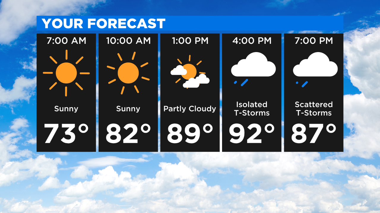
At this point, the area is not highlighted as having a chance for severe weather by the storm prediction center, but that could change by this afternoon. The combination of instability along with the trigger mechanism from the cold front should be enough with the set up to see a line of storms with strong gusty winds on the leading edge.
These storms could be from 7:00 p.m. until 11:00 p.m.
Rain showers should continue this weekend as a trough and upper low move in behind the cold front. The best chances for rain look to be late Saturday afternoon and late Sunday afternoon.
Weekend highs should be in the low 80s with morning lows on Sunday, seasonal.
A travel note: those planning to travel east or northeast on Friday, Tropical Storm Day will bring rain and flooding to parts of New England today and Saturday. The latest track for Fay moves the storm through eastern New York and over Vermont before moving into Canada and impacting Montreal.
Up to 7 inches of rain will be possible in spots of Fay tracks north.
Stay up to date with the KDKA app, which you can download here.