Hurricane Laura Turns Into Dangerous Category 4 Storm, Remnants Move Into Western Pa. This Weekend
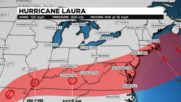
PITTSBURGH (KDKA) -- Hurricane Laura is now a massive Category 4 hurricane.
It was moving northwest at 16 mph and had maximum sustained winds near 140 mph, according to CBS News.
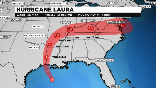
Laura is expected to make landfall after midnight, sometime around 3 a.m., near San Luis Pass, Texas, to west of Morgan City, Louisiana.
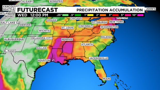
Damage will be catastrophic with life-threatening flash flooding and storm surge along the Gulf Coast about 10-20 feet and possibly extending as much as 30 miles inland.
Laura looks to deteriorate a few hours after making landfall, riding up the Texas-Louisiana state line as a Category 1 hurricane.
WEATHER LINKS:
Current Conditions | School Delays & Closings | Local Radar | Weather App | Photos
Through early Thursday, across portions of east Texas and western Louisiana, hurricane-force winds are expected to continue to spread inland.
Remnants of what will be Tropical Depression Laura will move into our region late Friday night and through Saturday, bringing around an inch or so of rain. This could pose the issue of flash flooding and even some afternoon storms.
Stay up to date with the KDKA app, which you can download here.