Pittsburgh Weather: Multiple Chances Of Snow Throughout Upcoming Week
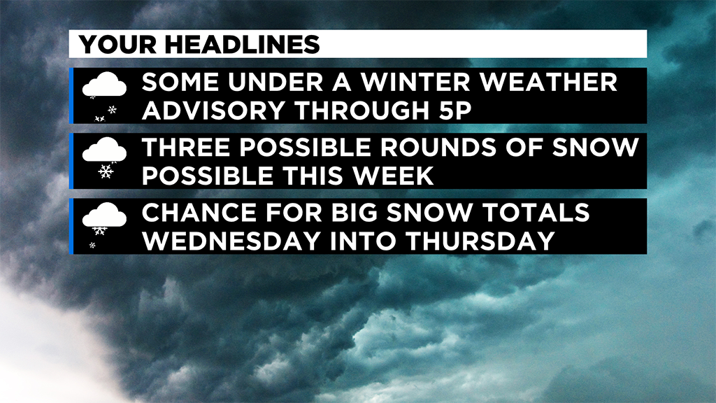
PITTSBURGH (KDKA) -- We are tracking three solid chances for some snow this week, including another big snow chance it looks like for Wednesday afternoon through Thursday.
We will talk about that in a bit, but first let's talk about this morning's snow chance where places in elevated spots could see more than an inch of snow.
For everyone else? It doesn't look like much accumulating snow with temperatures in Pittsburgh expected to remain above the freezing mark all morning long.
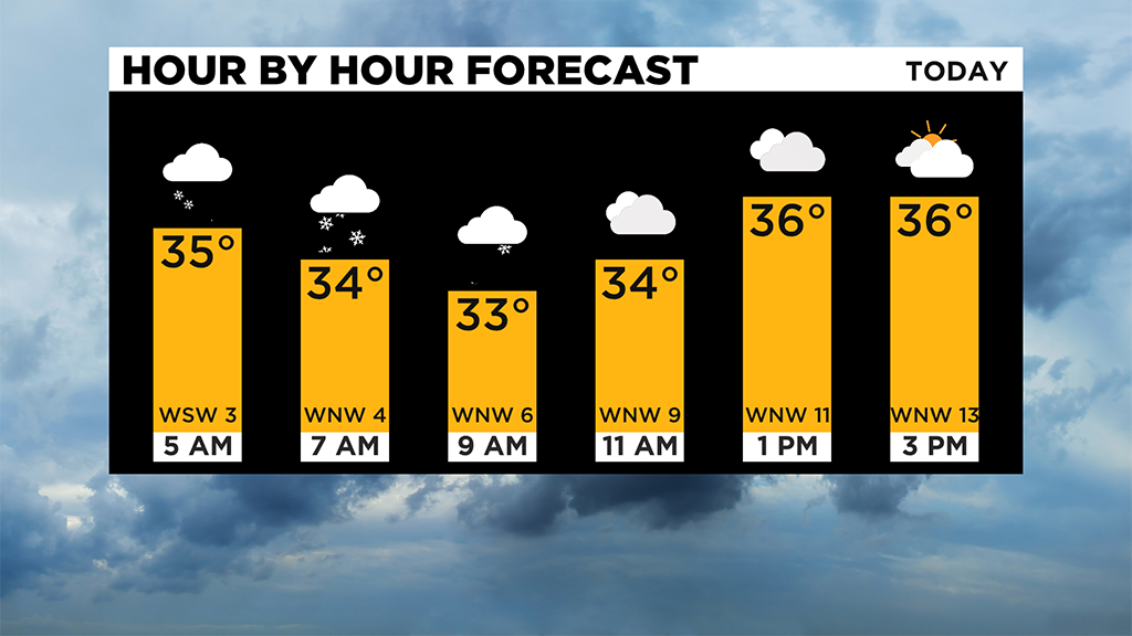
In situations like this, you may see some brief whitening of grass during the morning in Allegheny County, but with temperatures staying above the freezing mark along with ground temperatures above freezing, any snow on the ground will melt relatively quickly.
Total snow amounts of maybe 1/2" could fall for Pittsburgh, but at the end of the day there won't be any snow actually on the ground.
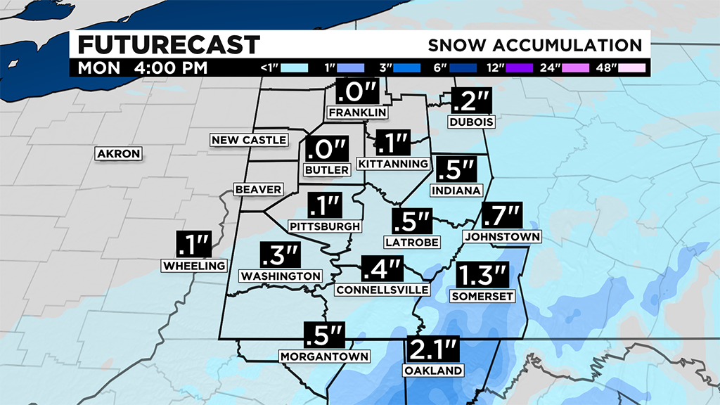
The heaviest of the snow is expected to fall during the morning hours with perhaps some flurries flying for the afternoon hours.
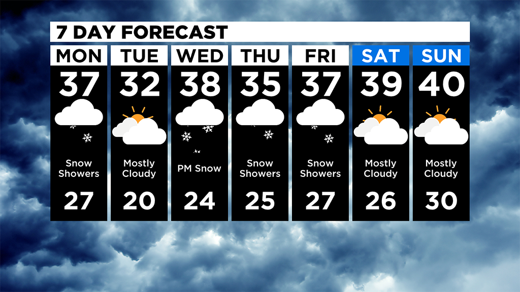
Taking a look at the week overall, it appears this will be a chilly week.
We should see a fairly long stretch with temperatures at or below freezing starting on Tuesday morning and continuing through Thursday morning.
Skies are expected to be cloudy throughout this entire time, meaning no big ups and downs with temperatures through the days.
Highs will most likely be near 30 degrees with morning lows in the mid to low 20's. Thursday and Friday afternoon should see temperatures just below the seasonal average of around 40 degrees.
Highs on Saturday and Sunday will likely be in the mid-40s.
While I don't like to talk about the 'next on after this one' snow storm, I do want to mention that the Wednesday through Thursday system could drop lots of snow in higher elevations and north of I-80.
How much snow? Well, historical data shows that this type of setup drops more than 6" of snow a whopping 50% of the time in these regions.
For other places like Pittsburgh, the amount of snow will be far less. Probably above 2", but not more than 4" anywhere that isn't in those other regions.
Obviously, things can change as the system is just this morning coming inland from the Pacific off the coast of Washington.
Obviously, a lot can change, but for now, many things are pointing to us being impacted including model consistency.
We will have a much better idea of what to expect over the next 24 hours.
WEATHER LINKS:
Current Conditions | School Delays & Closings | Local Radar | Weather App | Photos
Stay up to date with the KDKA app, which you can download here.