Pittsburgh Weather: Snow Expected To Begin Wednesday Afternoon, High Totals Forecast
PITTSBURGH (KDKA) - A historic snowstorm is certainly possible today with big snow totals being forecast. This month, we have already seen one snowstorm that dropped nearly 7" of snow.
That storm, on the first of the month, dropped the second most snow over the past five years in Pittsburgh and the fifth-most snow in a day since 2010, as well.
WEATHER LINKS:
Current Conditions | School Delays & Closings | Local Radar | Weather App | Photos
Buckle up, because this system could potentially drop more.
How much snow could there be?
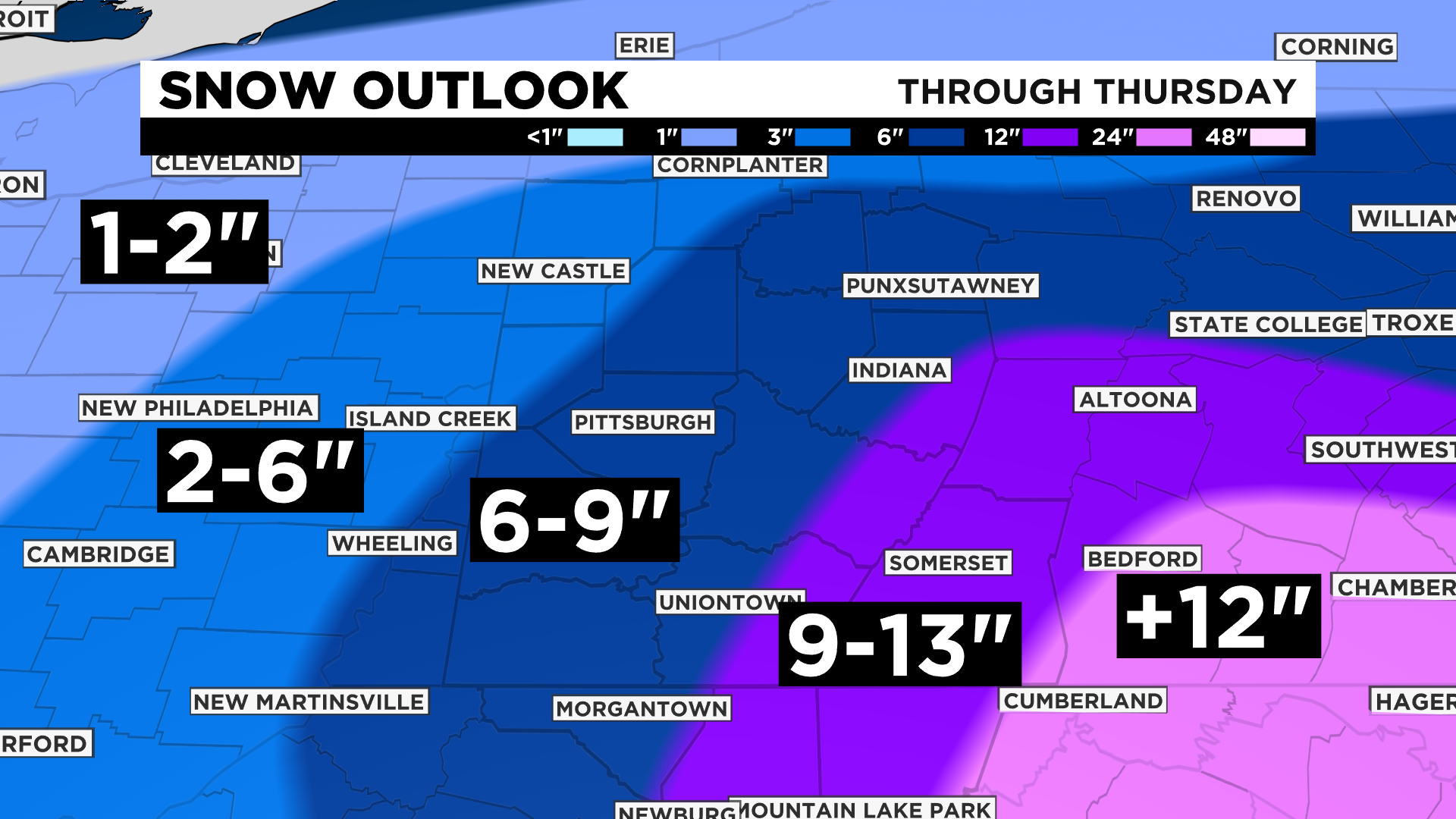
Going by the GFS long-range model, it could be 6-10 inches, depending on the snow ratio. It's always safe to go 15:1, at least for Pittsburgh, and that would put the area in the 8" range.
Another popular model, the EURO, is forecasting 10"-15" of snow, depending on the ratio. That is just a ridiculous amount of snow.
If anything, raw model data is showing that our snow forecast is too low.
At this point, there are really two options: there will be a snowstorm of historic proportions or a busted forecast with some of the forecasted snow coming in as rain.
The chances for a busted forecast are going down by the hour and road crews are right to be preparing for historic snow levels.
So, what should you expect?
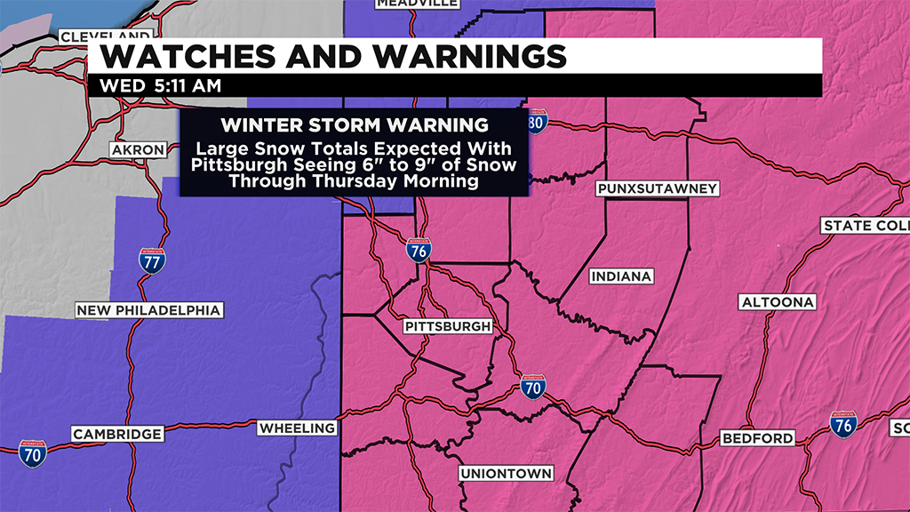
Things officially get kicked off at 7:00 a.m. this morning as all advisories and warnings begin at that time.
There likely won't be anything on the radar at that time, to be honest. Model data has been fairly consistent with little-to-no snow arriving before noon with the evening drive home being the time that will be most impacted.
Use the morning hours to be prepared. With temperatures for the day hovering around the freezing mark, this is expected to be heavy and wet snow.
Once it gets going, probably in the afternoon and evening hours, power outages could be expected, so make sure the mobile devices are charged and the flashlights are ready.
Going with the forecast, snow chances before noon are on the low side, snow really begins rolling in from the south, moving to the northeast, as the afternoon approaches.
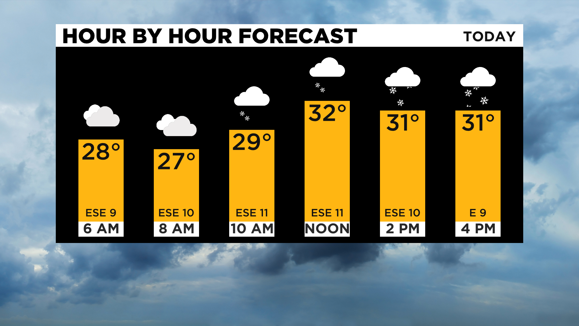
With the temperature near freezing, expect a heavy and wet snow that will cover the ground quickly. Snow rates will pick up quickly and the evening commute is expected to be challenging. Road conditions will continue to be poor through the evening with the heaviest snow occurring from around 7:00 p.m. through around midnight.
At this point, there could be snow rates topping an inch an hour in some places with whiteout conditions possible.
Do not be on the roads unless you absolutely need to be - if you have to be, allow road crews a wide area so that they can work and do what they need to do.
Almost as quickly as snow starts up, it will come to an end shortly after midnight for most places.
As of 4:30, NWS Pittsburgh says their office in Moon had measured 4.3 inches of snow, breaking record snowfall for this date, which was 1.9 inches in 1890.
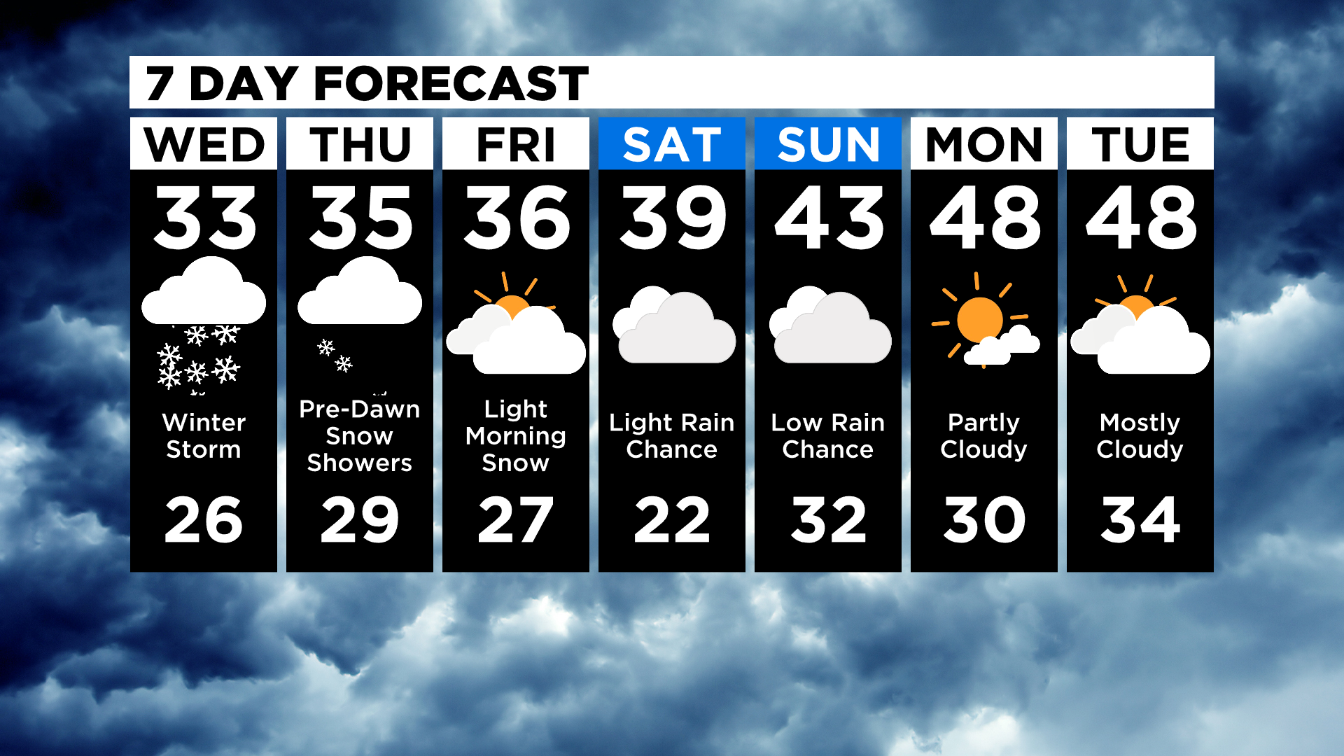
Looking ahead, most of the rest of the day on Thursday will be dry and windy. There is still a small snow chance on Friday morning, possibly just before midnight on Thursday, with some light around both Saturday and Sunday.
Of note, generally, there is a drop in forecast temperatures after a big snow with snow on the ground.
At this point, it looks like temperatures in the low 30s for Wednesday and Thursday. Highs in the upper 30s on Friday and 40s being possible through the weekend.
Stay up to date with the KDKA app, which you can download here.