Pittsburgh Weather: Wednesday Brings Warm Temperatures And Some Sunshine
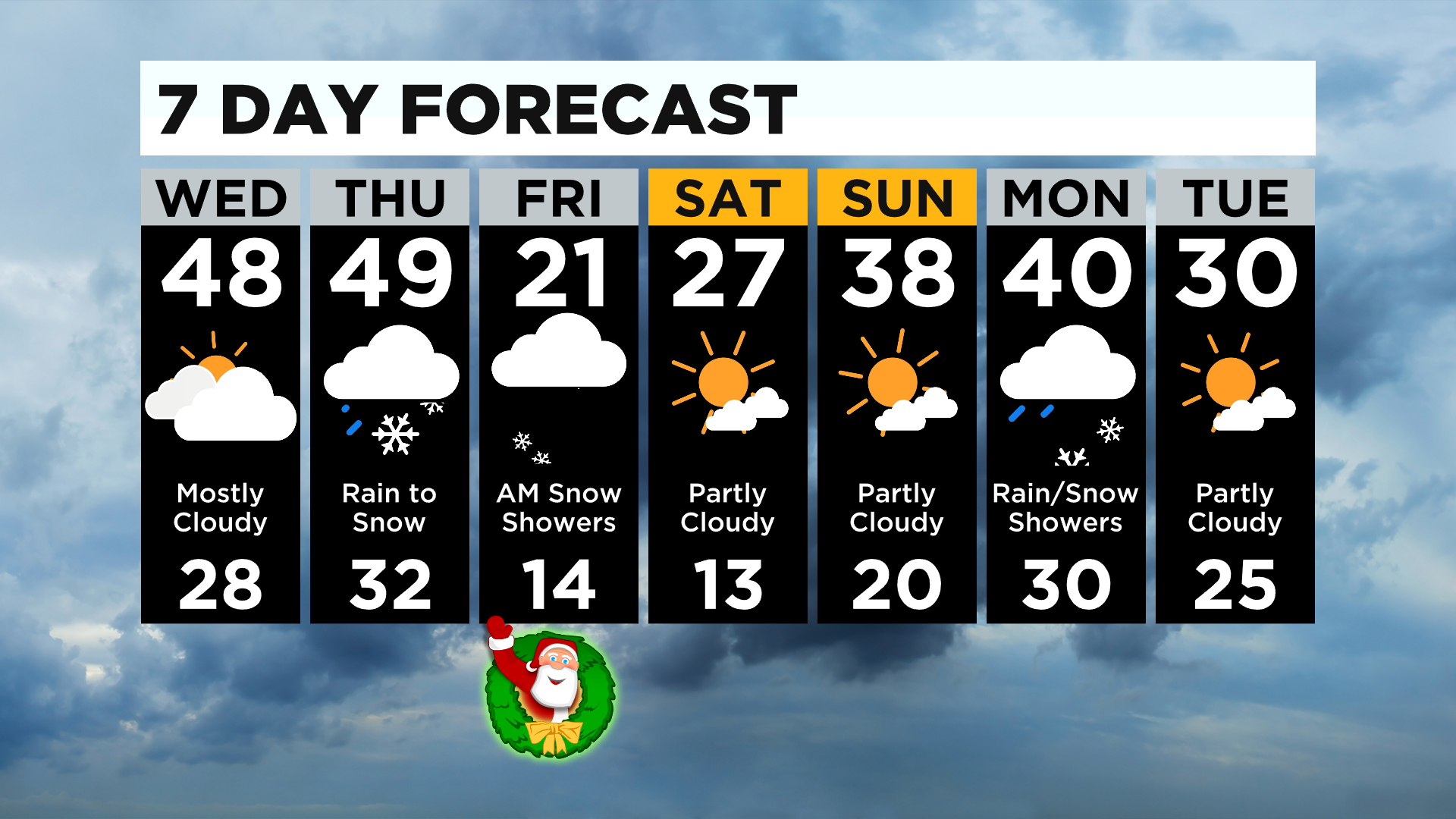
PITTSBURGH (KDKA) - Today's a day to enjoy with highs in the upper-40s with a little bit of sunshine.
Rain arrives overnight tonight, and we'll stay around 40 degrees overnight and early tomorrow morning. By the afternoon, the coldest air that we've seen so far this season begins to filter in.
WEATHER LINKS:
Current Conditions | School Delays & Closings | Local Radar | Weather App | Photos
Daytime temperatures look to be in the mid-30s and we'll see a transition to snow around dinner time.
Most areas will get around .50-.75" of rainfall at the onset of the system. It'll take a little time for the ground temperature to catch up with the air temperature but it looks like we'll have a White Christmas!
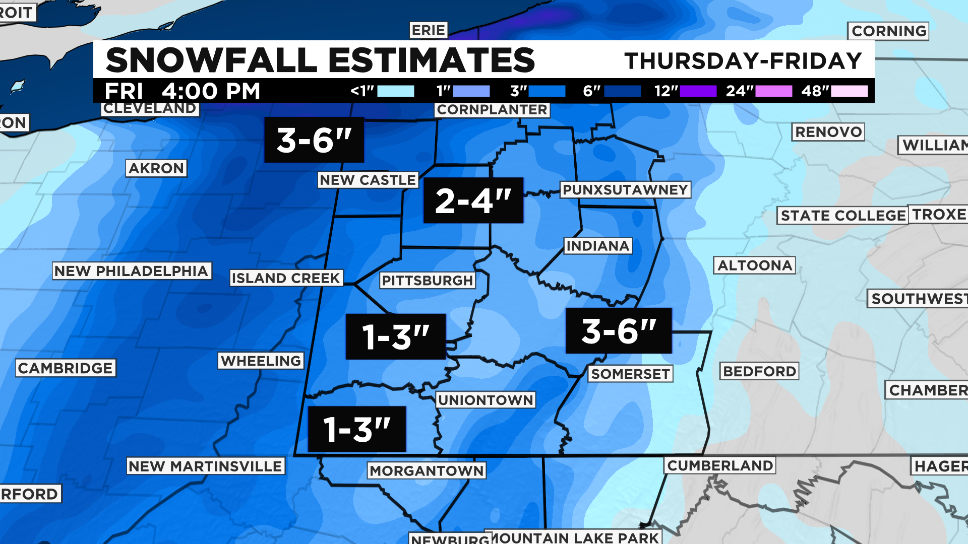
The only downfall is travel will be tricky on Christmas Eve. Early estimates are around 2-4" for the region with 3-6" possible north of I-80 and along the ridges. Areas southwest could end up with a little less than the 2-4".
Highs on Friday will be some of the coldest air we've seen so far this season, only making it to the low-20s for our highs around midnight and then temperatures drop to the teens in the afternoon with single-digit wind chills.
Saturday, we'll dry out but our highs struggle to make it to 30, but we will see some sunshine.
Then, we'll be back to average highs on Sunday and stay dry with more sunshine.
Stay up to date with the KDKA app, which you can download here.