Pittsburgh Weather: Winter Weather, Snow Chances
PITTSBURGH (KDKA) -- Winter weather has returned! We are waking up to temperatures in the mid-20's and even some patchy dense fog.
There's a Winter Weather Advisory for Garrett County in Maryland, and Preston and Tucker Counties in West Virginia.
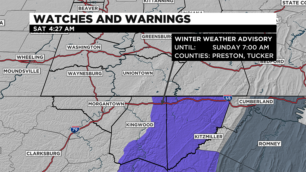
This advisory has been issued until Sunday evening, where the most accumulation is expected this weekend.
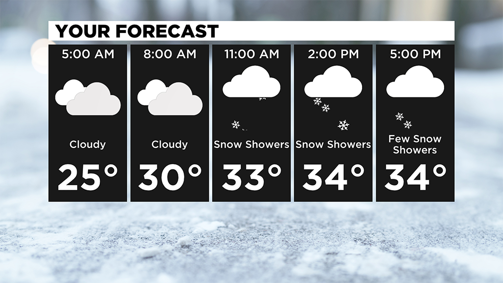
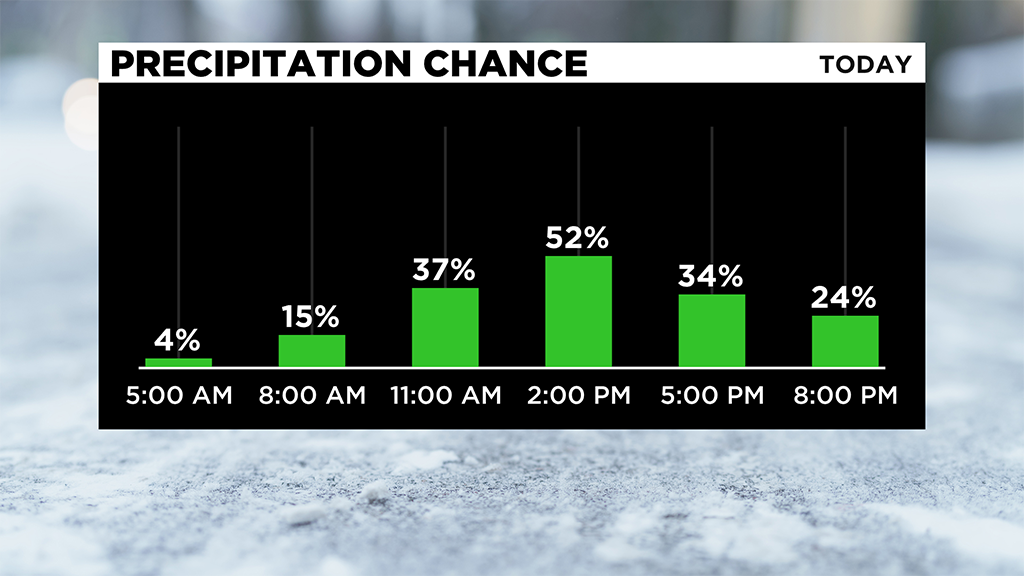
Snow showers will return later this morning and afternoon with a few heavy bands possible.
Lake enhanced snow showers take over for Sunday, which is when places along the ridges will pick up the most accumulation.
An inch or less is expected for the Pittsburgh area.
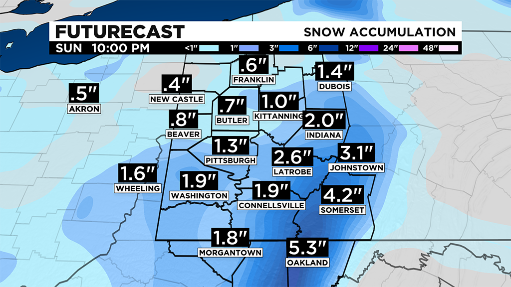
Ridges and higher elevations by Sunday evening could pick up 4-5" and areas north of Pittsburgh could pick up 1-2".
Temperatures will stay seasonable in the mid-30's.
Monday, we will be mostly cloudy with a flake around, but no additional accumulation is expected.
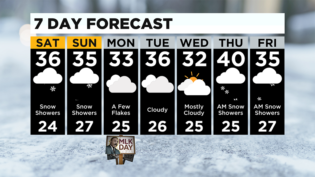
The weeks temperatures will stay in the mid-30's.
WEATHER LINKS:
Current Conditions | School Delays & Closings | Local Radar | Weather App | Photos
Stay up to date with the KDKA app, which you can download here.