Pittsburgh Weather: Wind Chills Driving Temperatures Into The Single Digits
PITTSBURGH (KDKA) - Good morning...cold weather has arrived.
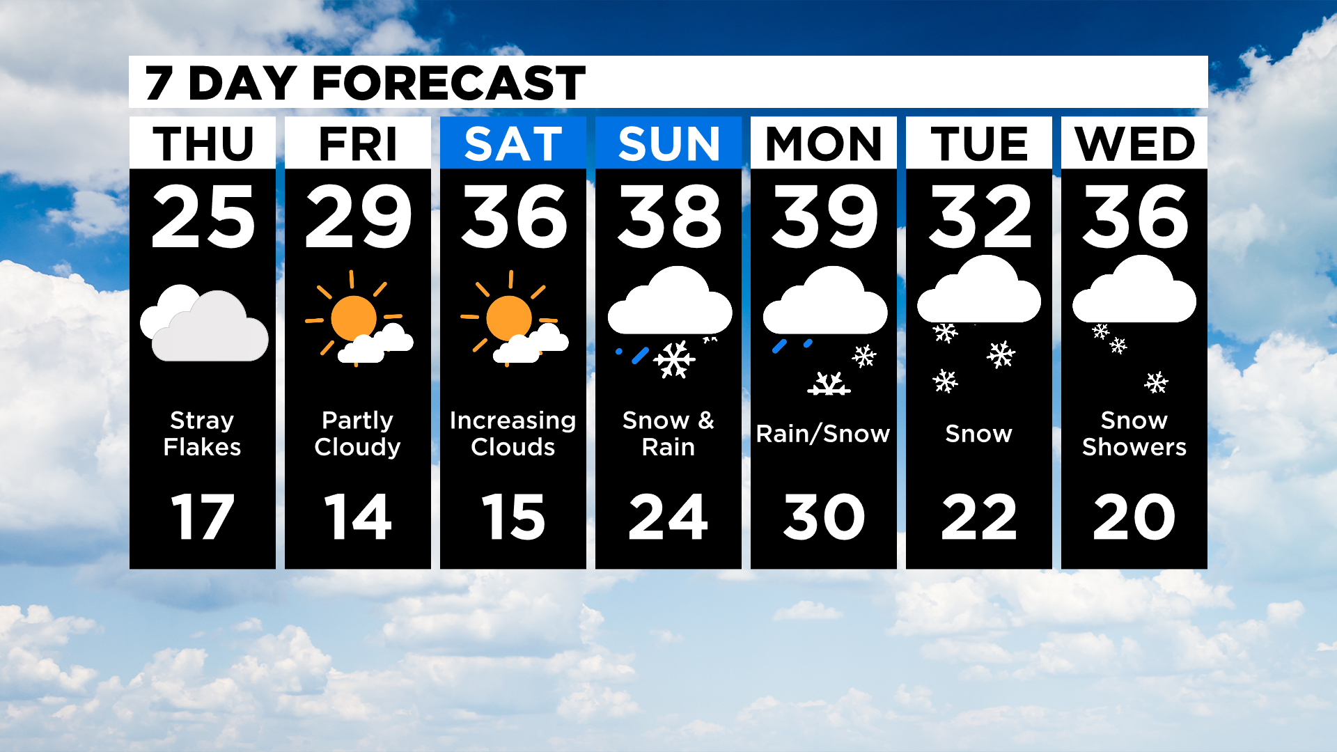
No, like really cold weather, with highs this afternoon just getting back to the mid-20s.
WEATHER LINKS:
Current Conditions | School Delays & Closings | Local Radar | Weather App | Photos
Morning lows will likely fall into the teens with wind chills down in single digits.
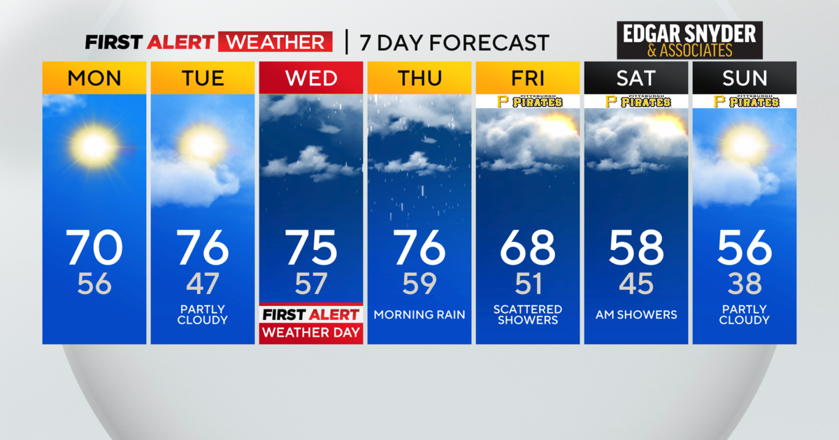
Today will be mostly cloudy and Friday will be just as cold as today with morning lows likely falling to the mid-teens.
Friday highs will get into the upper 20s with mostly sunny skies.
I am expecting the cold air mass to lift on Saturday but not before we see another brutally cold morning with temperatures in the mid-teens.
Highs on Saturday should hit the mid-30s.
I am still keeping a close eye on early next week with the potential for a major winter storm to track through our area.
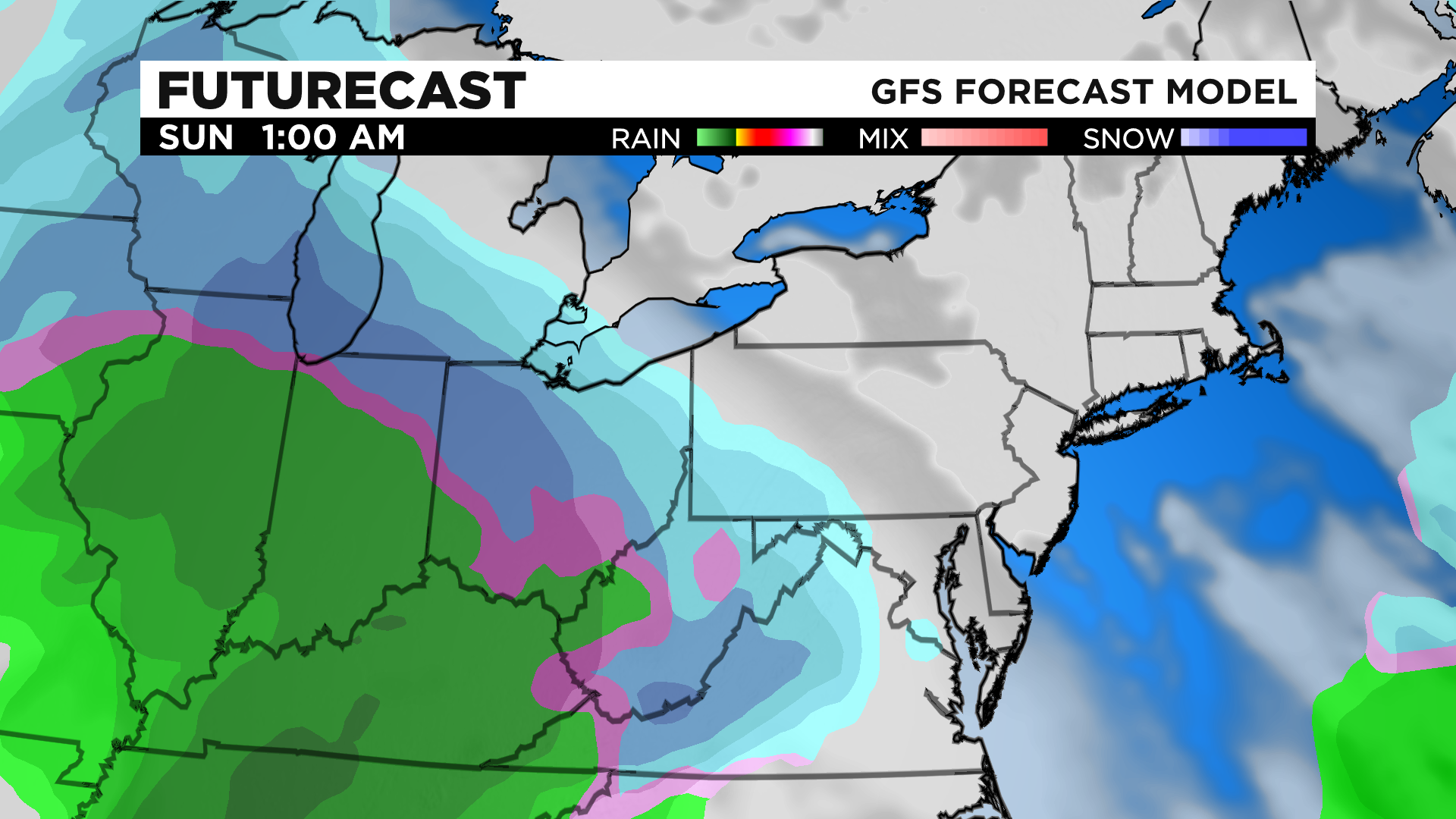
A couple of things yet to be decided.
First off is the exact track of the storm. Right now the track of heaviest snow comes right through western Pennsylvania. Also, how much will rain eat into our possible big snow totals? At this point Snow could begin as early as Sunday morning with us steadily warming up through Sunday.
Highs on Sunday will get close to 40 degrees. At some point, we are likely to see a change over from snow to rain late Sunday afternoon or evening. Then we will see another temperature drop with the rain changing back over to snow.
There is a chance for accumulating snow all the way through Wednesday morning after we see the change over on Monday. Several inches of snow is now expected.
Please be prepared.
Stay up to date with the KDKA app, which you can download here.