Winter Weather: 3-6" Of Prolonged Snowfall Expected For Pittsburgh Area
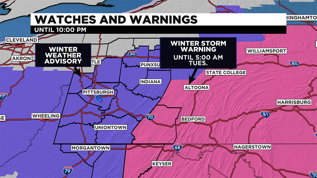
PITTSBURGH (KDKA) -- Winter Weather Advisories are in effect until 10:00 p.m. tonight.
Winter Storm Warnings for areas in the Laurels and East go until 5:00 a.m. Tuesday.
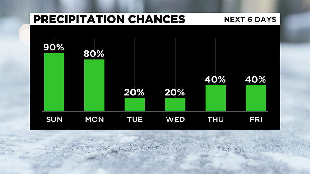
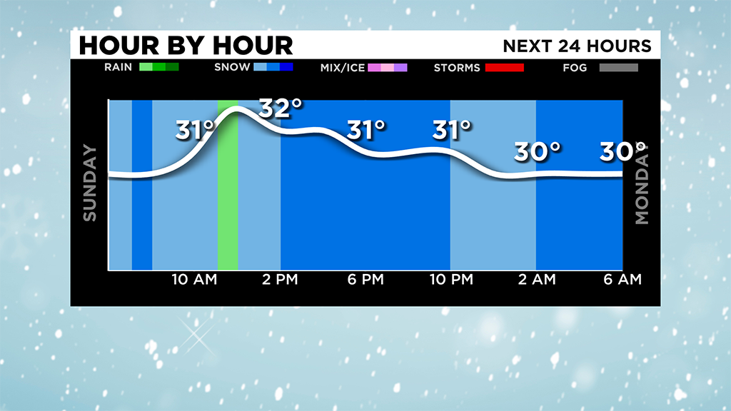
This area of low pressure is bringing snow at a rate of 1-2" per hour through the morning and afternoon.
This afternoon, a warm front will lift into the region, leaving areas south of Pittsburgh with a mix and even a brief period of freezing rain.
Less than a 1/10" of ice accumulation is expected, but roads will still be icy and slushy.
With temperatures around the freezing mark and even slightly above, this could take down snow totals for areas south of Pittsburgh to about 2-4".
Most areas will pick up 3-6" through tonight and then an additional 1-3" Monday and Tuesday.
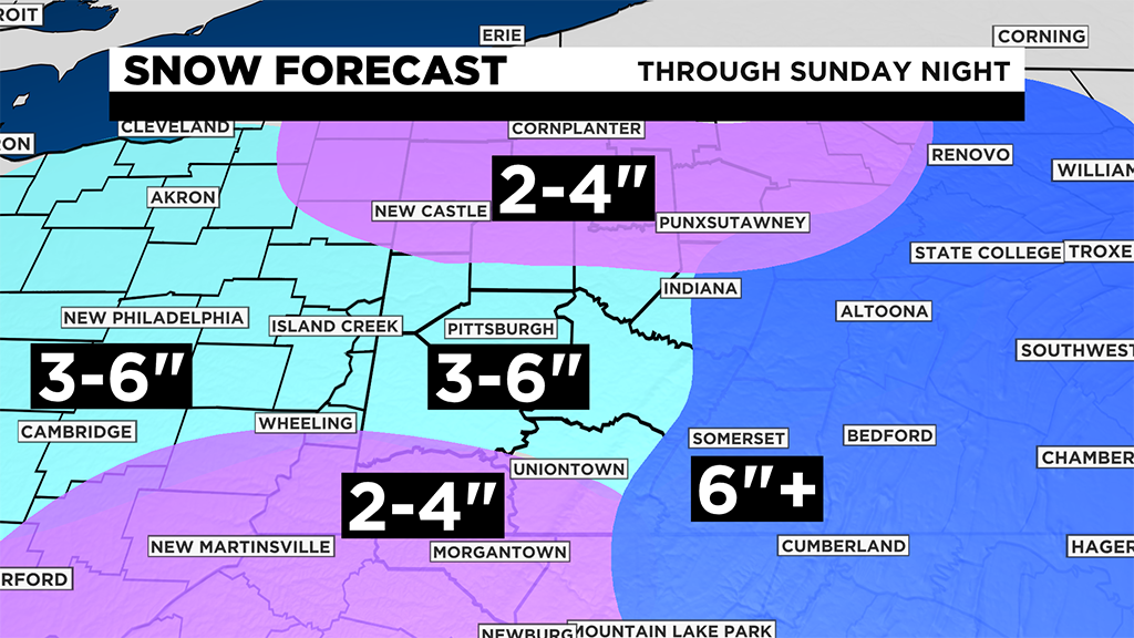
More advisories could be extended or added! Areas north should a little less of accumulation around 2-4".
Lake enhanced snow takes over Monday and that's where areas along the ridges and east will pick up most of their accumulating snow all the way through Tuesday morning of about 6-8".
WEATHER LINKS:
Current Conditions | School Delays & Closings | Local Radar | Weather App | Photos
Stay up to date with the KDKA app, which you can download here.