Pittsburgh Weather: 'Still Some Uncertainty,' But Winter Storm Could Bring Big Snow Totals Early Next Week
PITTSBURGH (KDKA) -- There are a few light scattered snow showers around this afternoon and this evening, but little to no accumulation is expected. That we can handle!
Our temperatures have been struggling to make it to 30 degrees and that's not going to change much over the weekend. Even colder air, says KDKA Meteorologist Mary Ours, will arrive for the start of the week.

She says right now we are watching two systems.
One disturbance that will move in on Saturday, but models are dialing back on snow totals. We may even see a little mix at times with temperatures right at the freezing mark. The only concern is for slick roads.
Dry air moves in Sunday, so it'll be a quiet day before some big snow totals for the start of the week.
WEATHER LINKS:
Current Conditions | School Delays & Closings | Local Radar | Weather App | Photos
There is still some uncertainty about what is to come Monday into Tuesday. What we know is a huge area of low pressure will be impacting us, but where the cut-off for rain and snow is is important.
Monday, for anyone commuting in the morning, looks to run into heavy snow. There will be a little break in the evening, then more snow and even rain/freezing rain moves in from the south.
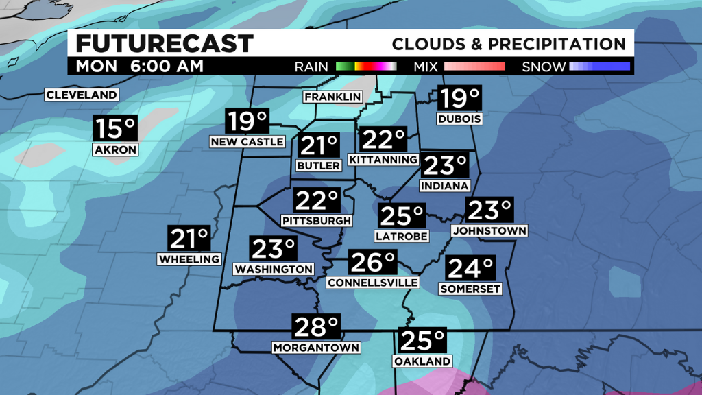
It's all dependent on how far north the warm air reaches.
Areas north of I-80 should stay all snow with significant snowfall amounts, while areas south and even in Pittsburgh could see rain, sleet and even freezing rain. We are keeping a close eye on this.
Stay up to date with the KDKA app, which you can download here.