Pittsburgh Weather: Wintry Conditions Of Heavy Snowfall, Sleet, & Ice On the Horizon
PITTSBURGH (KDKA) -- It'll be another chilly day with below normal highs right around freezing.
We will have a weak disturbance that will move through this afternoon, bringing scattered snow showers and even a wintry mix for areas south and east, but good news is models have dialed back on snow totals so little to no accumulation is to be expected.
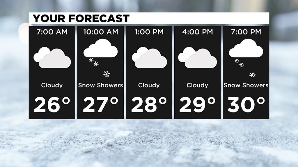
The only concern is for slick roads on bridges and overpasses and any untreated surfaces.
Dry air moves in Sunday, so it'll be a quiet day before some big snow totals for the start of the week.
The several waves of snow we are seeing arrives late Sunday and lasts through Tuesday!
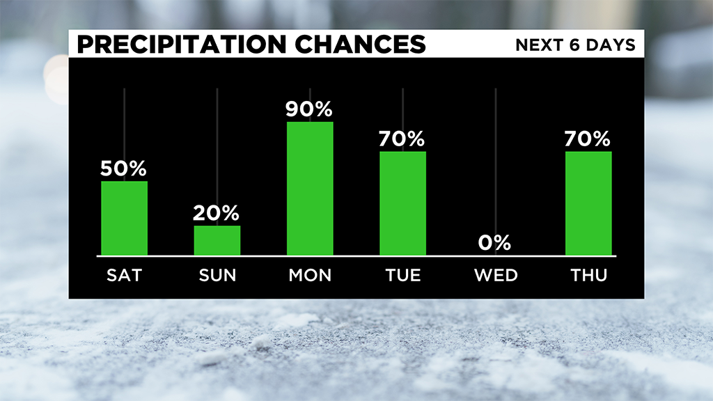
Monday into Tuesday there is still uncertainty.
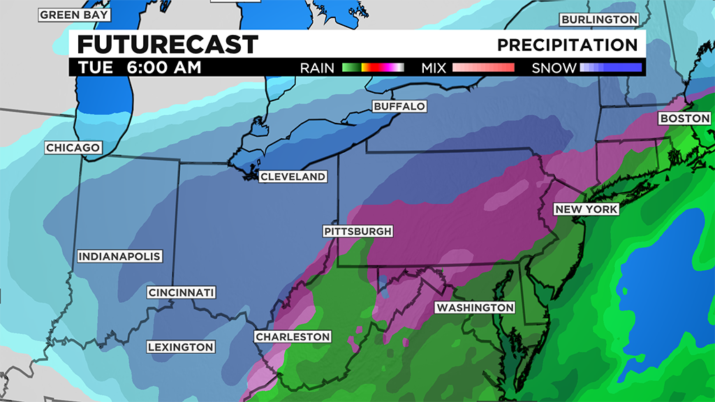
What we know is a large area of low pressure will be impacting us, but where the cut-off for rain and snow is important.
Monday morning for anyone commuting in looks to run into heavy snow picking up an inch or more in a short amount of time.
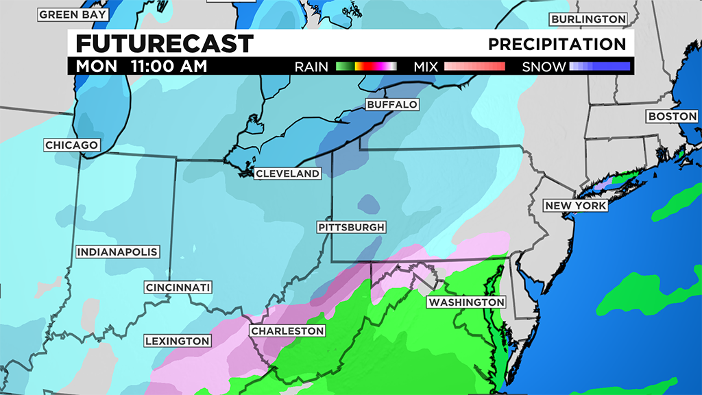
There will be a little break in the afternoon as we enter a dry slot then more snow, sleet and even rain/freezing rain moves in from the south.
It's all dependent on how far north the warm air reaches because that could take down snow totals.
Areas north of I-80 should stay all snow with significant snowfall amounts while areas south and even in Pittsburgh will see that mix of sleet and even freezing rain.
It's still too early to narrow down exactly how much snow is on the way but we will be impacted, and travel will be hazardous.
Models are pointing to about 3-6" in our region for Monday with higher amounts north and even some ice accumulation mixed in with that.
The system looks to wrap up by Tuesday afternoon and evening and we then dry out for Wednesday.
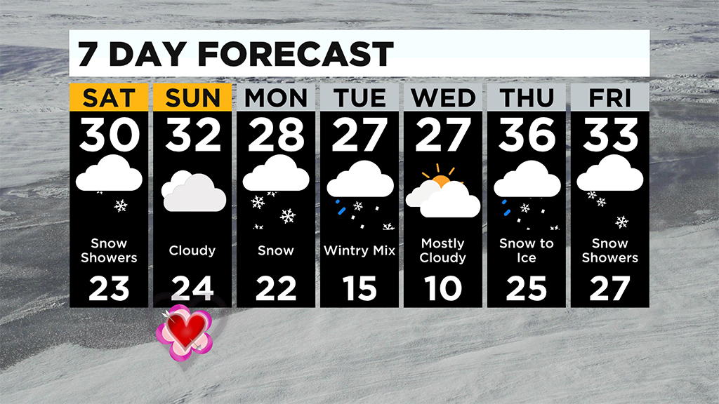
Another big thing is a refreeze Wednesday morning as lows look to drop near the single digits before we see the warmest day in a while on Thursday with highs in the mid to upper 30s but another wintry mix tracks through the region for the end of the week.
WEATHER LINKS:
Current Conditions | School Delays & Closings | Local Radar | Weather App | Photos
Stay up to date with the KDKA app, which you can download here.