Pittsburgh Weather: The Weekend Starts Cool And Cloudy
By: Ron Smiley
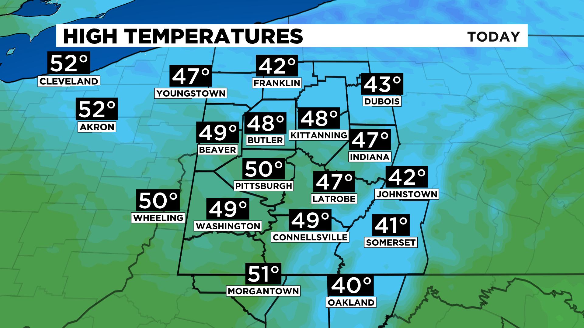
PITTSBURGH (KDKA) - Good morning, the cool, cloudy, and damp weather will stick around for another day today.
We continue to track an upper low-pressure system centered on top of Boston and moving to the east.
WEATHER LINKS:
Current Conditions | School Delays & Closings | Local Radar | Weather App | Photos
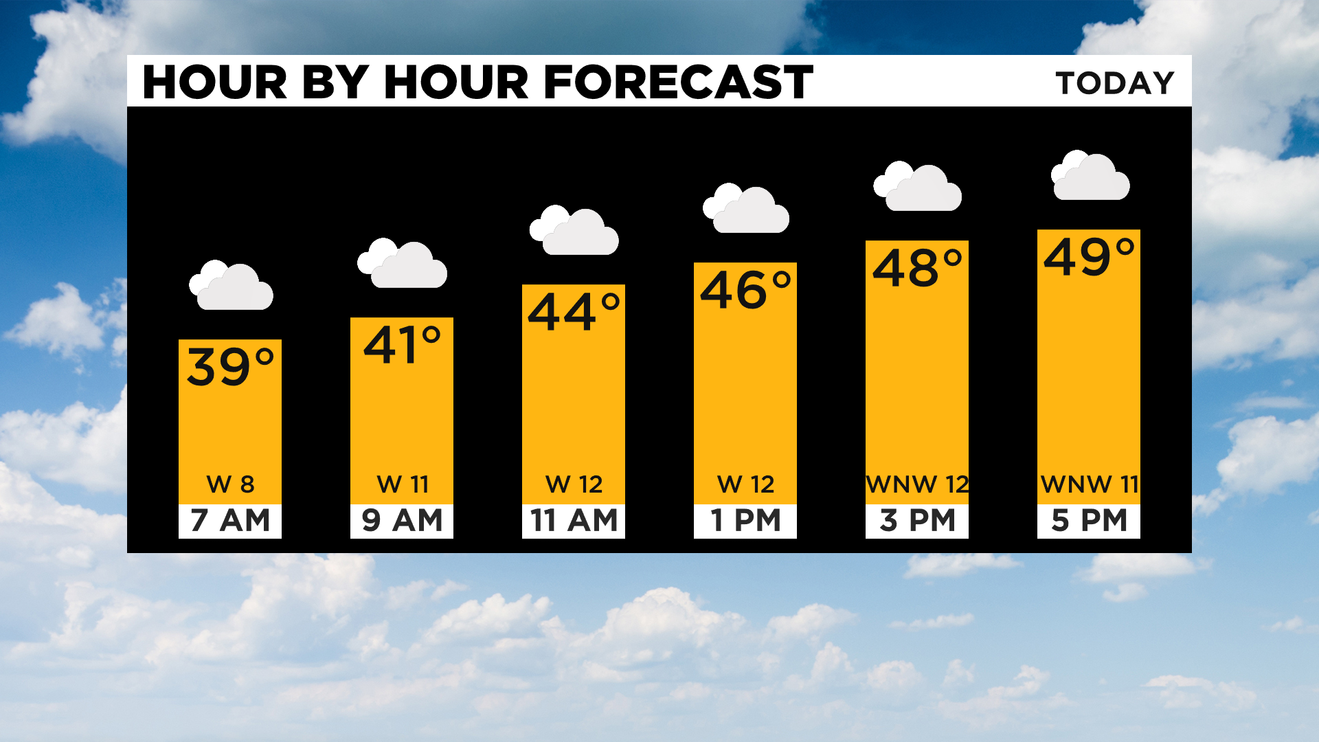
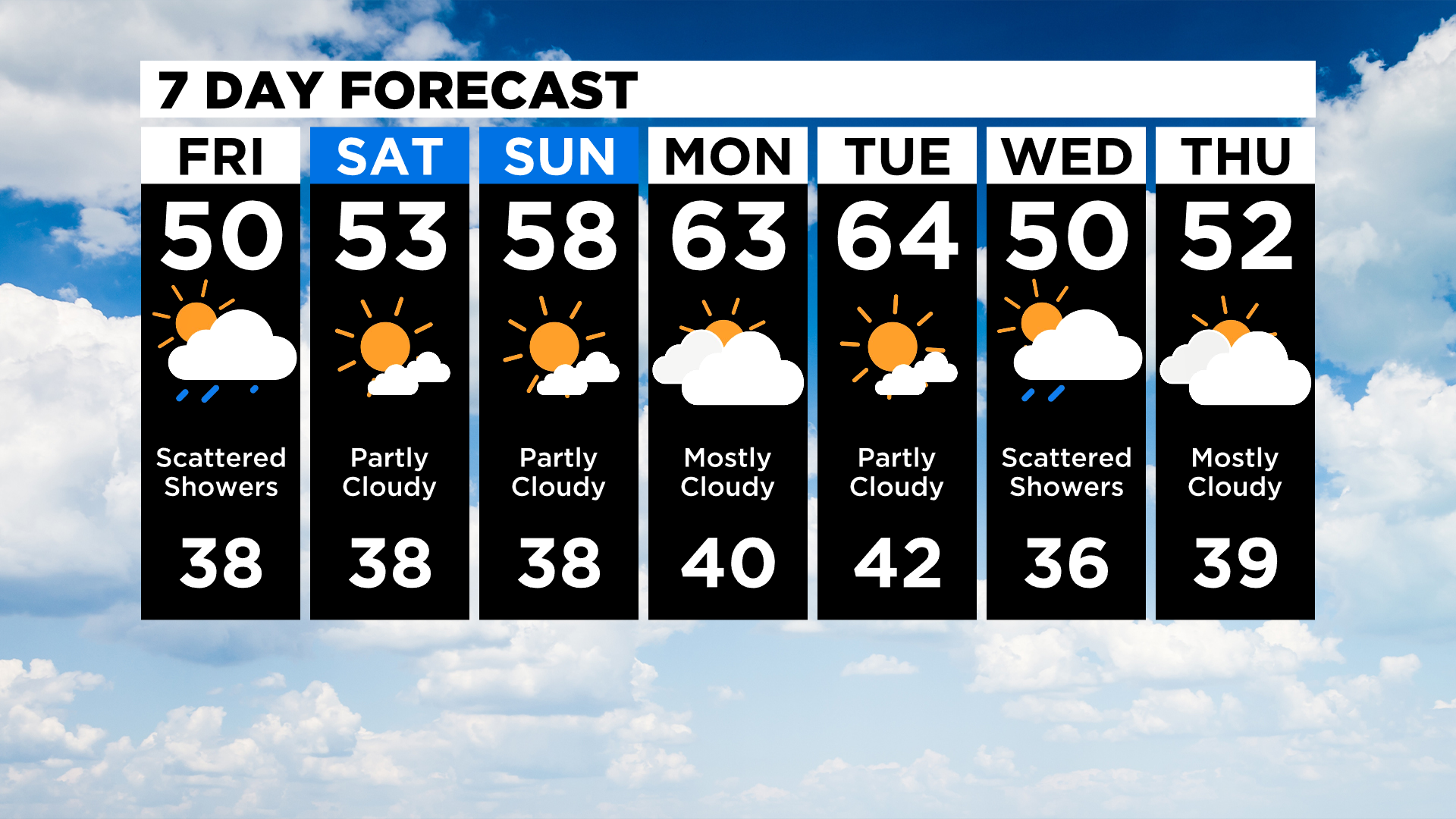
Opposite of what happened yesterday, our best chance for rain will come this morning with rain chances slowly ticking down through the late morning to afternoon hours. I am going to maintain a 20 percent chance for precipitation this evening, overnight, and into Saturday morning.
Most will be dry during this time period.
While the upper low moves away, you'd think our temperatures would start to go back up and they will this weekend. For today, our winds will be out of the west, blowing in the cool air that has pushed to the south on the backside of the system.
While temperatures do start to warm up (just a bit) on Saturday and Sunday, clear skies will continue to allow for morning lows in the 30s.
I think we hit the 60s for highs again as soon as Monday.
Looking way ahead, Monday and Tuesday may be the warmest days over the next two weeks. I warned you earlier this week that cooler air is expected to be in place over the next couple of weeks.
Cold is something we haven't seen too much of since March 1.
It's one of the reasons why Pittsburgh has seen only 0.9" of snow since the start of March and through April 15th.
Stay up to date with the KDKA app, which you can download here.