Pittsburgh Weather: Warmer Temperatures On The Horizon Following Chilly Week
By: Ron Smiley
PITTSBURGH (KDKA) - Hello, another chilly start to your day with morning lows dropping to at or below freezing.
A couple of days ago I was talking about how you'd normally expect to see the week's coldest temperatures this morning and not necessarily on Thursday like model data was showing.
Why did I think that?
This morning we are seeing clear skies, where we had cloudy conditions yesterday morning at this time and still a chance for some light snow.
WEATHER LINKS:
Current Conditions | School Delays & Closings | Local Radar | Weather App | Photos
Winds are also down this morning where yesterday we had winds gusting past 30mph.
The only concern I had with that forecast was that we would see warmer air rolling in behind last night's warm front. I still thought that the air in place was cold enough for us to see temperatures falling to a degree or two colder than yesterday and that appears to be the case.
Yesterday's morning low fell down to 31 degrees, this morning's low will be near there. It will be interesting in the end to see if we fall below or not. Model data, either way, was fairly off when comparing what it forecast for lows today as compared to what it forecast for lows yesterday.
Looking ahead, we should see plenty of sunshine this morning with clouds rolling in as we head into the afternoon. We will likely see mostly cloudy skies for a couple of hours, with skies rolling back to partly cloudy skies by the evening rush.
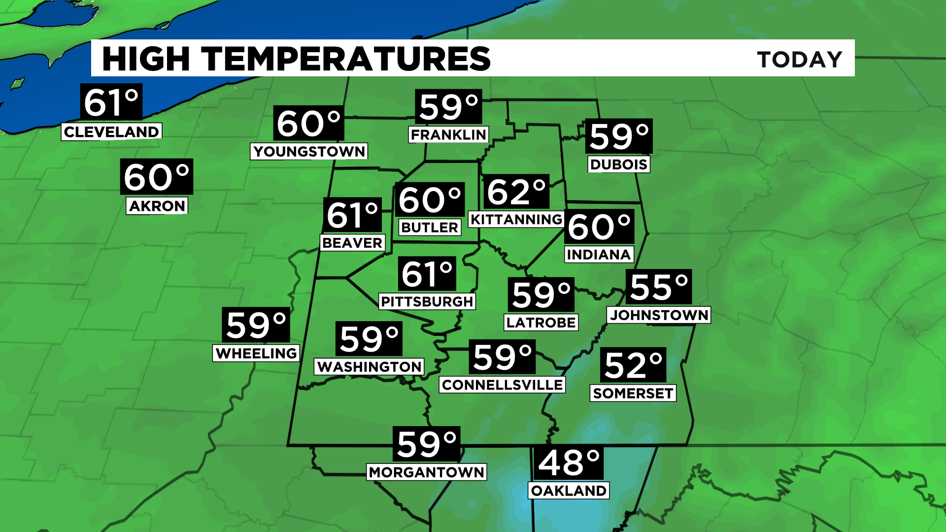
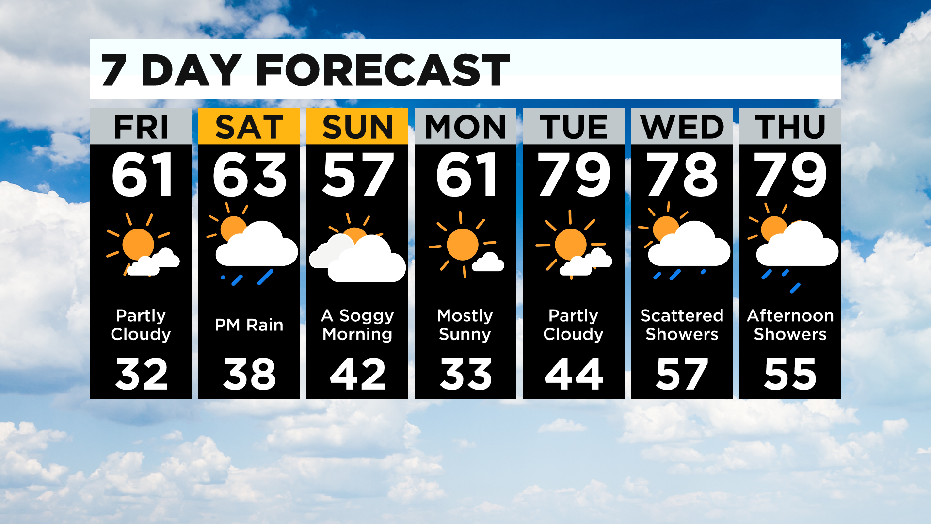
Highs today should be around 60 degrees; I have Pittsburgh hitting 61 for today's high. Noon temperatures should be in the mid-50s. Winds will be lighter than yesterday, but I still have them at 7-15mph this afternoon. Winds will be out of the west-northwest.
Saturday morning temperatures are likely to drop into the mid to upper 40s with Saturday highs near 60. Saturday will see a rain chance as we see a surface low move in from the southwest.
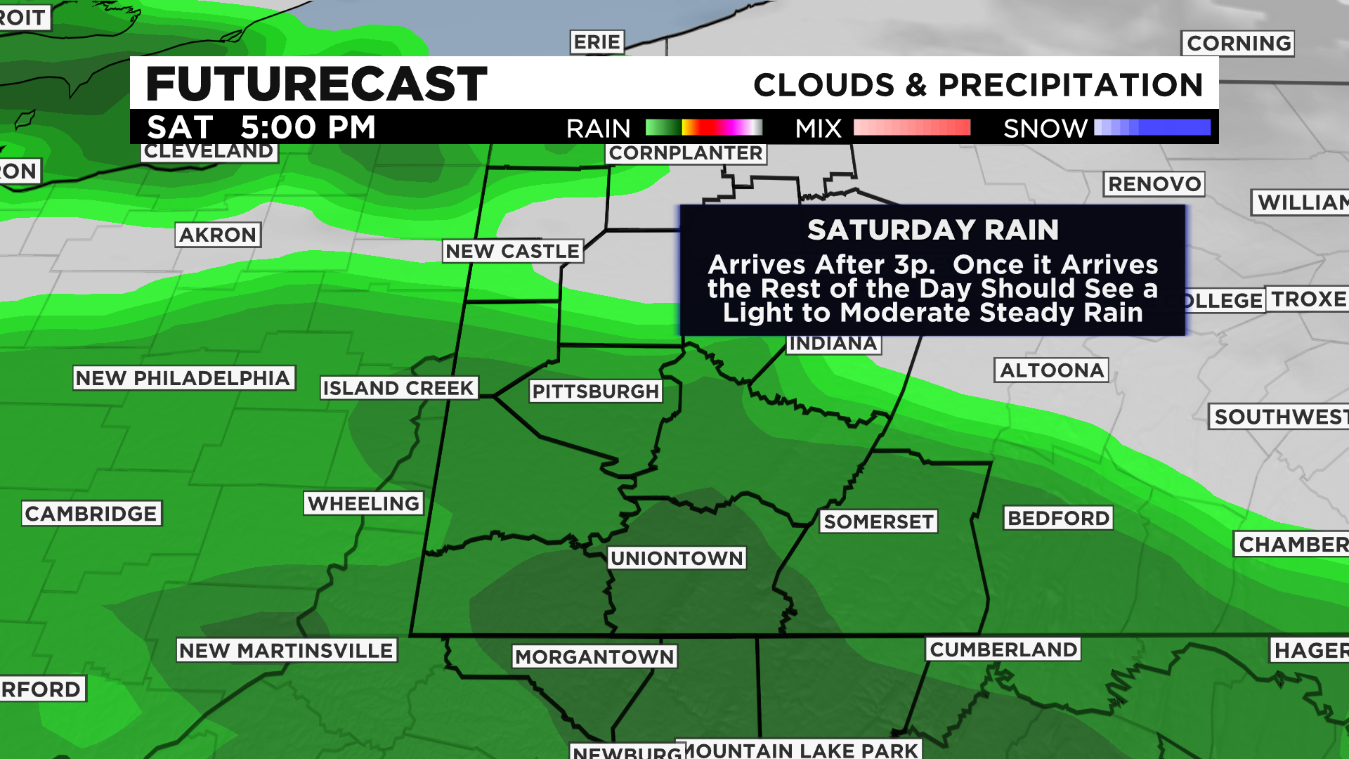
This should be all rain and interestingly enough the leading edge of this system will be a warm front, with us in the warm sector Sunday morning.
The cold front slides through at around 10:00 a.m. on Sunday, with cooler air flowing in for the rest of the day on Sunday.
Highs on Sunday will likely fail to hit the 60-degree mark.
The warm-up really arrives on Tuesday of next week.
In fact, up until then, temperatures will technically be below average for this time of the year.
Tuesday though I'm expecting highs to be in the upper 70s to near 80 degrees.
This type of weather sticks around for the rest of the workweek.
Stay up to date with the KDKA app, which you can download here.