Pittsburgh Weather: Chances Of Severe Weather, Thunderstorms
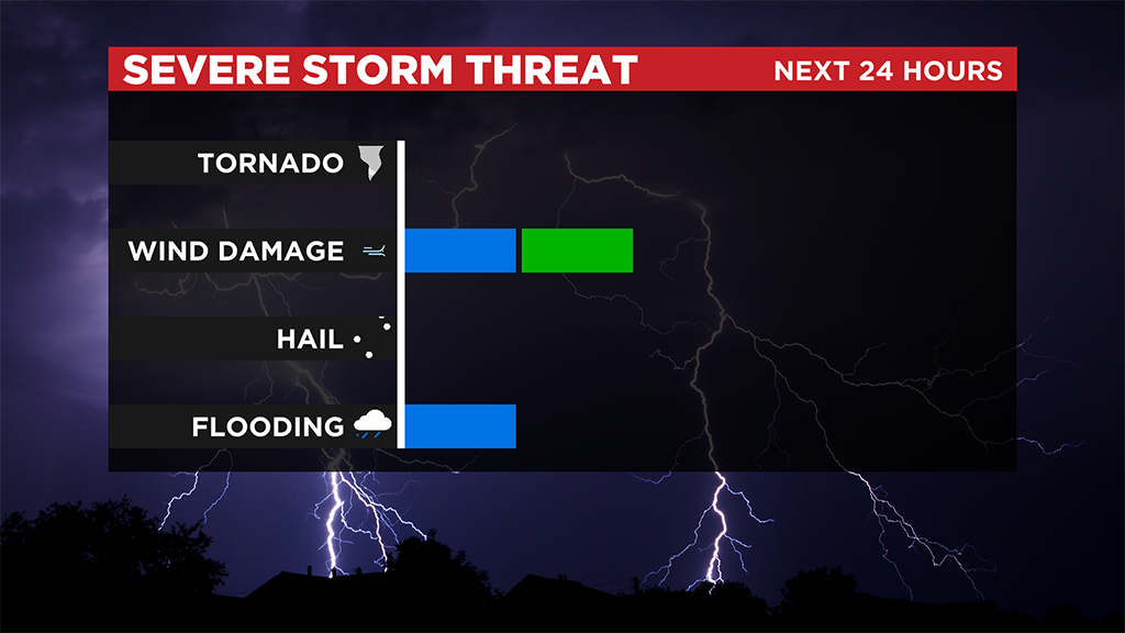
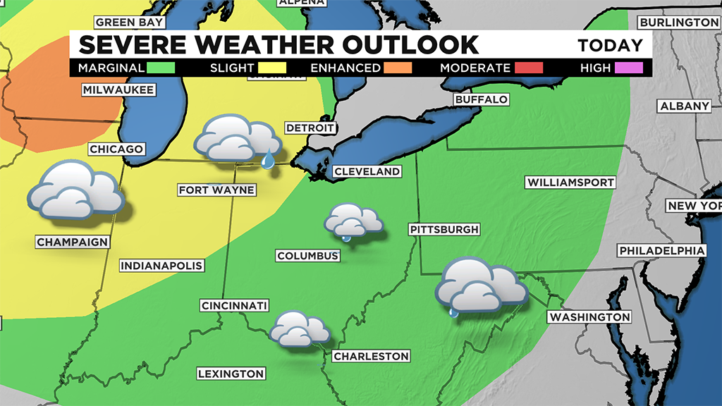
PITTSBURGH (KDKA) -- Rain and storm chances are back today. The area is under a marginal risk of severe weather with strong straight line wind being the main concern for us.
Storms also could have downpours and frequent lightning that also could pose dangers. Clearly on days like today, you should remain weather aware.

The set-up is fairly straight forward. We have a warm and unstable air mass in place.
Highs yesterday hit 90º. It was the third 90° day of the year.
To our northwest is an upper low that is slowly moving to the east. We also have strong winds in the mid-levels and dynamics of the atmosphere indicate strong wind gusts will be possible.
This set-up remains in place through the rest of the work week.
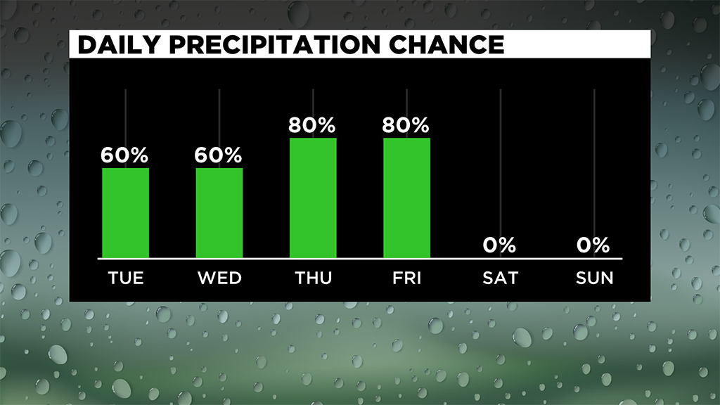
As the upper low gets closer (through Friday) our rain chances will tick up. Storm chances will also be on the rise.
At this point, we are already listed as having a marginal risk (lowest risk level out of five levels) of severe storms through Thursday. Friday will also likely be a severe storm day.
Rain and storm chances will also likely keep us out of the 90s for highs for the rest of the week.
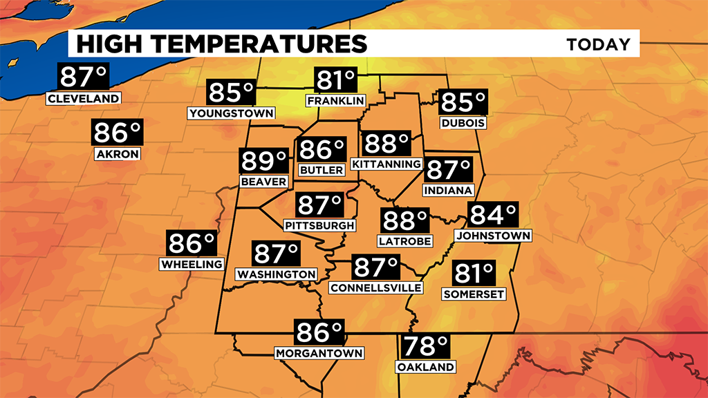
Technically the hottest air mass of the year is in place right now.
If we were expected to be dry, I'd be forecasting highs around 95 for Thursday and Friday.
Rain chances though, along with mostly cloudy to overcast skies will keep those highs in the upper 80's though.
Still hot and still plenty humid, but not one for the record books.
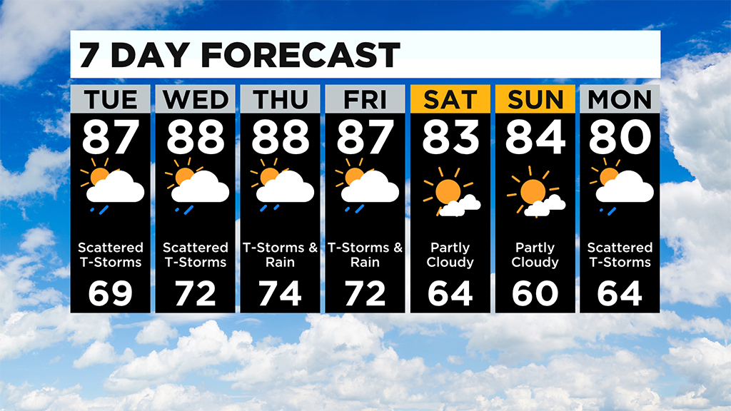
Looking ahead, the weekend is looking dry with highs in the mid to low 80s.
WEATHER LINKS:
Current Conditions | School Delays & Closings | Local Radar | Weather App | Photos
Stay up to date with the KDKA app, which you can download here.