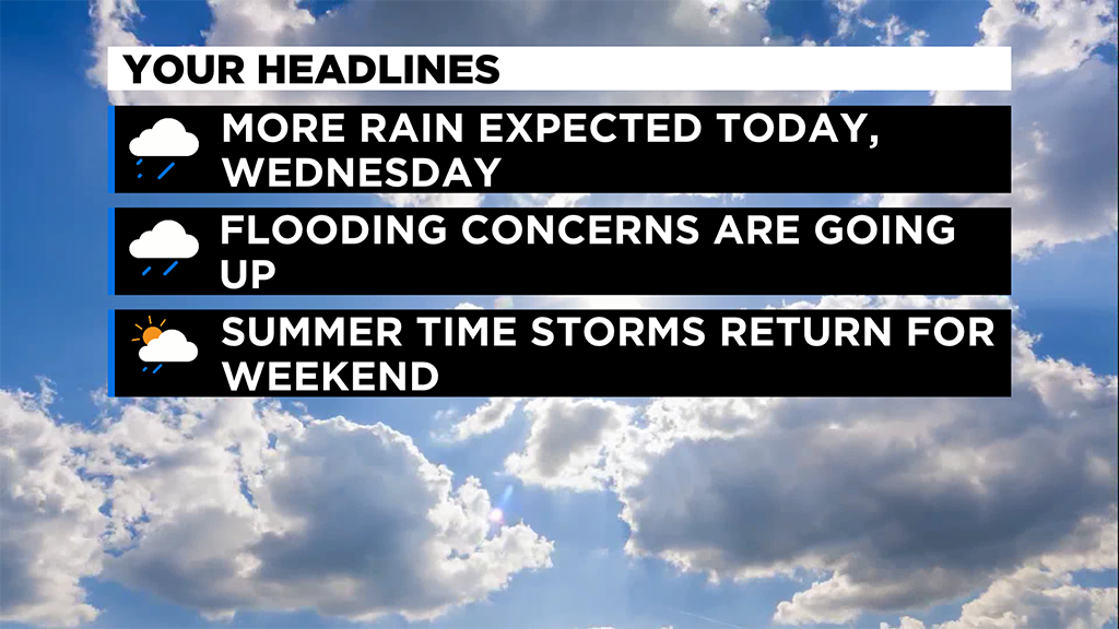
Pittsburgh Weather: More Rain Tuesday, Remnants Of Tropical Storm Fred To Arrive Soon
PITTSBURGH (KDKA) -- More rain is expected throughout the Pittsburgh area with a day similar to yesterday.
I think most folks want to know about what to expect on Wednesday as rain from post tropical Fred moves through our area so we have a lot to talk about.
Technically, today and tomorrow's rain is all part of the same big system.
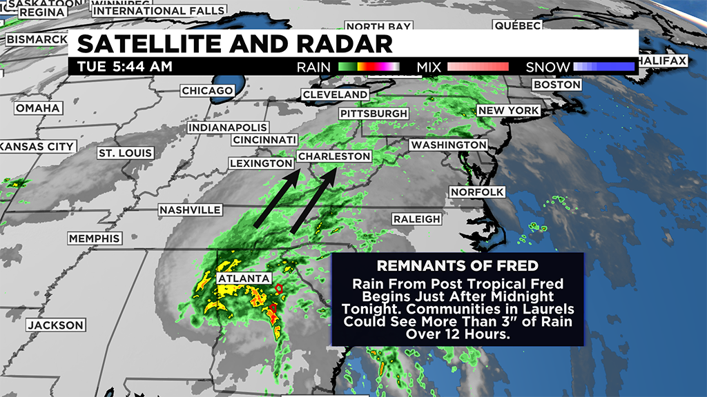
Clearly if you look at radar imagery you can see pretty clearly the storm that peaked as Tropical Storm Fred churning through Georgia. But you can also see the line of showers that extends from this area of low pressure up to our region. So technically you can see how what is happening today is part of the moisture rich environment that is now in place. Model data shows our best chance for rain comes today from 10:00 a.m. through 4:00 p.m. While this may be true, we will have a chance to see rain through the day today, tonight and tomorrow with our rain chances overall ticking up through the day today.
Most places today can expect to see around fifteen hundredths of an inch of rain. There will be isolated instances of places seeing well above that but I think for today the chance for seeing a flood advisory or warning is low.
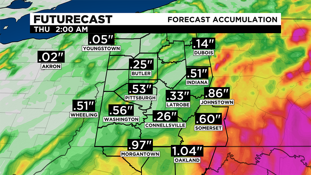
The flooding chance for Wednesday will be high though with some areas potentially seeing more than 3" of rain.
My biggest concern for short term flooding of a day occurs for places in the Ridges and Laurels.
This should translate into an extended river flooding risk lasting into early next week for the Allegheny and the Ohio. Expect the usual suspects when it comes to high water levels including the Ohio River at the Point that would impact downtown Pittsburgh.
Moving back to today's weather.
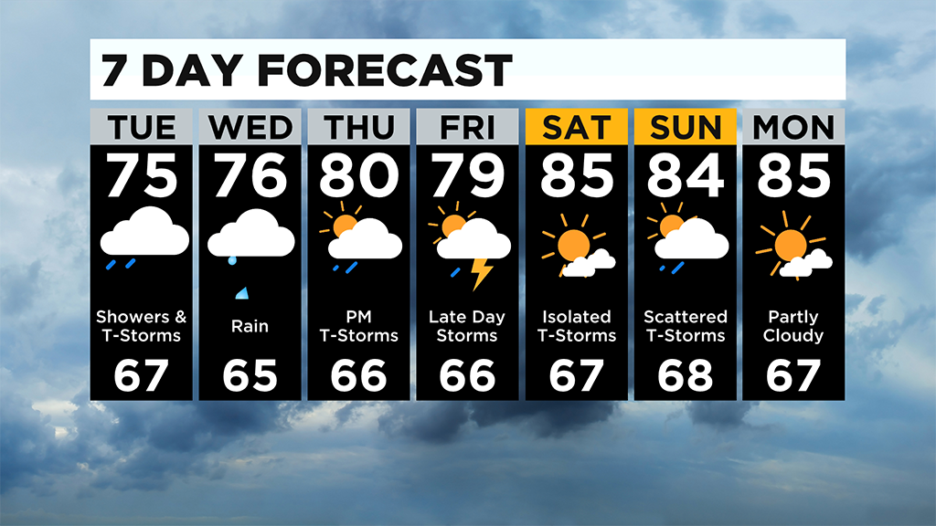
There will be rain around. Highs should be similar to yesterday's 74°. I have Pittsburgh seeing a high of 75°. It will be VERY humid.
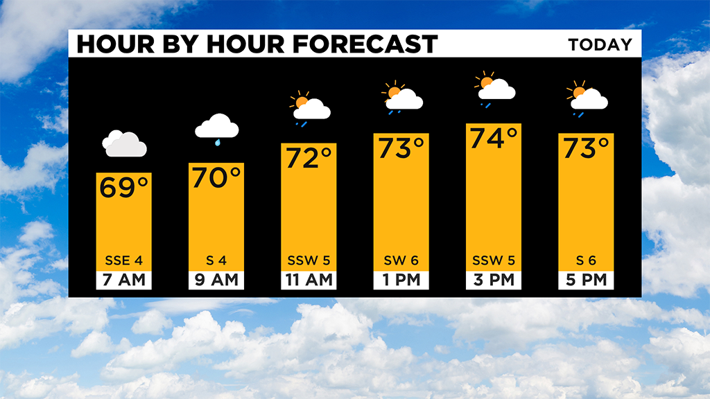
Your comfort level will be low with humidity so high. Morning temperatures are near 70 with noon temperatures expected to be in the low 70s.
Looking ahead, we get back to a more summertime pattern heading into the weekend. Rain chances will be in the isolated range on Thursday, and more scattered for Friday, Saturday and Sunday.
Rain chances should be back to peaking in the afternoon to evening hours during the hottest time of the day. Highs will also be back above average with weekend highs expected to be in the mid 80s and morning lows near 70 degrees.
WEATHER LINKS:
Current Conditions | School Delays & Closings | Local Radar | Weather App | Photos
Stay up to date with the KDKA app, which you can download here.