Pittsburgh Weather: NWS Confirms Tornadoes Touched Down In Western Pennsylvania On Thursday Night
PITTSBURGH (KDKA) - Two tornados happened last night in Allegheny County along with straight-line wind damage around the region.
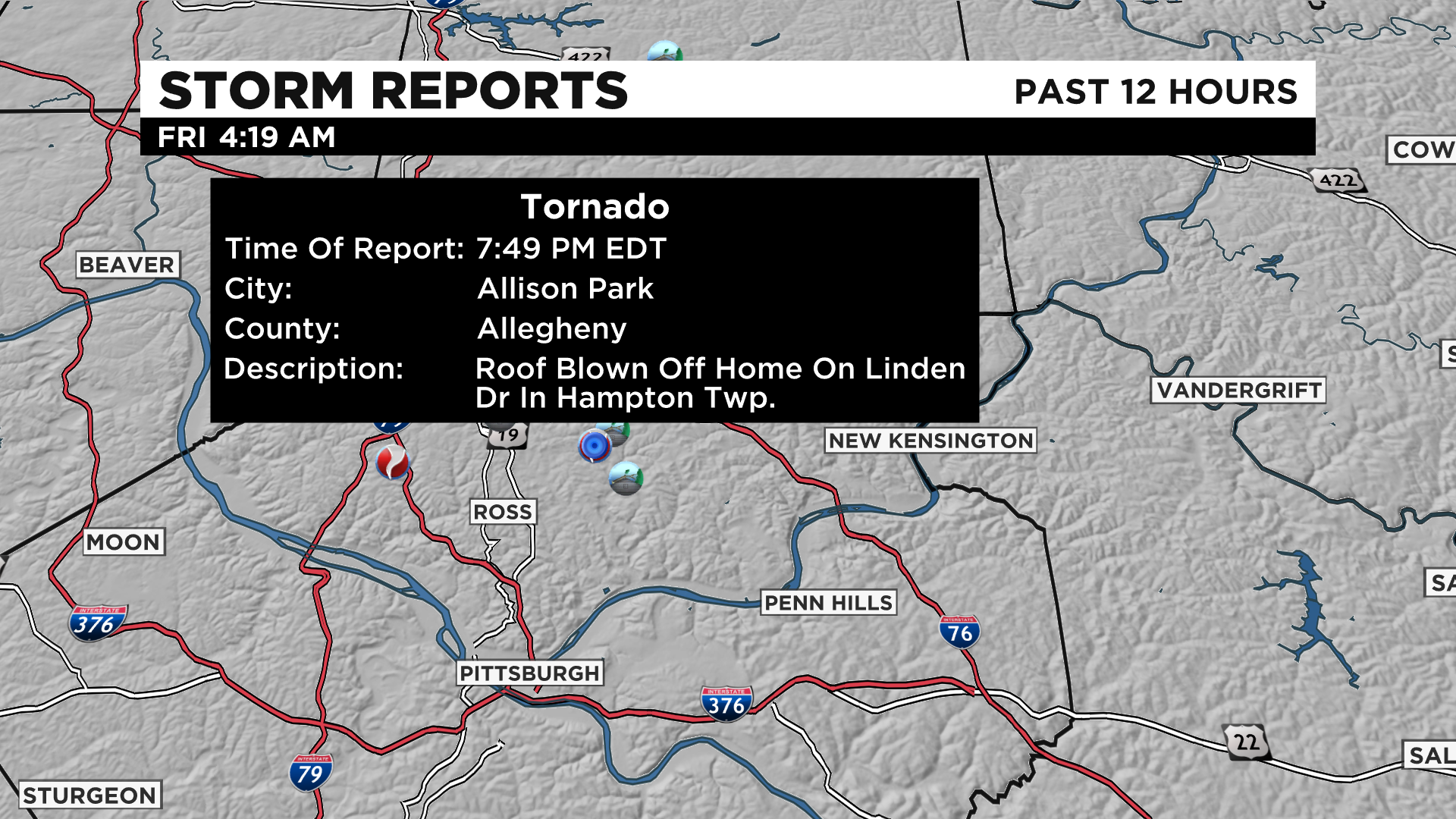
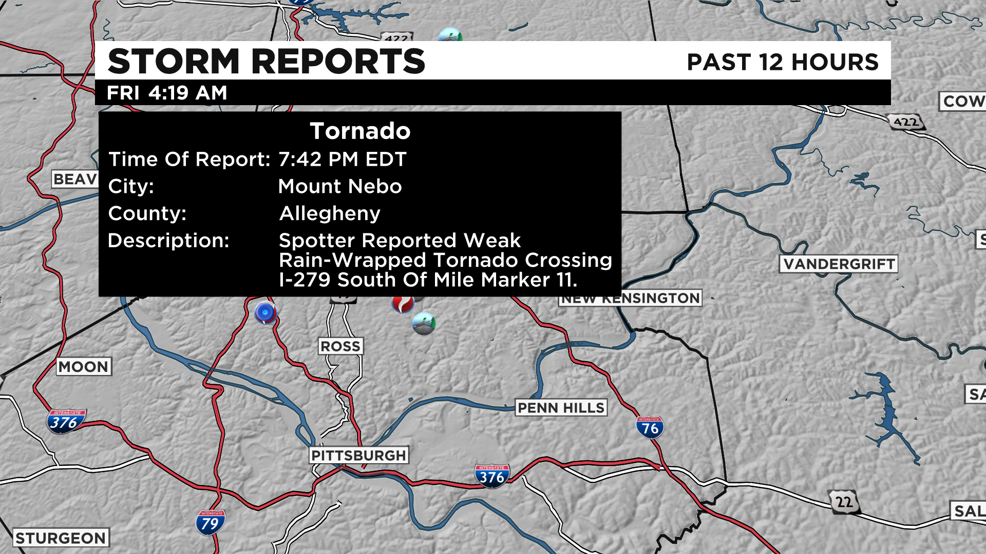
The National Weather Service confirmed tornadoes touched down in Hampton Township as well as Mount Nebo.
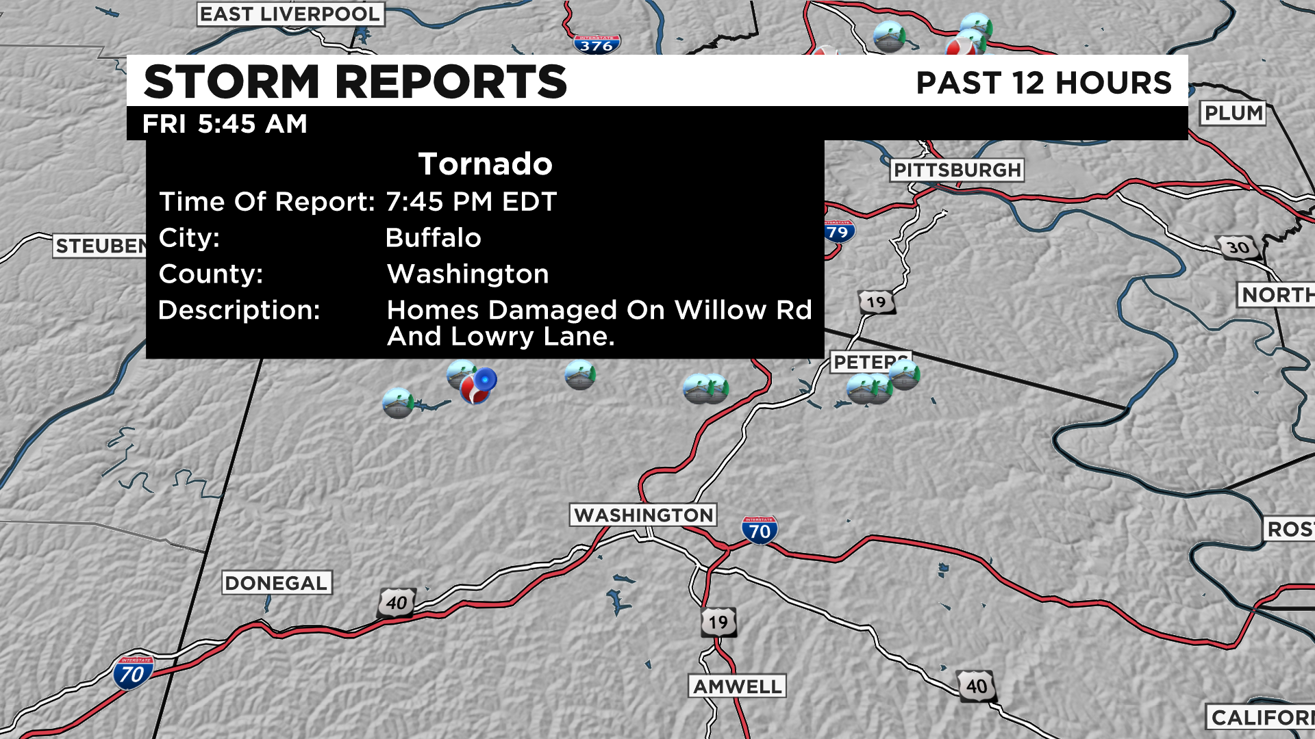
They also confirmed a tornado touched down in Buffalo Township in Washington County.
Crews will be out surveying today so check back for updates.
WEATHER LINKS:
Current Conditions | School Delays & Closings | Local Radar | Weather App | Photos
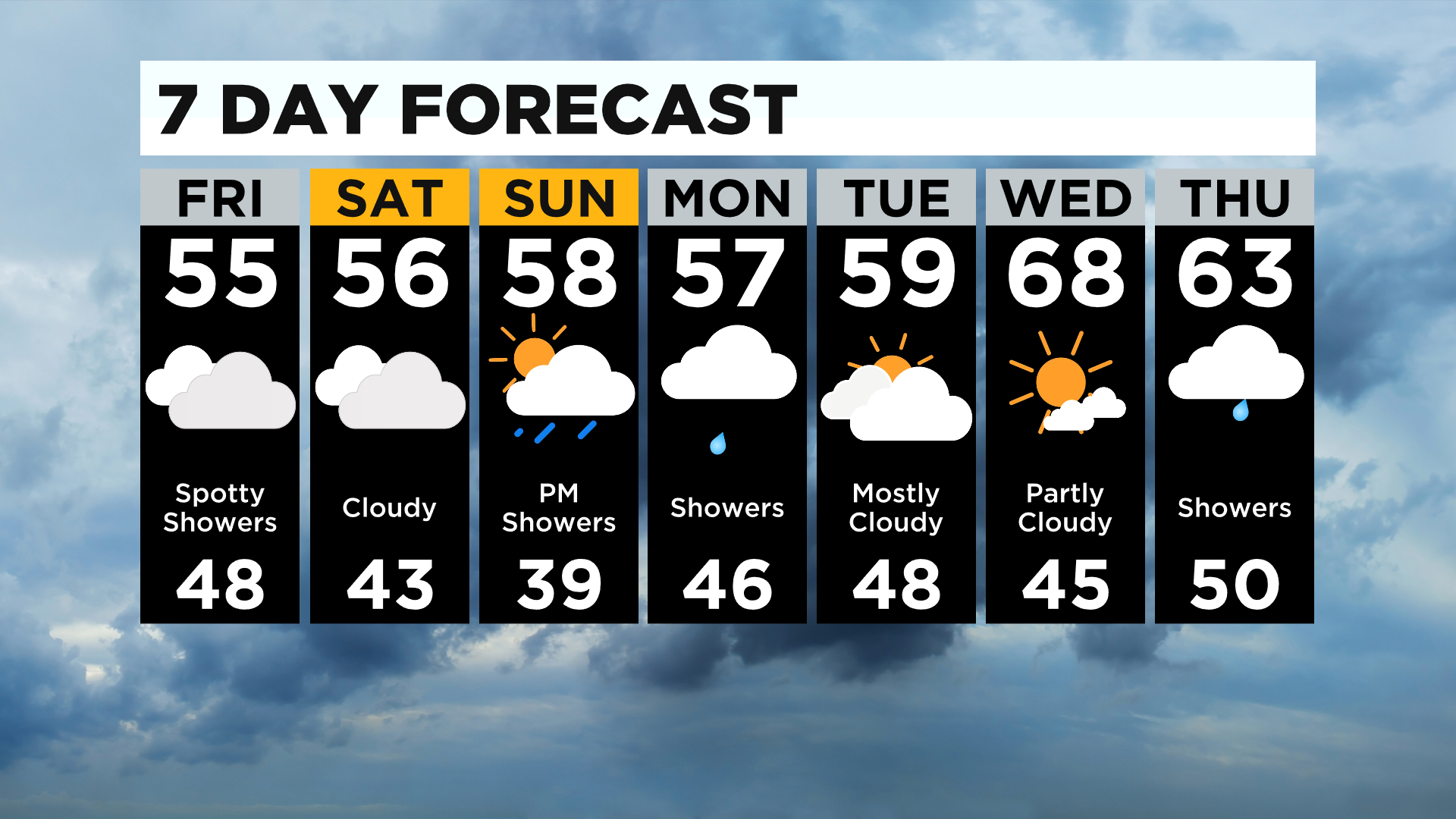
It's another mild morning with many waking up around 50.
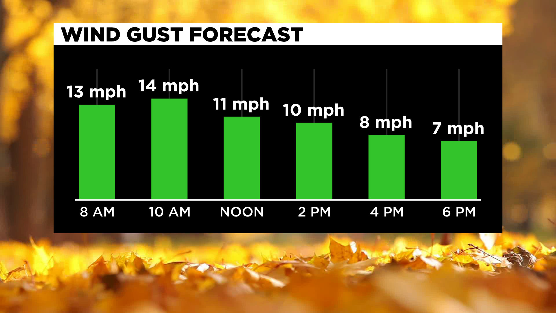
We will have a few spotty showers this morning lasting through the day and stay mostly cloudy. No severe weather is expected today. There will be occasional wind gusts around 10-15 mph.
The cold front that moved through yesterday is out of here and we have an upper low that'll move through keeping the chance for light spotty rain this afternoon and evening.
It'll be cooler behind this front, and we won't move much temperature wise with highs only in the mid-50s.
For Friday night football, I'd grab the rain gear just in case, but most areas should stay dry.
If anything, it'll be a brief shower and temperatures will be around 50.
The new fall foliage map was issued yesterday, and we are nearing peak through the 27th. Some areas north and along the ridges are already fading. It's taking a while for the colors to change because of how warm it's been but the cooler mornings will help to enhance and pop those colors in the next few days.
It'll be a great weekend for the pumpkin patch or apple picking with some sunshine, but you'll need the jacket as highs will only be in the mid to upper 50s!
A spotty shower can't be ruled out tomorrow but the only big chance for rain is Sunday afternoon and evening north of Pittsburgh where some heavy downpours are possible.
Sunday morning will be the coldest of the week with lows back in the mid to upper 30s. Some spots could have light patchy frost.
Rain returns on Monday with highs staying in the mid to upper 50s then mid-week we see highs back in the mid to upper 60s and possibly even 70!
Stay up to date with the KDKA app, which you can download here.