Pittsburgh Weather: Rain And Snow Chances
PITTSBURGH (KDKA) -- Cooler air has arrived and radar is showing pockets of snow in the Laurels.
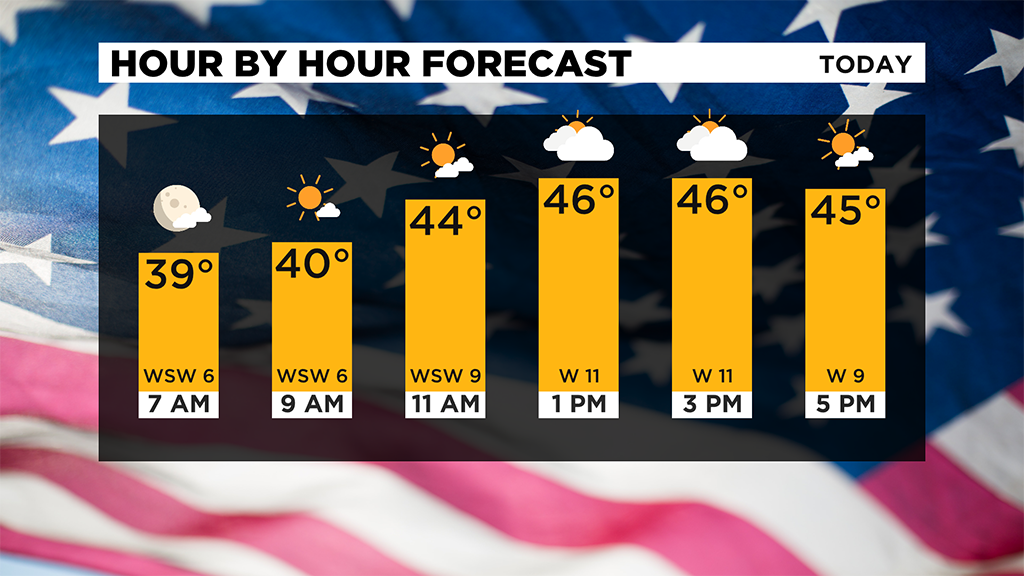
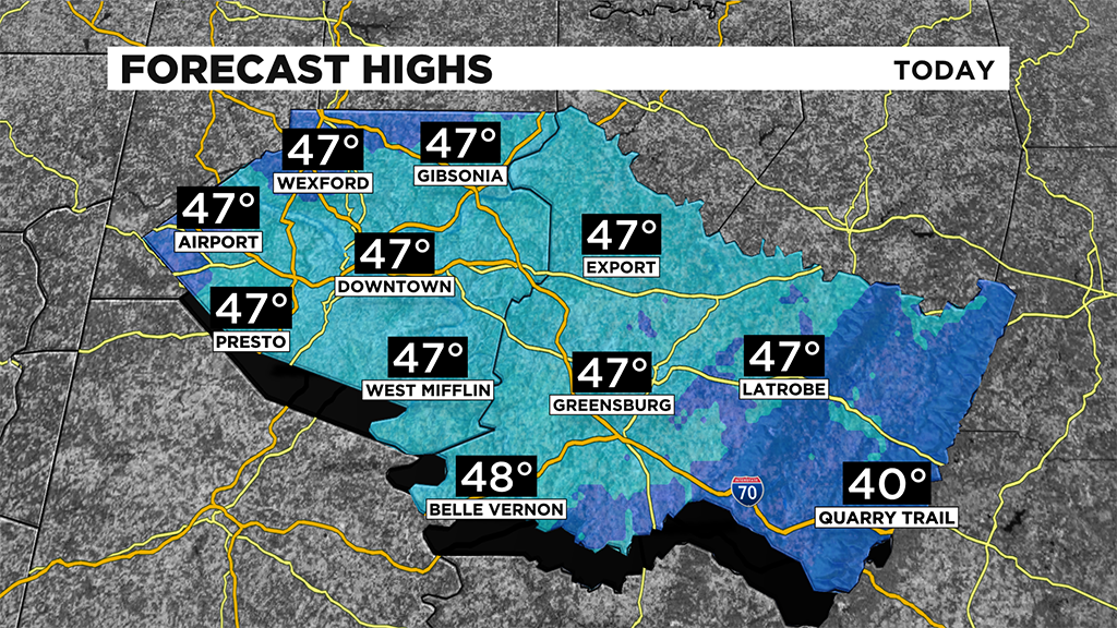
While I expect the Pittsburgh area to be dry for the rest of the day, that isn't likely going to be the case for everyone.
Places north of I-80 will see rain (and even a low snow chance) during the afternoon and evening with the first lake effect event of the year occurring on Lake Erie's southern coast.
While the rain chance moves out today, the cold air is really just now arriving.
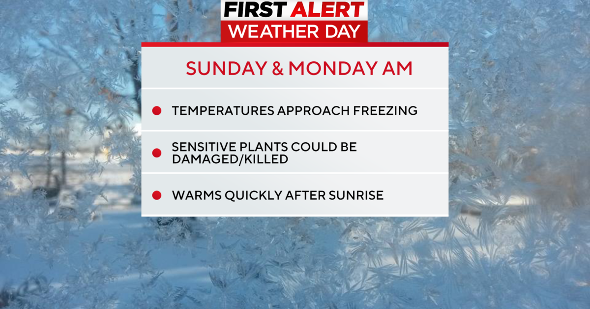
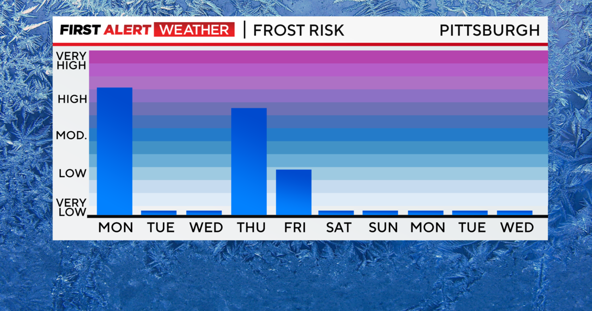
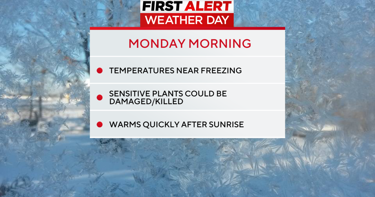
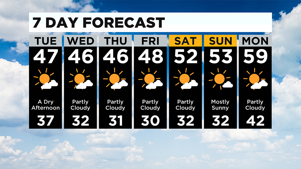
I fully expect we will get a freeze watch or warning for cold weather around Wednesday, Thursday and Friday.
Morning lows on each of these days are expected to be right at 32 degrees in Pittsburgh.
Highs on these days will be in the mid-40's. It will be dry and cool.
While the weekend will be slightly warmer, it won't be by much. Weekend highs should hit the 50's with morning lows still in the low 30's.
Just quickly taking a look back at the month of October, it was the second warmest on record at the Pittsburgh airport with an average daily temperature of 59.5°.
We just barely fell short of the top year (1949) by a tenth of a degree. It was the warmest October in 72 years.
WEATHER LINKS:
Current Conditions | School Delays & Closings | Local Radar | Weather App | Photos
Stay up to date with the KDKA app, which you can download here.