Pittsburgh Weather: Record Warmth Possible On Thursday
PITTSBURGH (KDKA) - Record warmth is possible today with high temperatures in Western PA hitting the mid to low 60s.
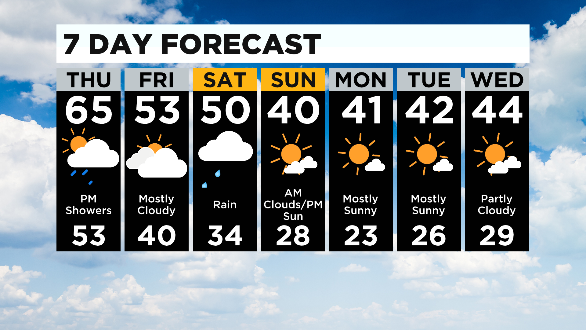
The record high for today in Pittsburgh is 64 degrees. I am forecasting a high of 65° in Pittsburgh today.
WEATHER LINKS:
Current Conditions | School Delays & Closings | Local Radar | Weather App | Photos
So far this month the Pittsburgh average temperature is running 3.9° above average. That's the warmest start to the month of December since 2015 and the third-warmest start to December over the last decade.
Overall it is just the 31st warmest start to December over the last 150 years.
High but not extremely so.
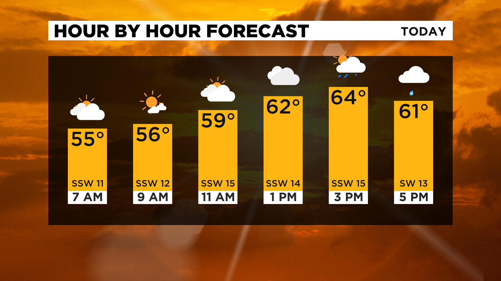
Looking at today, morning temperatures are starting off in the mid to upper 50s.
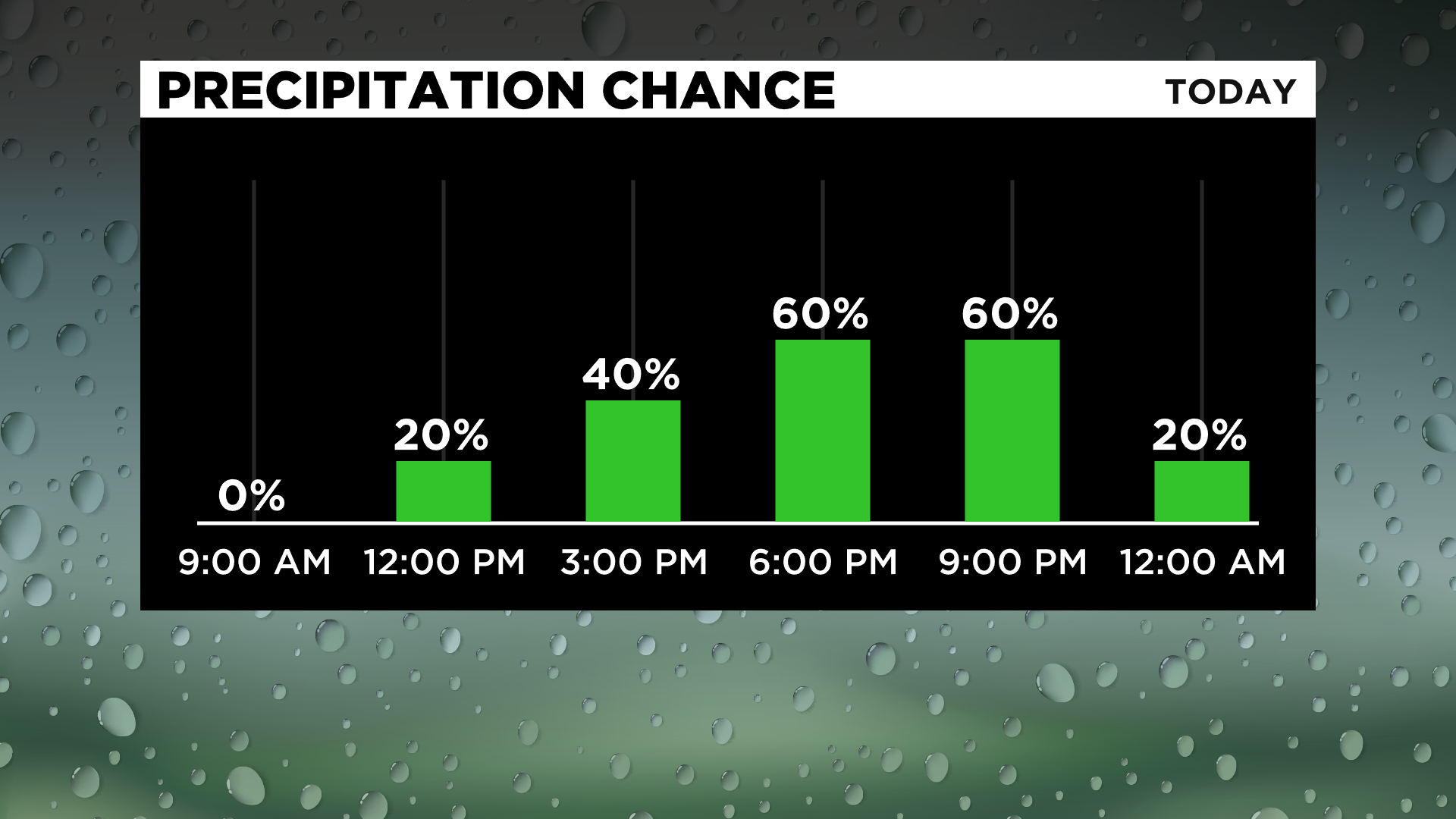
It is windy with gusts topping 20mph. We will be dry this morning with rain chances arriving this afternoon. Morning skies should be partly cloudy. Cloudy skies roll in for the afternoon with most remaining dry through 3:00 p.m.
After that scattered to widespread showers with an isolated weak storm should be expected. Rain totals should be less than a tenth of an inch.
I have noon temperatures hitting the low 60s.
Heading into the weekend, rain arrives again Friday evening, sticking around through most of the day on Saturday. Rain totals should be around a half-inch to three-quarters of an inch.
Saturday should be your classic rainy day as a warm front stalls on top of our region followed by the center of a mid-level low along with the cold front moving through around sunset.
Sunday should be cooler, with some light snow possible in spots.
Stay up to date with the KDKA app, which you can download here.