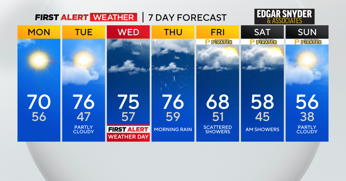
Pittsburgh Weather: A Winter Storm System Continues To Develop. Here's What We Know
PITTSBURGH (KDKA) -- By now, you probably have heard about the winter storm system that is eyeing the east Sunday into Monday.
WEATHER LINKS:
Current Conditions | School Delays & Closings | Local Radar | Weather App | Photos

An important thing to remember is that the main energy of this system is still out in the Pacific Ocean.
When the energy is out that far, there are things we can see, but there are many that we can't. Once this "low" comes on the shore, we will have the opportunity to gather a lot more data from weather balloons and surface instruments.
This will allow us to tighten up the projected path and have a better idea of how this will impact the Pittsburgh area.
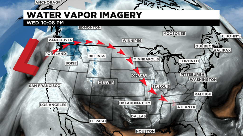
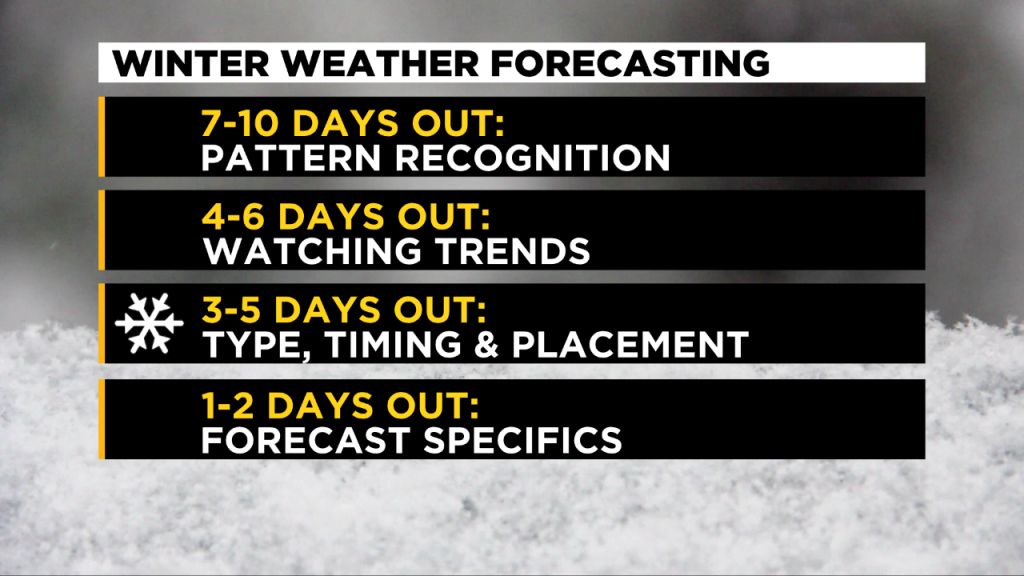
Without that information, we can, however, infer some parts of this system. We do know that a winter storm system is likely going to impact the eastern part of the US. We do know that this would likely time into the region Sunday into Monday. What we do not know is how exactly this will arrive.
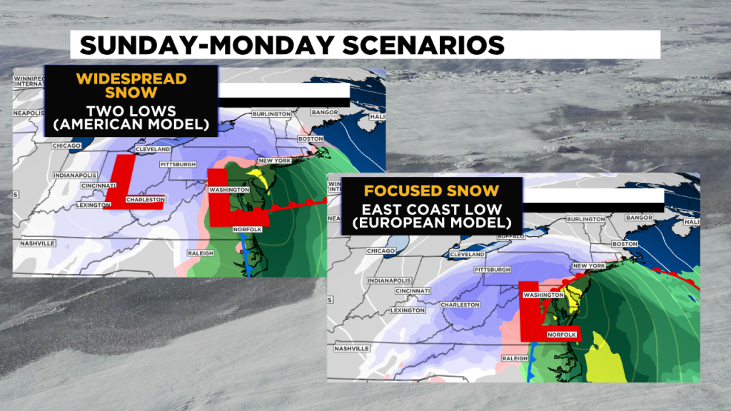
That can be the difference between a widespread, big snowfall or a more focused one. The two major mid-range models we use are showing two scenarios. The European model shows the more focused snow from Pittsburgh to the east, while the American model shows the more widespread scenario.
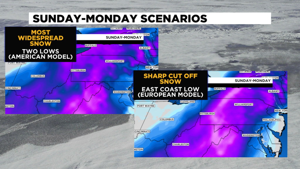
You can see that these differences cause a big difference in how the snow moves in the region. KDKA Meteorologist Ray Petelin wants to note that he left snow totals off these maps. The reason is amounts projected by the models have not been consistent, and that is one of the main things we have to wait on to learn more.
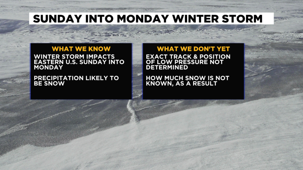
That is par for the course with how winter storms systems are forecast. While we know a storm system is developing and could disrupt our area, the magnitude and exact placement of it is usually not known until a day or two before.
Once we get a better idea of these factors, we will be able to put numbers on the map, that will hopefully resemble the numbers in your driveway. Stay with KDKA-TV as we continue to watch this system unfold.
Stay up to date with the KDKA app, which you can download here.