Pittsburgh Weather: Single-Digit Wind Chills Come Ahead Of Massive Snow Storm Projected For Sunday
PITTSBURGH (KDKA) -- We are nearly 10" below average for snowfall this season but more snow is on the way that will most likely catch us up and put us back on track.
WEATHER LINKS
Current Conditions | School Delays & Closings | Local Radar | Weather App | Photos
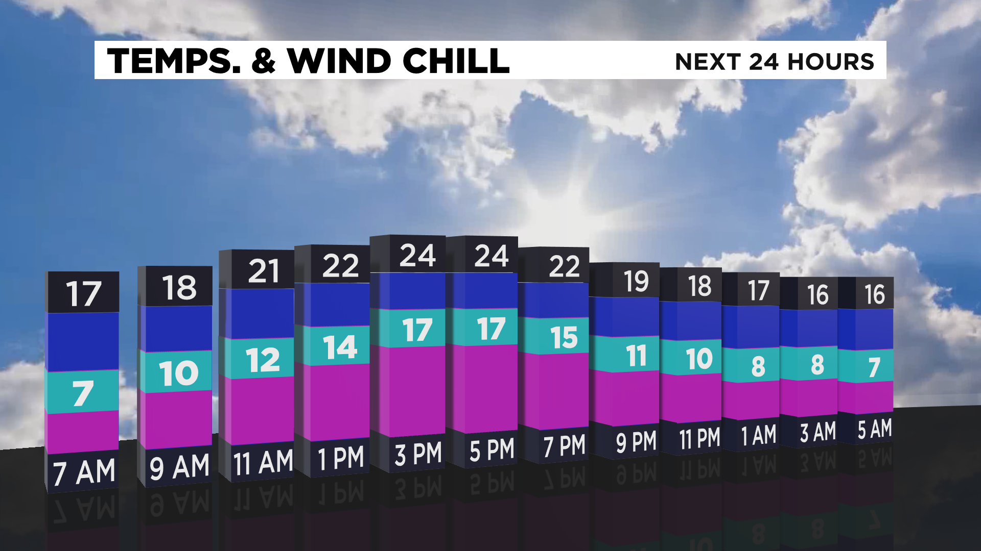
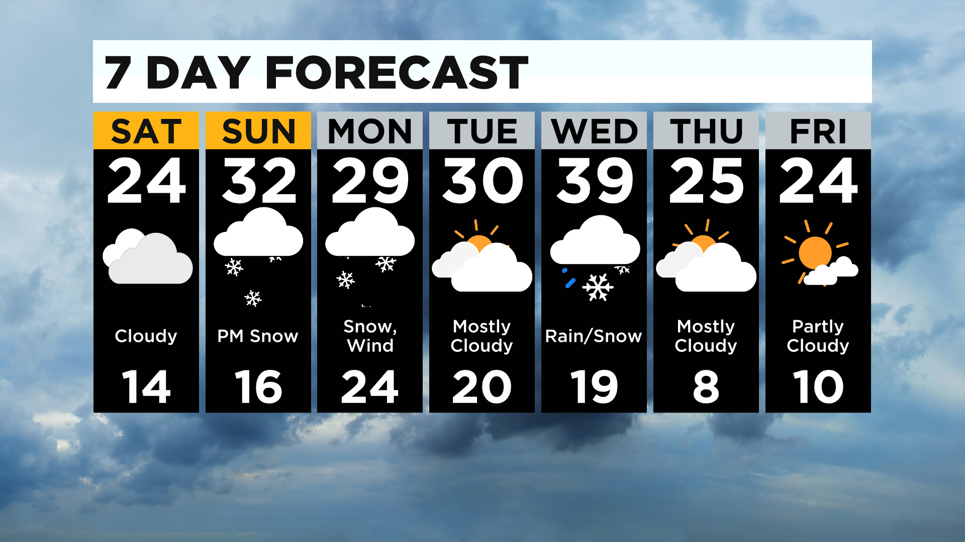
First things first, it's frigid today with lows in the teens and single digit wind chills. Highs only stay in the low 20s and feeling in the teens for much of the day. Don't forget to bring your pets inside - It's the law!
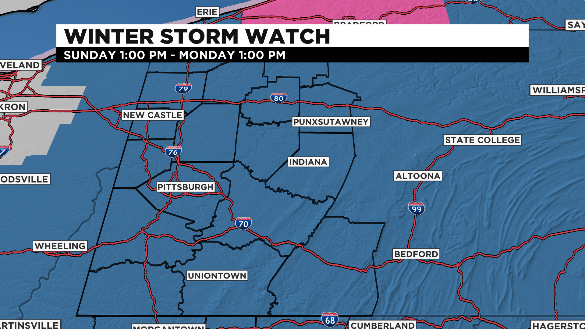
There's a Winter Storm Watch that starts at 1:00 p.m. Sunday and goes to 1:00 p.m. Monday.
Now if you have plans first thing Sunday morning it'll be cold in the teens once again but it will be dry.
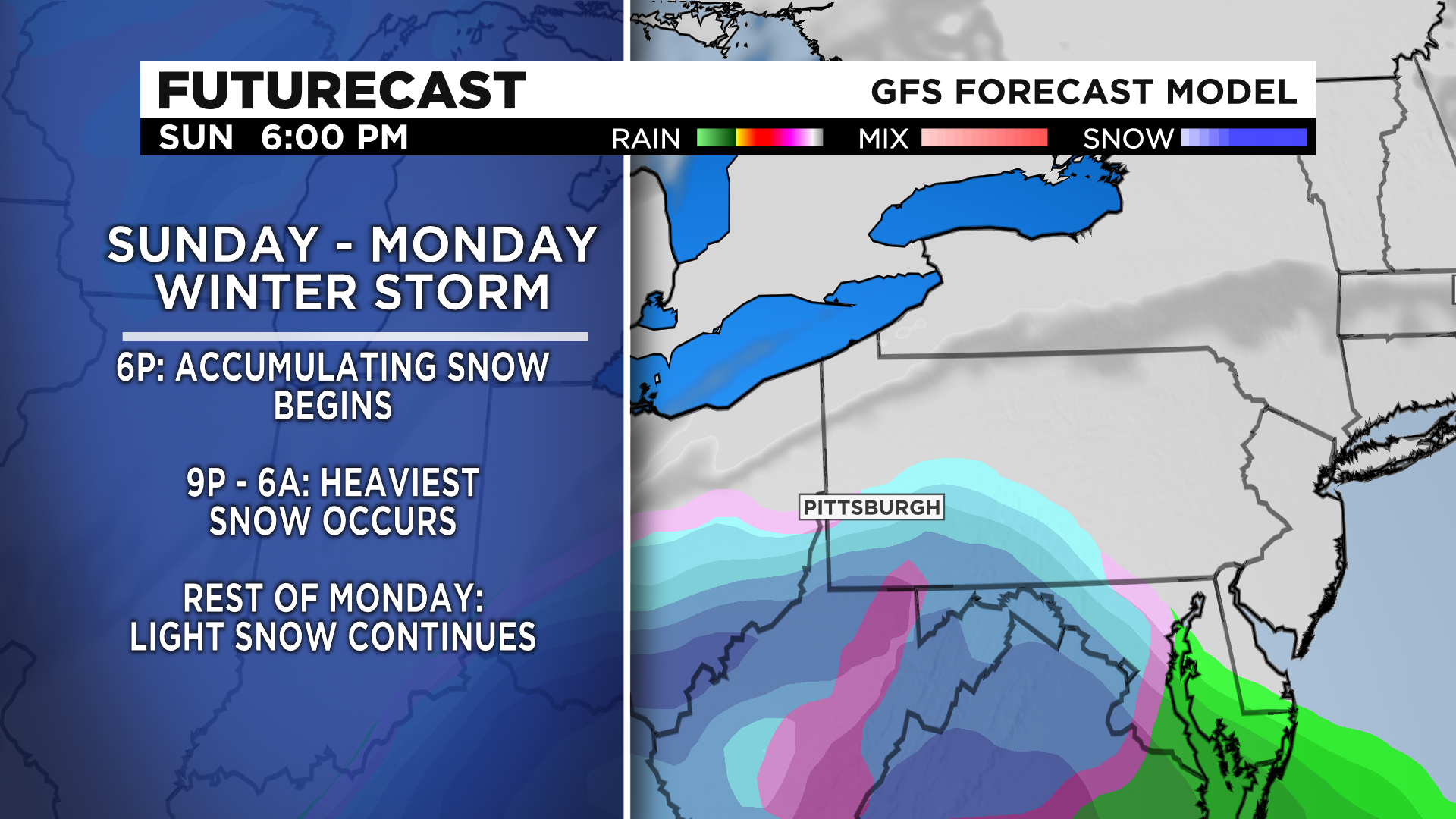
This colder air also sets up our region to see all snow Sunday night into Monday and a lot of it for many.
We will begin to see snow as early as 1:00 p.m. for areas south of I-70 and 3:00 p.m. for Pittsburgh.

Snow accumulates around dinner time and will wrap up around Monday afternoon.
Totals are getting bigger, confidence is getting greater and yes, it's rare that we see this much in Pittsburgh. 8" or more of snow only happens once every 4 years and 12" or more happens once every 14 years.
Right now it looks like there's a curve from Washington to Butler, cutting off southern parts of Allegheny, stretching north of I-80 then back down towards Indiana County through Somerset and northwestern parts of Maryland that could see half a foot to upwards of a foot of snow.
There's a dry slot and even a brief period of freezing rain is possible for Westmoreland, Greene and Fayette Counties that could only se 4-9" so less amounts than surrounding areas.
Things can and will probably still change and we will constantly be adjusting the forecast but a lot of models are starting to line up with one another.
The big concern is the NAM suggesting warmer air aloft which would mean less snow, but other models are pointing to colder temperatures below freezing.

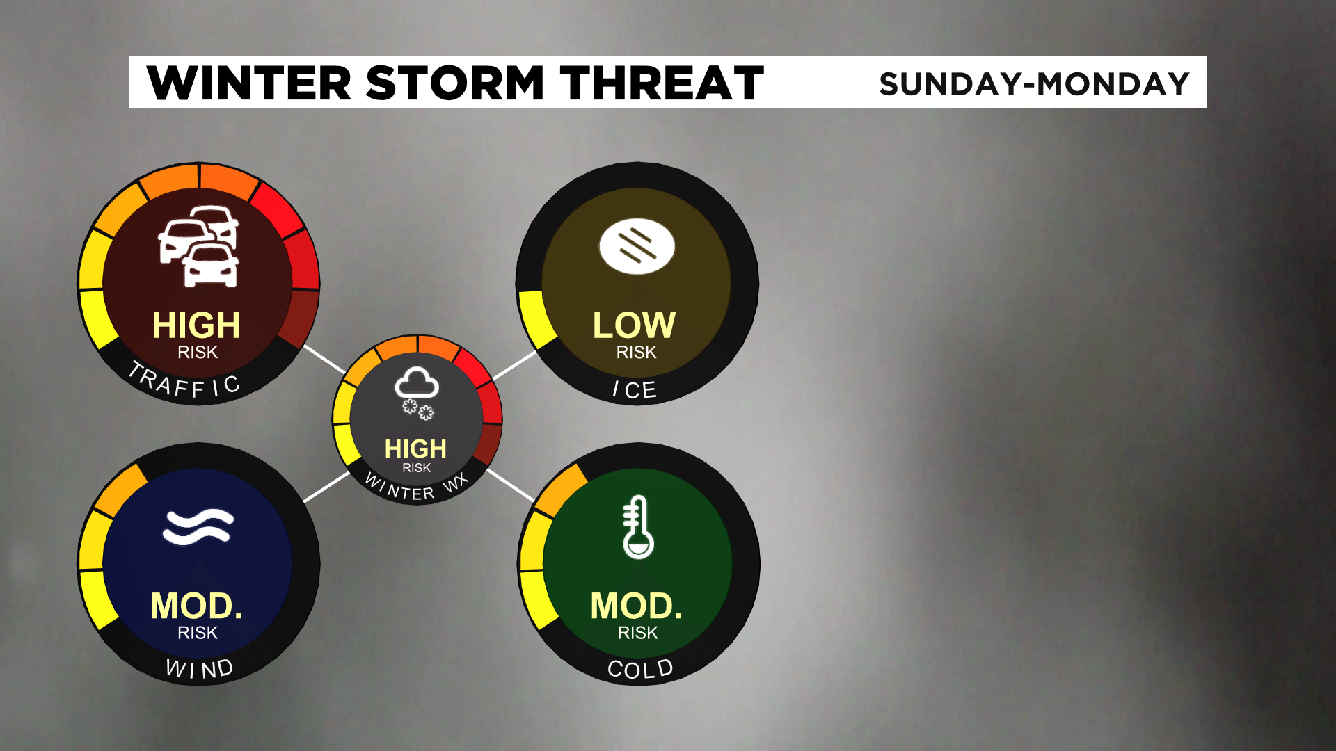
Whether this is 5" or a foot of snow, roads are going to be very dangerous to travel on Sunday evening through much of the first part of Monday.
No work for some and no school Monday so if you don't have to be on the roads stay inside or go outside and play in the snow but bundle up and be safe!