Pittsburgh Weather: Bitter Cold Temperatures Expected This Weekend
PITTSBURGH (KDKA) - I think there's a lot of good news in your forecast today. First off, there was a chance for snow showers this morning with some low visibility.
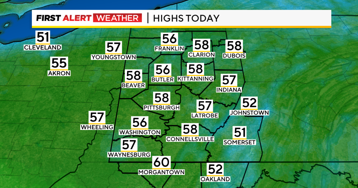
Right Now: Warmest start to the day so far this week with temperatures in the mid to upper 30s
Alert: None
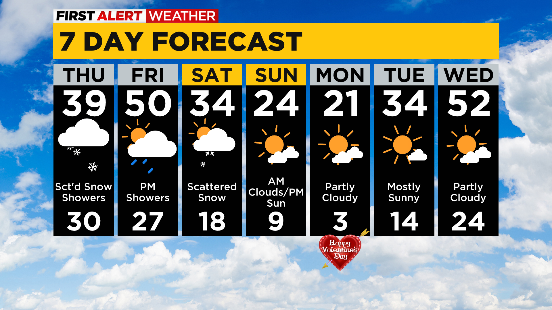
Aware: Light rain is expected for the evening commute on Friday night. The rain changes over to snow showers on Saturday. Temperatures turn bitterly cold for Sunday and Monday.
WEATHER LINKS:
Current Conditions | School Delays & Closings | Local Radar | Weather App | Photos
While many of the dynamics that I was expecting yesterday are in place this morning, winds have remained out of the southwest.
This is keeping temperatures up and our snow chances VERY low today.
Model data is now jumping to my forecast with likely dry conditions for places south of I-80.
Temperatures will be in the mid to upper 30s all day today with cloudy skies. Temperatures will plummet overnight as skies clear with us back in the 20s on Friday morning for lows.
There should be light winds with a wind chill value coming in at around 20 degrees for most of the morning. High temperatures on Friday are expected to hit 50 degrees though!
Looking ahead, Friday will see evening rain chances, changing to snow chances for Saturday.
We then turn COLD.
How cold? Temperatures will be in single digits on Sunday and Monday mornings.

Valentine's day will probably be the coldest day of the next week with a high of just 21 and morning lows just a couple of degrees above 0.
Stay up to date with the KDKA app, which you can download here.