Pittsburgh Weather: Flood Chances Remain Throughout Western Pa.
PITTSBURGH (KDKA) -- The First Alert is called off for the rest of Friday and will go into effect again Saturday morning with a quick burst of snow, leaving roads slick.
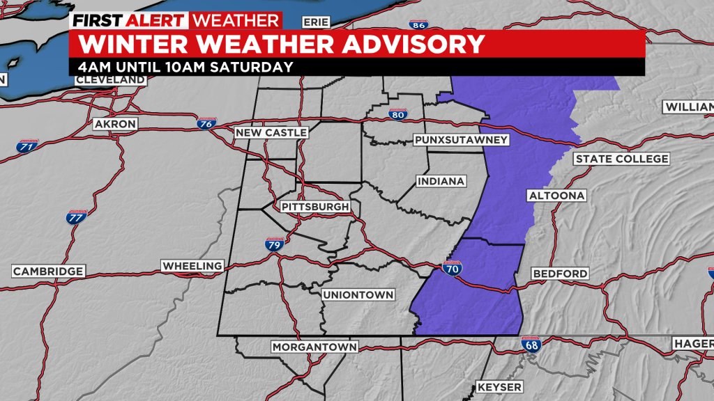
FIRST ALERT: A quick-hitting system will zip through the area Saturday morning. This will bring a quick accumulation of snow. Around a half-inch to an inch is expected in the span of a couple of hours.
This will lead to potentially fast changes in road surfaces and visibility, but should not be a problem though the whole day. Somerset County does have a winter weather advisory for Saturday morning as 1 to 3 inches of snow is possible there in that same, short time span.
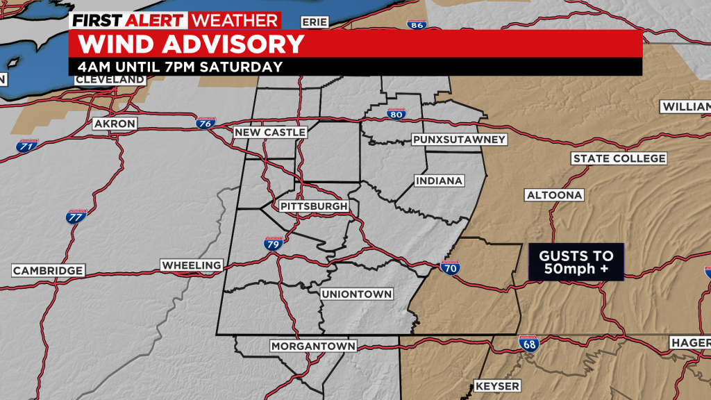
For Somerset and Garrett counties, a wind advisory is in effect Saturday for wind gusts that could top 50 miles per hour. This will blow snow and potentially lead to some power outages.
As for the river situation, these waters will crest and drop this weekend. There will still be impacts to the North Shore River Walk, Point State Park and the 10th Street Bypass.
Waters look to top off near 24.5 inches. This is the level where the fountain takes on water and is very close to the point where the water starts to fill in the Bathtub Section of the Parkway. That happens at 25 inches.

Next week, we are watching a couple of systems, but they are too far off with too much uncertainty to make Alert Days right now.
WATCH: NewsChopper 2 flies over flooding in Beaver and Butler counties
WATCH: NewsChopper 2 spots eagle
WEATHER LINKS
Current Conditions | School Delays & Closings | Local Radar | Weather App | Photos
Stay up to date with the KDKA app, which you can download here.