Pittsburgh Weather: Tornado Watch Expires For Several Counties
PITTSBURGH (KDKA) - Today is going to be an active weather day with rain possible this morning followed by potential storms this evening.
Right Now: A Tornado Watch for parts of the Pittsburgh area has expired..
The Watch covered Allegheny, Greene, Washington and Beaver counties as well as parts of Ohio, West Virginia and Kentucky. It expired at 9:50 p.m.
A watch means there are ingredients in the atmosphere, but no immediate threat has been detected. Should radar indicate a possible tornado or a tornado is spotted, a warning will be issued at that time.
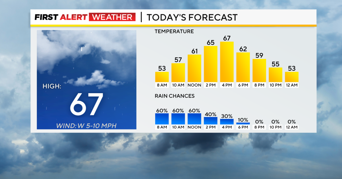
Alert: Today is a First Alert Weather Day. Morning rain will make for a sloppy commute. Showers will be scattered to isolated this afternoon. Stormy conditions are possible this evening but at this point, the severe weather chance remains low and unorganized.
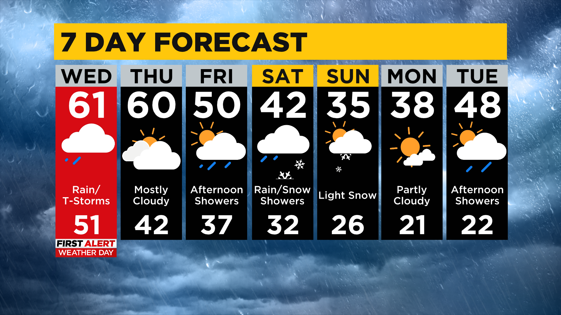
Aware: Weekend snow is expected with Laurels possibly seeing accumulating snow on both Saturday and Sunday. Measurable snow is expected for Pittsburgh on Sunday but anything that tries to stick will be gone within an hour.
Between the morning rain and the evening storms, scattered showers will be possible for the afternoon.
WEATHER LINKS:
Current Conditions | School Delays & Closings | Local Radar | Weather App | Photos
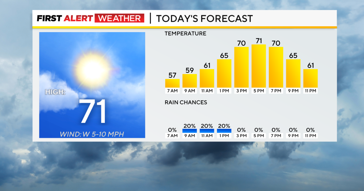
Afternoon temperatures will be near 60 with the sun at times poking out between mostly cloudy skies. Wind speeds will be between 10-15mph this afternoon coming in out of the southeast. Part of our area has been highlighted as being under a marginal risk of severe weather.
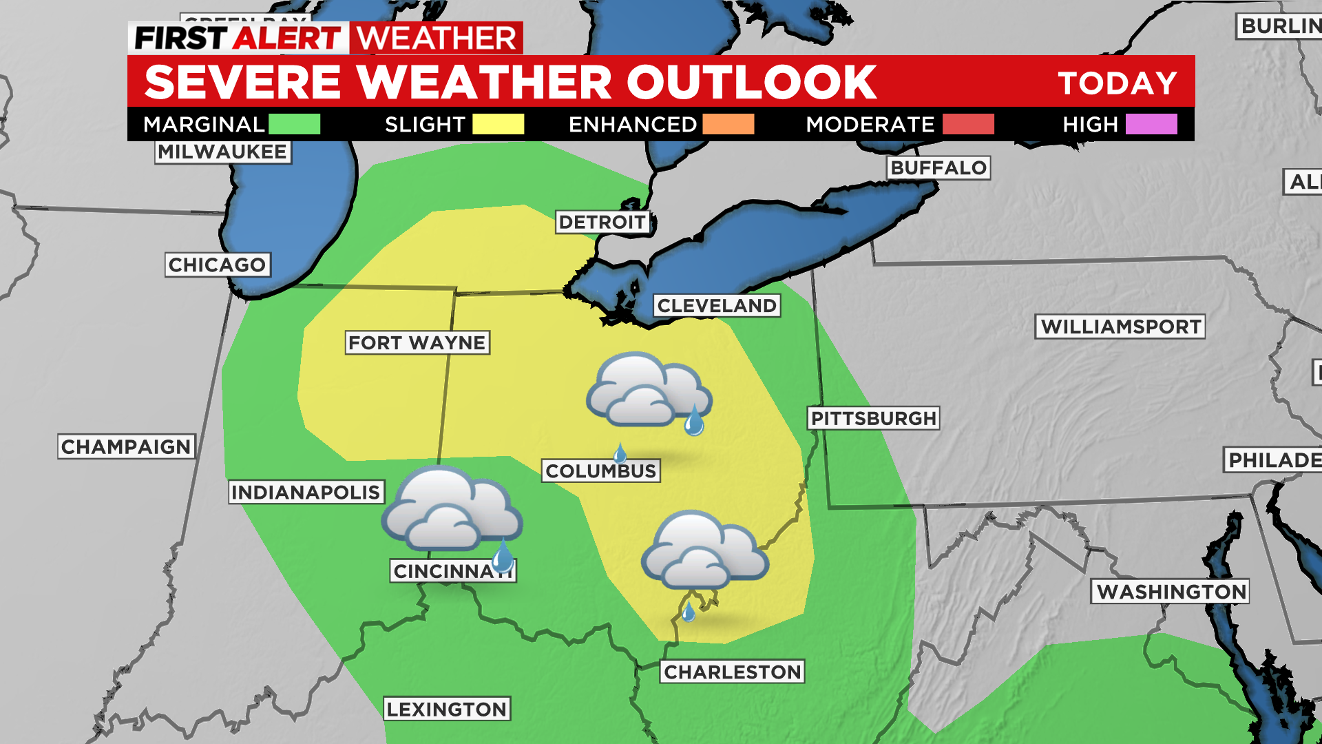
It is still possible if conditions warrant for us to be bumped up into the slight risk range by the end of the day. If temperatures rise to the mid to upper 60s expect us to see the severe risk area extend into our area.
While the overall severe chance remains low for now, if we do see severe weather everything is going to be on the table.
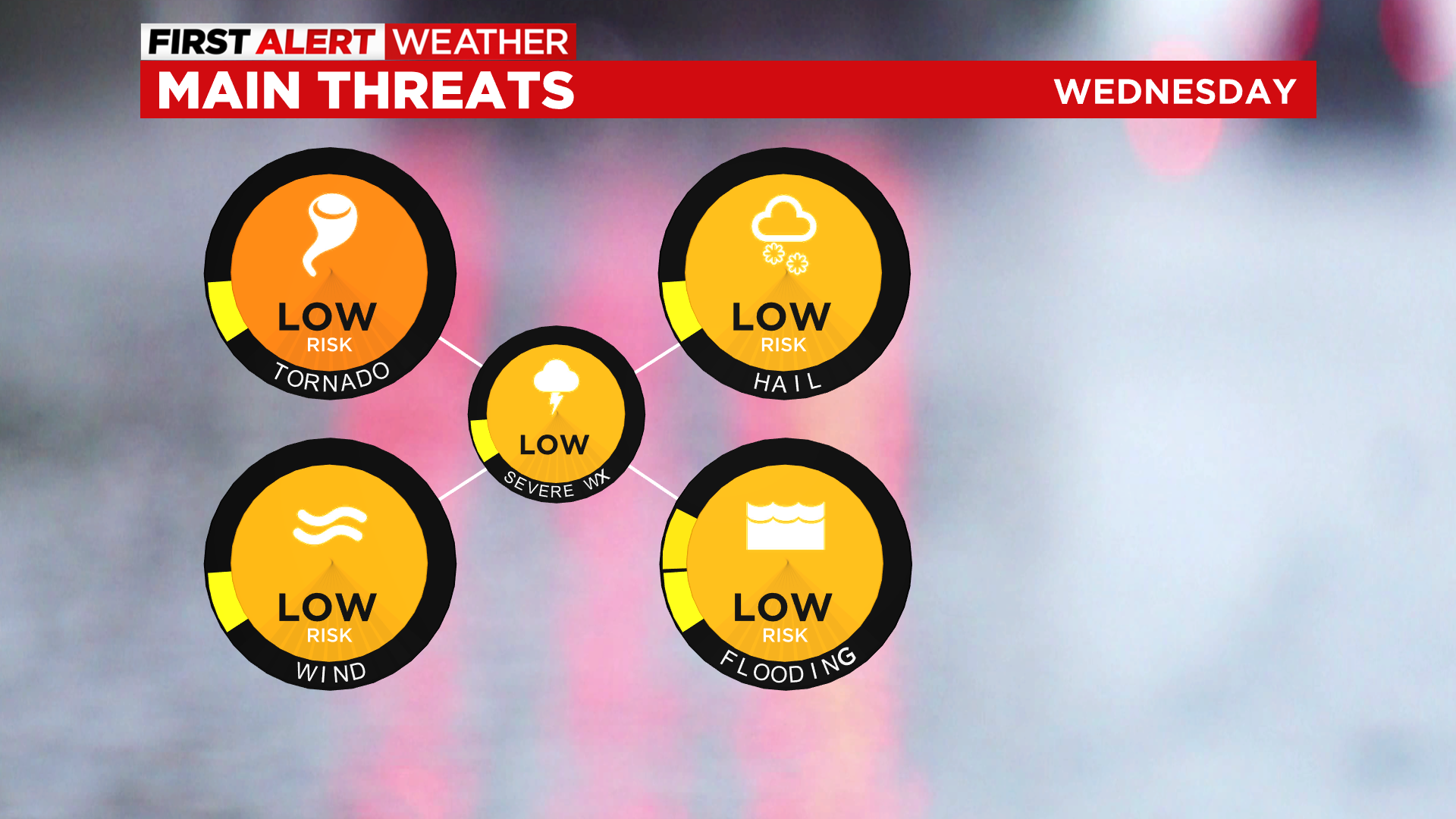
This means large hail, destructive straight-line wind and even tornados will be possible. The storm prediction center puts the chance for any of those Timing for severe storms looks to be fairly late with the highest chance occurring from around 7 p.m. to 11 p.m. this evening.
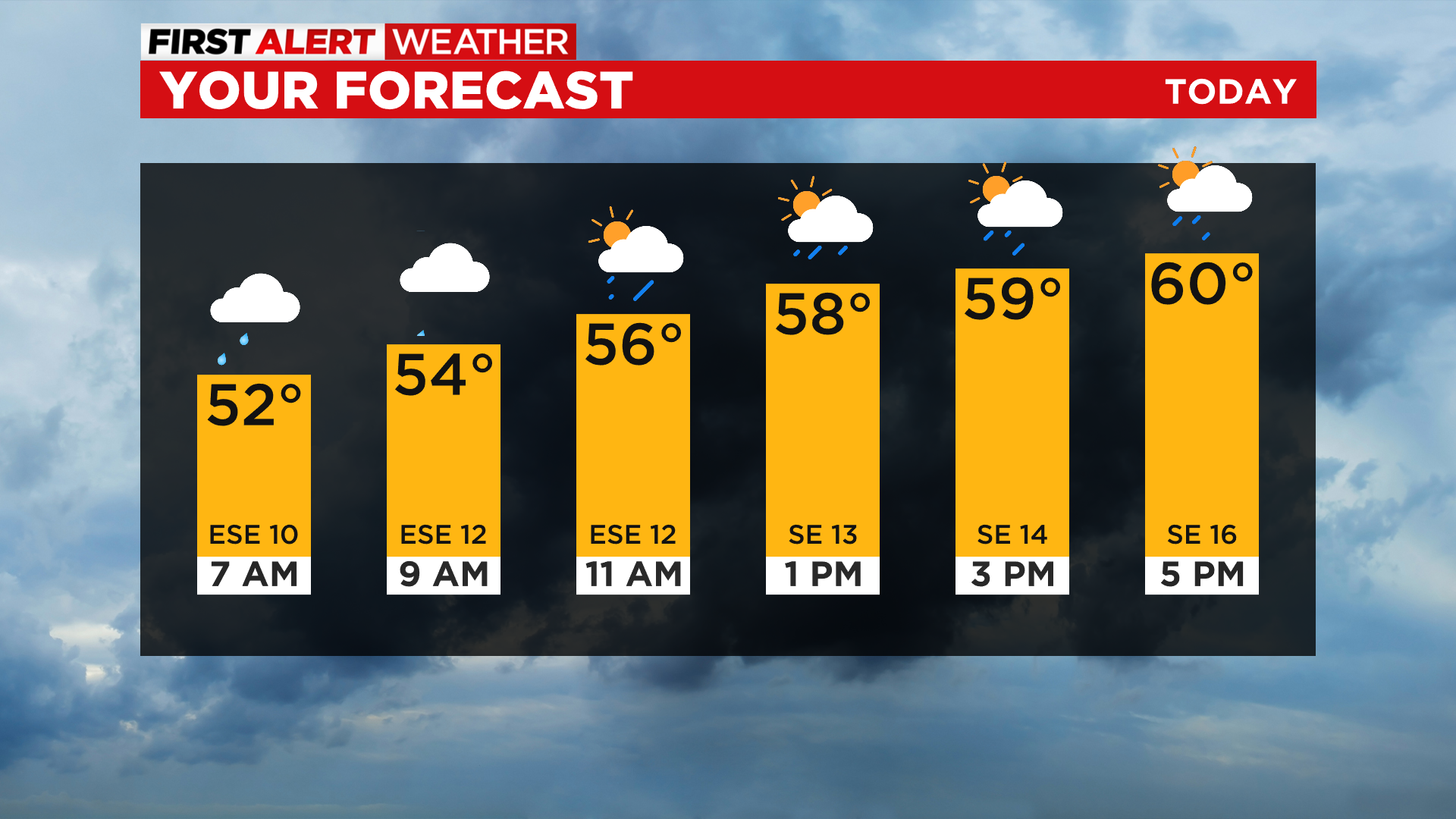
Morning lows should be near 50 degrees with afternoon highs in the low 60s.
This afternoon is actually looking pretty nice with a lot of dry time but some gusty winds. Skies should remain mostly cloudy to overcast.
Looking ahead, light drizzle will be possible in spots on Thursday as we see temperatures start to drop for the afternoon to the evening. Cooler weather will be in place for Friday, Saturday, and Sunday.
Stay up to date with the KDKA app, which you can download here.