Warm-Up Coming This Weekend, Snow In 7-Day Forecast
Follow KDKA-TV: Facebook | Twitter
PITTSBURGH (KDKA) -- Snow is back in the seven-day forecast, but this weekend, we are tracking a warm-up. Highs on Friday will be near 50 degrees.

Here's a rundown of what you can expect over the next week:
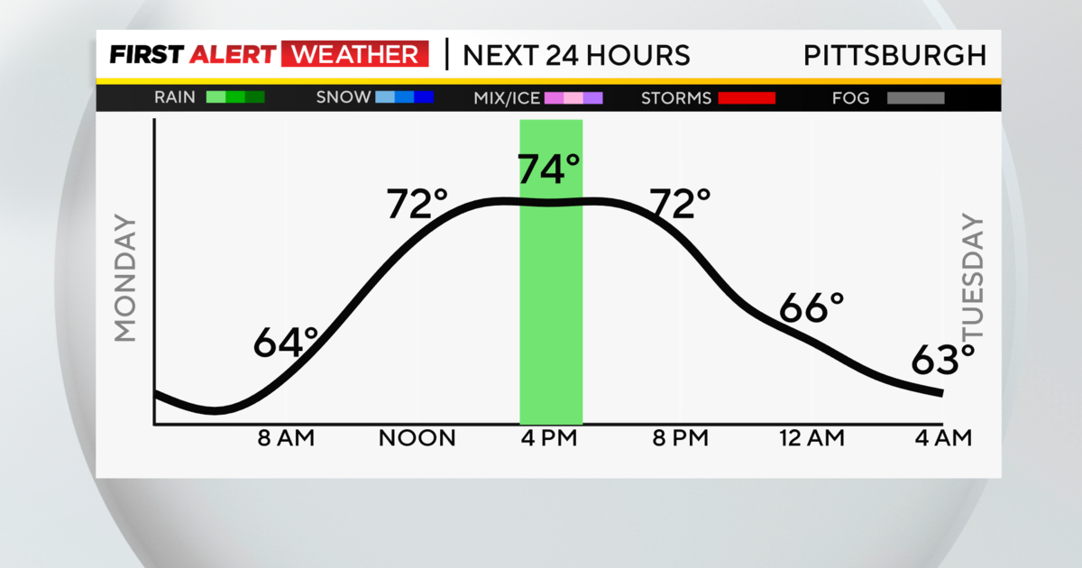
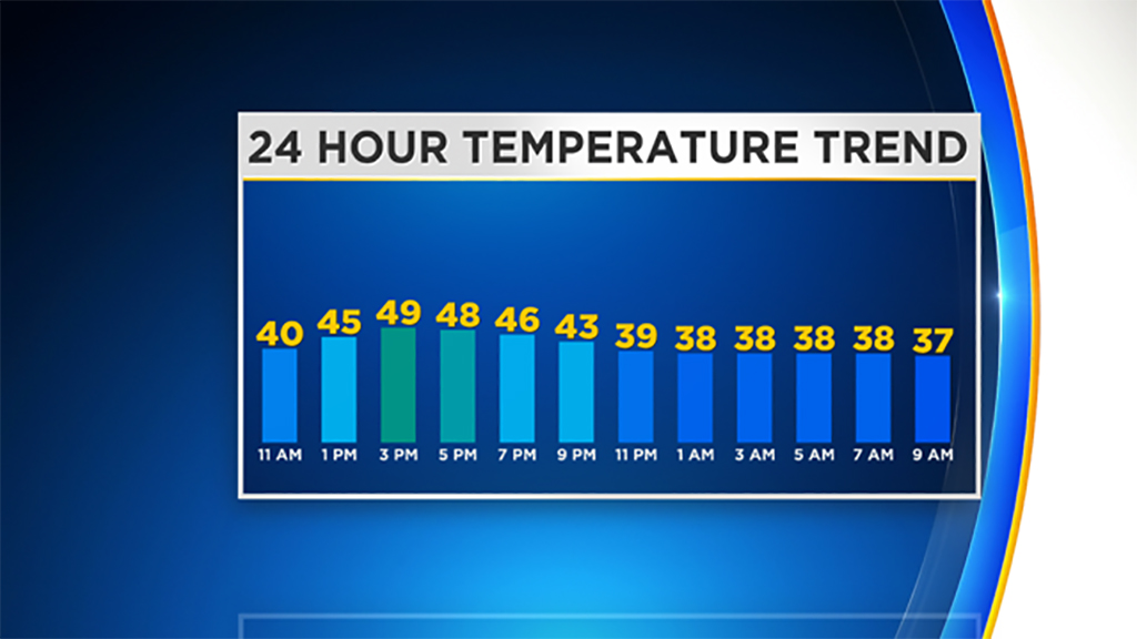
Today: Highs will be near 50 degrees with high clouds rolling in from the south Winds will be variable from the day from 2 to 7 mph. Winds in the morning will be out of the south. Afternoon winds will be from the east with evening winds coming in out of the north.

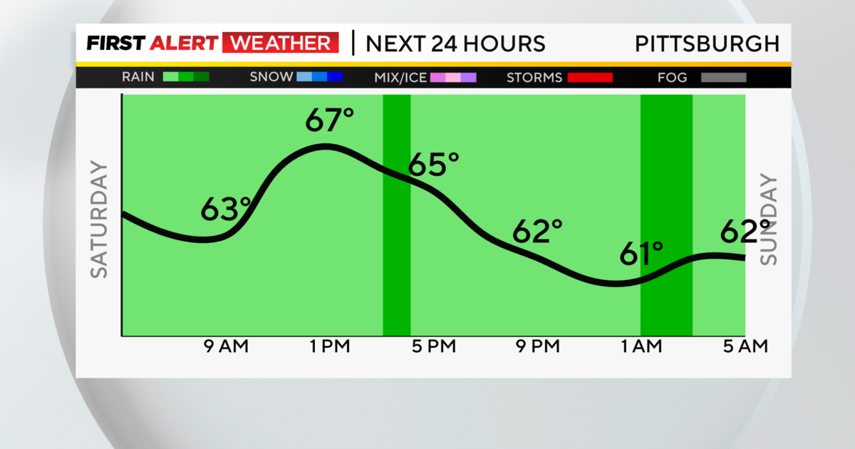
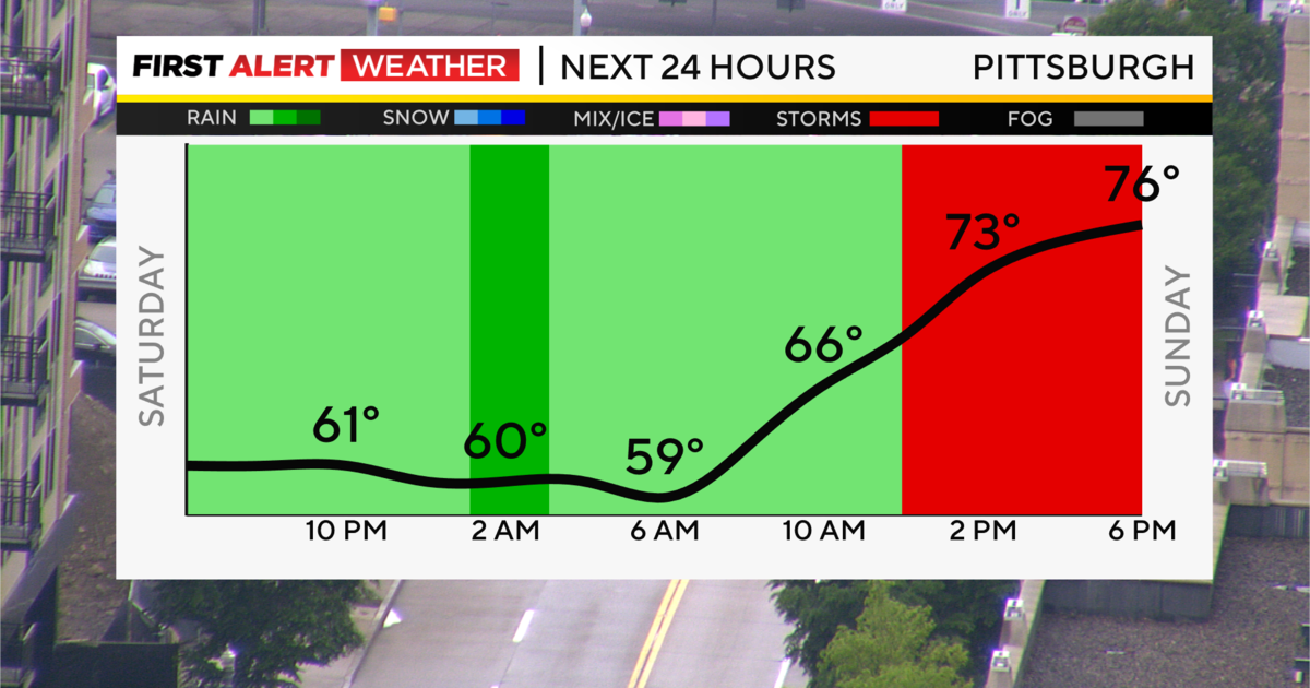
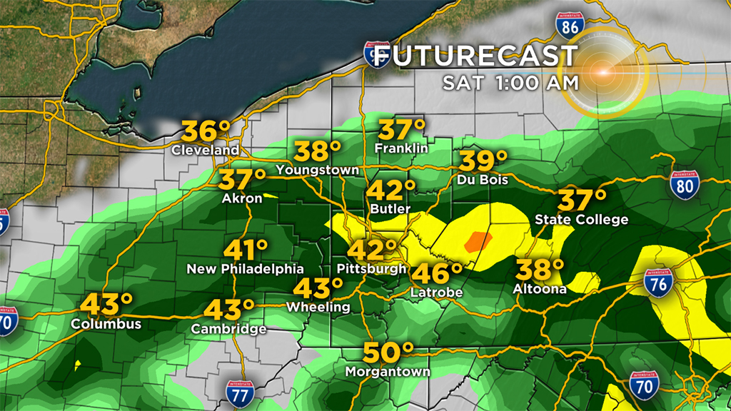
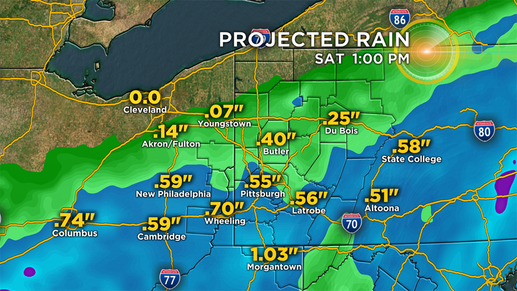
Overnight: Window for rain showers arrives after 8 p.m. I think Pittsburgh stays dry through 10 p.m. Rain showers are expected through the overnight hours with the heaviest and steadiest rain moving through from 11 p.m. to 4 a.m. on Saturday.
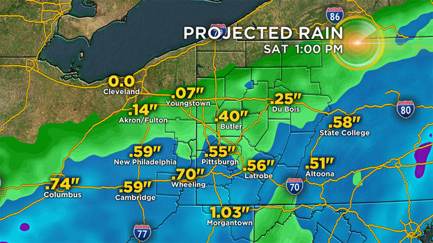
Saturday: Dry for the afternoon. Expect spotty rain showers from 7 a.m. through 11 a.m. Winds will be coming in from the northwest at 5 to 10 mph.
Sunday: Dry but cooler with highs near 40 degrees.
Next week: All eyes are on the winter weather system that is set to arrive on Tuesday. At this point it looks like rain showers through day Tuesday with a wintry mix expected on Wednesday. Accumulating snow is now possible on Thursday.
