Pittsburgh Weather: Record-Setting Rainfall Possible Later This Week, Flooding A Big Concern
Follow KDKA-TV: Facebook | Twitter
PITTSBURGH (KDKA) -- It feels like a warm-up is Western Pennsylvania's reward for getting through the frigid temperatures of last week.
Temperatures fell 5 below zero at one point with wind chills surpassing minus-30 degrees at times in some spots. If you just do the math, you could say, at times, it will "feel" 90 degrees warmer today than it did last Wednesday.
With the warmer temperatures comes some concerns due to all the ice and snow melting and rain showers expected on Wednesday and Thursday. At this point, this is both good news and bad news.
WEATHER LINKS:
Current Conditions | School Delays & Closings | Local Radar | Weather App | Photos
The good news?
It looks like much of the melt will have been achieved before the next round of heavy rain is expected to arrive on Wednesday and Thursday.
The bad news?
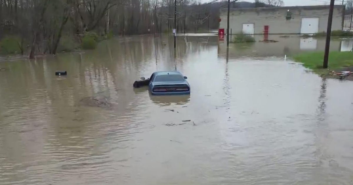
Record-setting rainfall can't be ruled out with the one-two punch of weather headed our way during the back half of the week.
Some of that rain, especially Wednesday evening into Thursday, will be heavy. With the recent snow melt, freezing and thawing, and this incoming rain, we're watching for potential rising waters and landslides later this week.

The local National Weather Service office notes that the precipitable water forecast was in the range of 1.3 inches to 1.4 inches. Precipitable water is a measurement of how much water you would have if you somehow took out all the moisture from the top of the atmosphere to the bottom. That's more a measurement you would expect to see in New Orleans or Florida and not here.
In fact, the National Weather Service says it's an unprecedented number and there is no correlation of flooding with it. It is something they are monitoring.

In forecasting, the more moisture you have to work with, the more unstable the air mass. It also means there's a potential for heavy rain. All will be true with this event starting Wednesday and lasting through Friday morning. Big rain totals will be possible over a large swath of the area. Ground will be saturated and flooding is a concern.
Be prepared.
Stay up to date with the KDKA app, which you can download here.