Pittsburgh Weather: Significant Winter Storm Could Drop Heavy Snow, Ice Across Region
Follow KDKA-TV: Facebook | Twitter
PITTSBURGH (KDKA) -- It looks like we have at least one more good snow in us this season, probably more than just one, to be honest.
Everything is coming together for another solid round of snow impacting the area beginning on Sunday afternoon and going into early Monday.
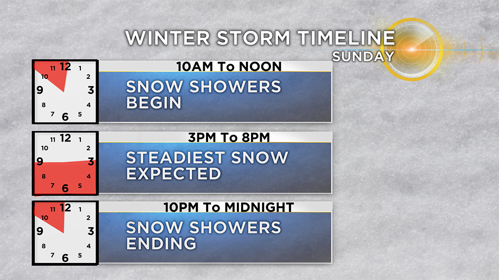
The snow is slated to begin late Sunday morning into early Sunday afternoon, with the steadiest and heaviest snow expected late in the afternoon through the evening hours.
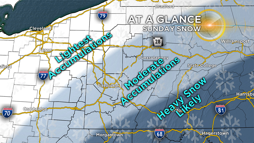
Since the energy (or low pressure) driving this storm is expected south, we are currently anticipating the heaviest snow to be to our south. Model trends have been ticking the storm south over of the last 24 hours, but Friday night's weather balloon launches will be our first, real sampling of what this storm is working with, ingredient-wise.
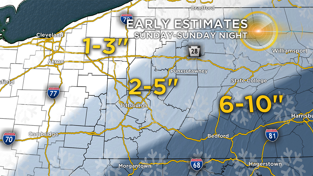
Currently, 2 to 5 inches is possible for much of the area, including the city of Pittsburgh.
Higher amounts of snow look most likely in the Ridges and South of the Mason-Dixon Line. Right now, our early estimates look like snow could fall there in a range of 6 to 10 inches.
North of I-80, accumulations look lighter with 1 to 3 inches.
Should shifts in the track happen, you will see shifts in where the heaviest snow falls.
The snow should be a light, airy snow that falls for around 12 hours. Heaviest snow rates will occur once the sun goes down, between the hours of 8 p.m. through 1 a.m. Snow rates could briefly top 0.75 inches per hour in elevated areas, but overall snow rates aren't expected to be that high.
The snow totals will come from a steady and consistent snow falling across the area.
WEATHER LINKS:
Current Conditions | School Delays & Closings | Local Radar | Weather App | Photos
Behind the snow comes frigid temperatures with highs in just the 20s beginning on Monday and continuing through Wednesday. Single digit temperatures are expected Tuesday and Wednesday morning with windy conditions making Monday possibly the coldest feels-like day of the week.
The first half of March is looking fairly cool. Thanks, Mr. Groundhog!
Stay up to date with the KDKA app, which you can download here.