Pittsburgh Weather: Rain Chances Set To Return With Possibility Of Severe Weather
Follow KDKA-TV: Facebook | Twitter
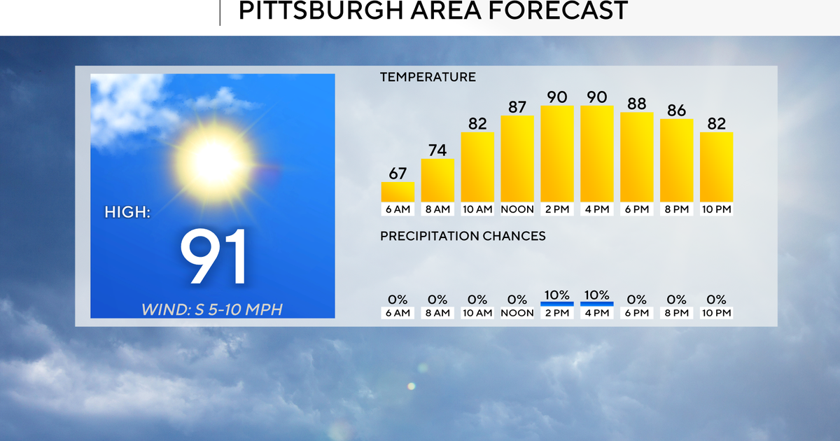
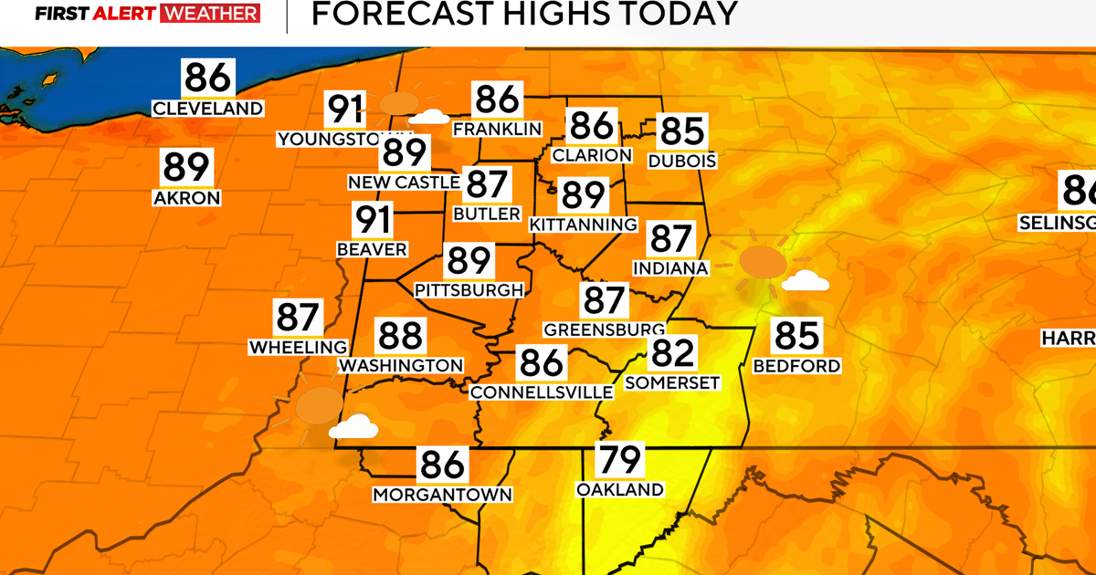
PITTSBURGH (KDKA) -- Fantastic weather is expected for today and Thursday.
Today should be partly cloudy with highs near 60 degrees. The afternoon will be a little on the breezy side with wind out of the northwest at 7-15 mph. Clouds will roll in after 4 p.m. with overcast skies overnight. Warmer air surges back into the area overnight as a warm front arrives around midnight.
Temperatures on Thursday will be near 70 degrees, about 10 degrees warmer than today's highs.

While Thursday will be dry, rain chances are expected to return on Friday. While low, there will be a storm chance, and really, our best chance so far this year for seeing a line of storms developing and pushing through the area. While severe weather isn't being forecast just yet, numbers are showing a chance for severe weather both Friday and Sunday.
While it hasn't been too long since our last severe thunderstorm warning (26 days), and even our first tornado (91 days), it has been a while since any type of severe watch has been issued. The last thunderstorm and tornado watches were issued 189 days ago on Oct. 2. There's a good chance the stretch of non-severe days will be broken this weekend.
The first chance for storms comes in the way of an upper low tracking over Central Ontario and Northern Quebec that will drop a cold front through the area. If anything, the concern, at this point, will come from the possibility of a straight line of storms bringing strong wind gust.
WEATHER LINKS:
Current Conditions | School Delays & Closings | Local Radar | Weather App | Photos
The chance for severe weather at this time is small, but you should expect to see a couple of weak storms passing by, especially if a line of storms develops.
The more concerning storm system develops on Friday in southwestern Texas and moves our way from there. A negative tilt will bring storm chances mainly to the southwest, but there will also be a chance for gusty winds and perhaps even an isolated tornado with the setup.
Any singular cells may also drop large hail. At this point, the track of the low can change, or the low just doesn't develop like it is forecast to develop. Either way, it goes it is something we should watch.
Stay up to date with the KDKA app, which you can download here.