Pittsburgh Weather: Cooler Temperatures Moving In As Forecasters Watch Dorian's Path
PITTSBURGH (KDKA) -- A passing cold front will help to cool us off for the rest of the work week.
Radar showed a couple of isolated thunderstorms near the city of Erie early this morning. The front stretches from just south of Toronto to Detroit and then down to Fort Wayne.
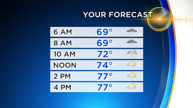
The best chance for rain today, associated with the front, comes this morning, but KDKA Meteorologist Ron Smiley says he also expects to see isolated rain showers this afternoon.
WEATHER LINKS:
Current Conditions | School Delays & Closings | Local Radar | Weather App | Photos
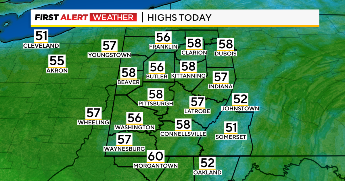
Yesterday's high hit 81 degrees, and Smiley is forecasting a high today of 78 degrees today, so not too much off of yesterday's high.
Dry conditions are expected on Thursday and Friday with afternoon rain chances back on Saturday as another front pushes through the area.
While we will not have a direct hit from Hurricane Dorian, model data is all over the place beginning on Sunday due to the complex nature of the storm.
At this point, Smiley says he cannot even tell if temperatures will be going up or down behind Saturday's front. There could be some big swings in temps and even rain chances from Sunday to Tuesday due to Dorian's impact.
Stay up to date with the KDKA app, which you can download here.