Pittsburgh Weather: Winds Gusts To Pick Up, Lake Effect Show Showers Possible Tuesday Morning
PITTSBURGH (KDKA) -- A trough of cold air is in place to start the day with the coldest blast of air set to arrive overnight.
For today, radar is showing a mid-level low pressure area sliding just south of the trough. This will bring light snow to parts of West Virginia through the morning hours before it pushes off to the East Coast.
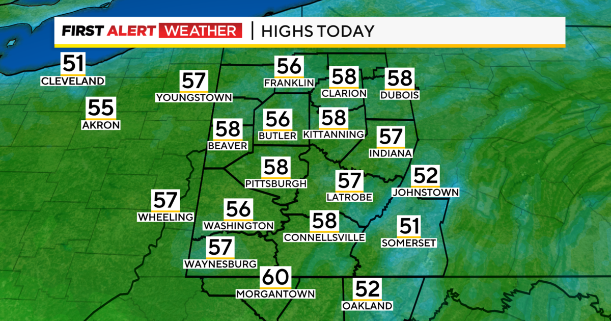
The system should have no impact on our region, with only people from Morgantown on down having any possible issues with snow.
WEATHER LINKS:
Current Conditions | School Delays & Closings | Local Radar | Weather App | Photos
Heading into the afternoon, we will begin to see winds picking up, coming out of the north northwest. They will last into the evening and overnight hours.
This, along with an upper low rotating around the base of the trough of cold air will mean lake effect snow showers coming in off of Lake Erie.
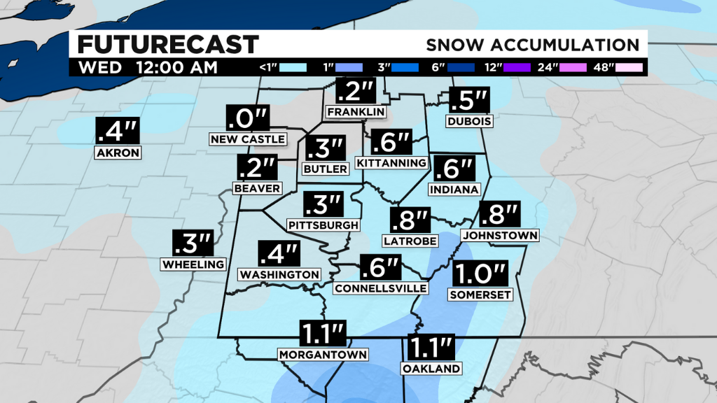
Places north of I-80, the snow belt, and the Laurels and Ridges all could see accumulating snow with traffic in many cases slowed by the snow.
Here's the 3 weather things to know heading out door in Pittsburgh:
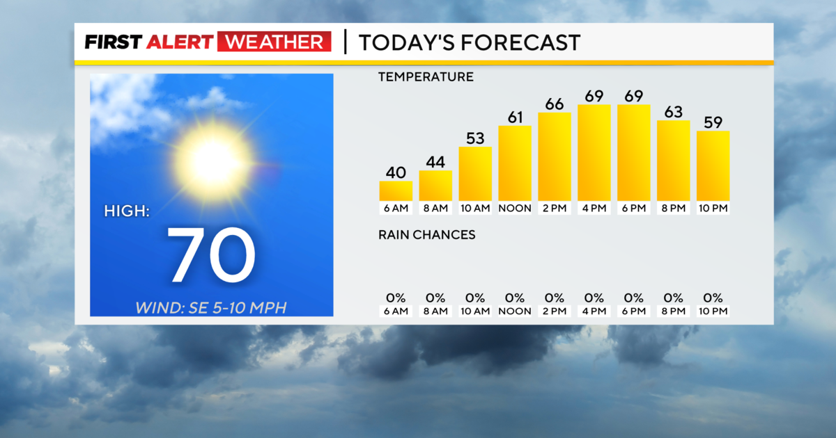
1) Cloudy, slightly cooler today than seasonal norms.
2) Lake effect snow could slow Tuesday morning travel in usual (Laurels, North of I-80) snow day spots.
3) Dry rest of work week.#YourDayPGH #KDKAwx pic.twitter.com/e0P3bkaeZo
— Ron Smiley ???? (@RonSmileyWx) December 7, 2020
Wind gusts will top 25mph in Pittsburgh and could top 35mph in elevated areas. This means not only will we see snow showers ,but also lowered visibility on roads in some places due to high wind speeds and decent snowfall.
Stay up to date with the KDKA app, which you can download here.