Pittsburgh Weather: Snow Wraps Up This Morning, Overcast Day Ahead
PITTSBURGH (KDKA) - Good morning!
We made it through a historic day of snow in western Pennsylvania with snow totals across the region ranging from as low as 6" of snow all way up to around a foot of snow.
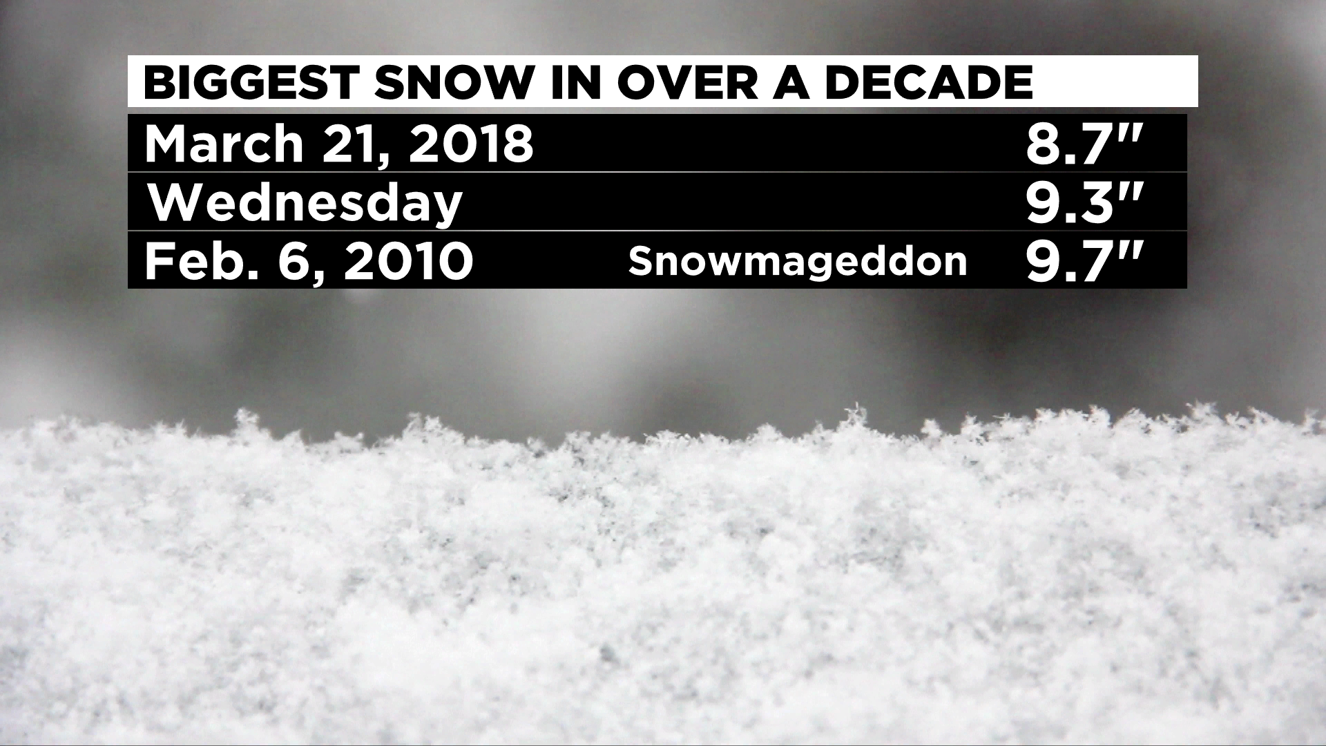
At this point, it looks like the Snowbelt counties, and specifically, Indiana County, take the prize for most snow.
Surprisingly, there are some big totals coming out of Washington County, as well. Not that they didn't have a solid chance to see a lot of snow, but I think I have seen two double-digit totals coming in from Washington County.

The snow hadn't officially stopped as of 2:00 a.m. and it appears, with relatively poor road conditions, that our winter storm warnings or at the very least, winter weather advisories will continue for the area.
If you don't have to head out in this weather throughout the morning, just stay at home.
So, what comes next?
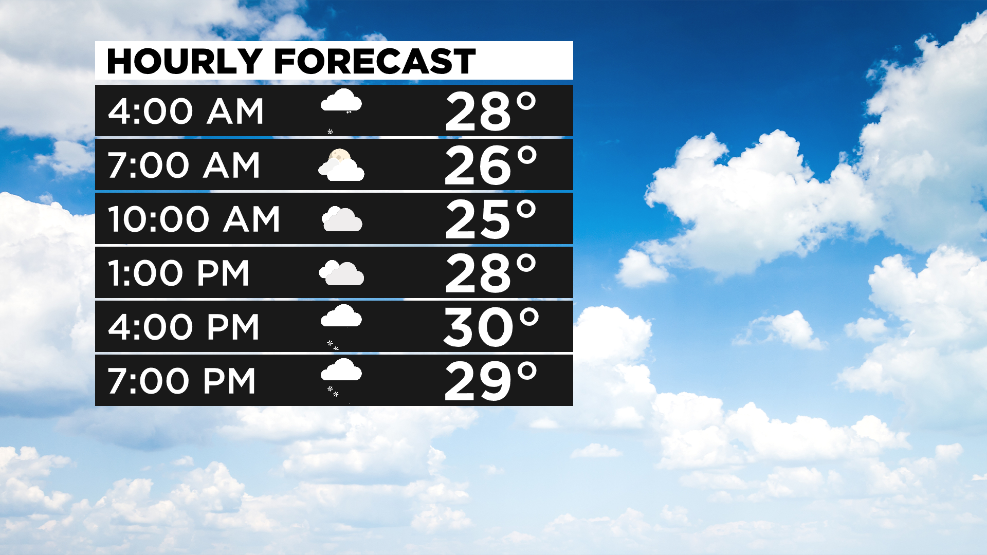
Snow from this system should wrap up well before sunrise with us looking at an overcast day. Data has continued to show light snow still possible for some through the day with maybe some additional accumulations this evening and overnight for some places.
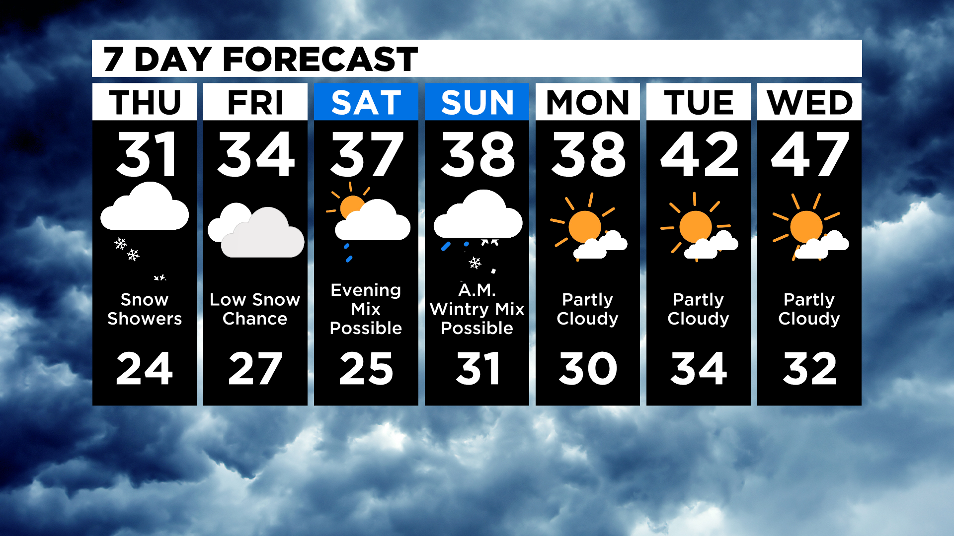
We stay overcast most of the weekend.
Dealing with temperatures, highs today will likely remain in the mid-to-low 30s. It doesn't look like we'll hit more than about 32 degrees with the overcast skies and several inches of snow on the ground.
One of my favorite high-resolution daily models is showing a high of just 30 degrees and I generally side with that model when it comes to the daily forecast.
If you have been following my discussions lately, you'll know that I have been skeptical of temperatures heading into the weekend, feeling that model data was doing a poor job of dealing with expected snow on the ground. My forecast highs will be ticking down through the weekend. Model data continues this morning to bring temperatures into the 40s starting on Saturday.
With several inches of snow on the ground, I just don't see how that is going to be possible. I don't know if we honestly see the upper 30s for high both on Saturday and Sunday. I am going to drop those highs to the mid-30s and that may still be too high.
The other issue temperatures present over the weekend is the possibility of drizzle or a wintry mix. At this point, I am just going to split the difference but the upper atmosphere is cold enough for snow, so what we see late Saturday into Sunday morning will be entirely dependent on temperatures close to the surface.