Pittsburgh Weather: Mostly Cloudy And Seasonable Saturday
PITTSBURGH (KDKA) - Today, we are waking up to lows above normal like yesterday, but it feels even colder than that in the lower 20s and upper-teens for some.
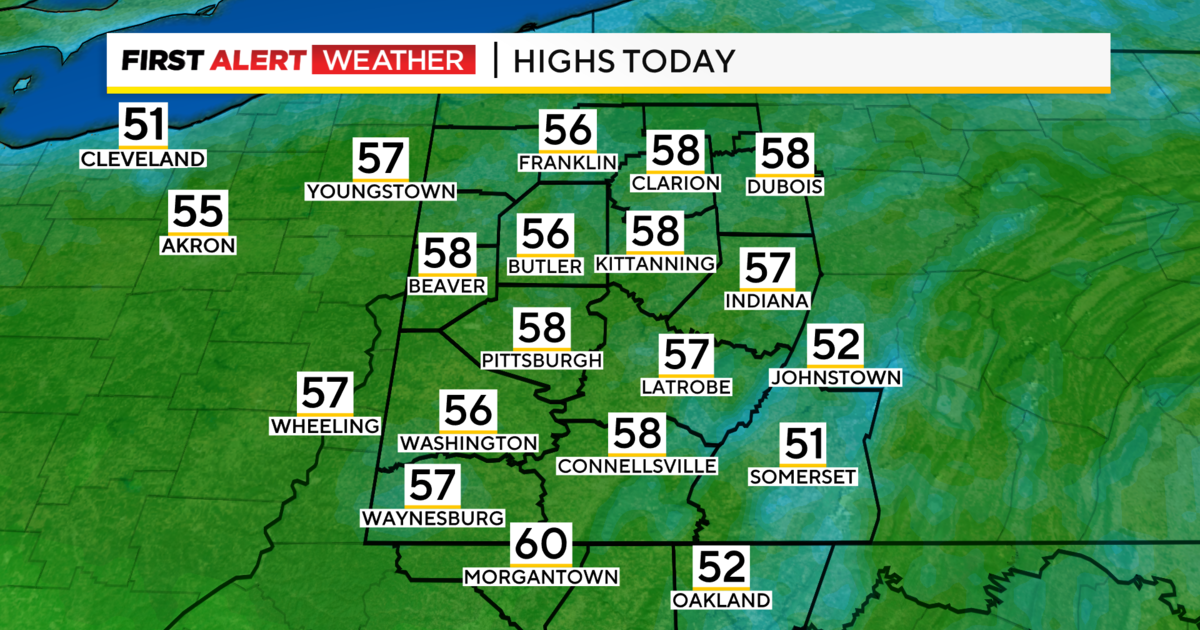
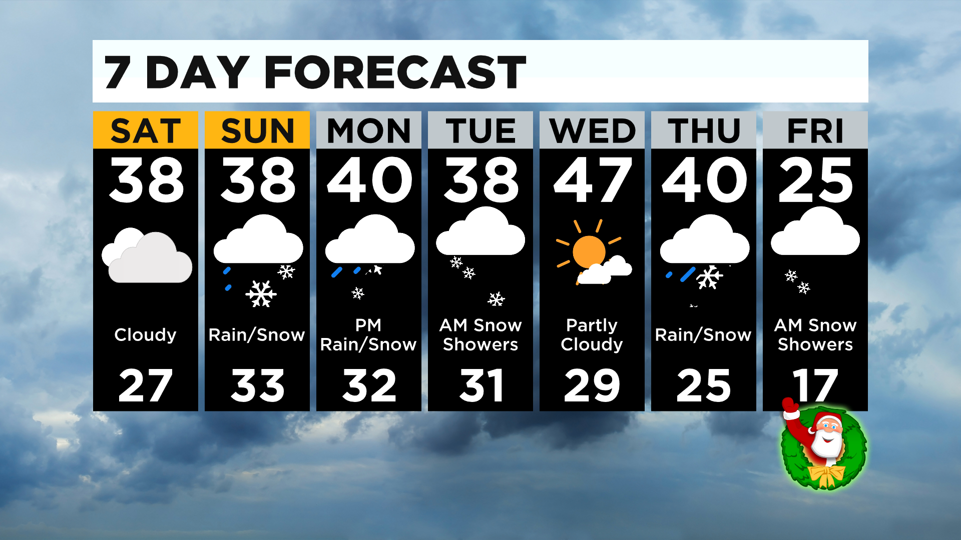
Today sets up to be seasonable, but still cold, with highs in the upper-30s.
WEATHER LINKS:
Current Conditions | School Delays & Closings | Local Radar | Weather App | Photos
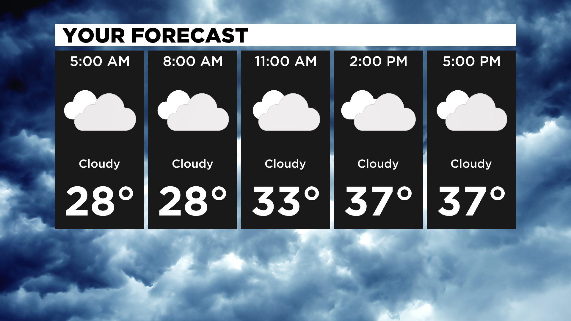
Mostly cloudy skies will last through much of the day then our next system arrives overnight through Sunday.
The system starts off as snow showers north though about 10:00 a.m. and then switches to rain and snow showers, then by the afternoon, all rain showers. It looks to wrap up by the evening.
High temperatures on Sunday will be near 40 degrees, so little-to-no snow accumulation is to be expected. Mostly everyone, except for a few spots north of I-80, should remain under an inch even for the morning snow showers.
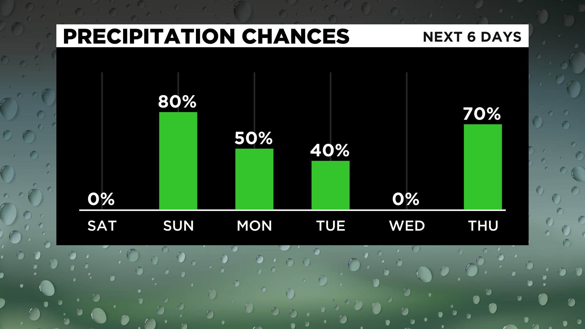
Monday, there's a chance for a few rain and snow showers at night that could linger into Tuesday with little-to-no accumulation.
Wednesday, we see temperatures in the upper-40s and maybe even a peek or two of sunshine, but don't let that fool you - we're looking at the coldest temperatures of the season to arrive by Christmas.
A white Christmas isn't out of the question just yet, either. We are still seeing a chance for a mix on Christmas Eve with highs near 40 then scattered snow showers on Christmas morning with highs only in the low-to-mid 20s and lows dropping to the teens.
Stay up to date with the KDKA app, which you can download here.