Pittsburgh Weather: Lingering Snow Chances, Cold Temperatures
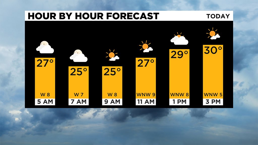
PITTSBURGH (KDKA) -- While there may still be some light snow around after sunrise this morning, it won't be much and should continue to thin out and end over the course of the rest of the morning.
Really, places north of I-80 and into the Laurels will have the best chance for lingering snow, but there should be no issues due it.
The real story today is just how cold it is expected to be for the day.
Yesterday, I forecasted today's highs hitting possibly at midnight with us likely getting back to the midnight temperature during the day.
I am now bumping up our afternoon temperature to 31 degrees so that will be our daily high.
Skies today will be partly cloudy with clearing skies overnight.
This should allow us to see temperatures near 20 degrees to start off our day on Wednesday morning.
Looking ahead, the active jetstream means a quick warm-up through the day on Wednesday with highs likely hitting the mid to upper 40s Wednesday evening. Do we hit 50 degrees?
I am also bumping up my Thursday high as warm air will continue to move in through around 2:00 a.m. on Thursday morning.
Thursday's high will be higher than Wednesday's high and at this point I think we will likely hit 50 degrees before temperatures plummet before the sun rises Thursday morning.
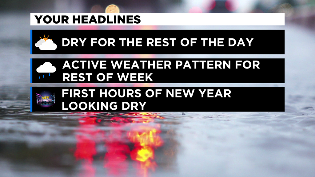
Most of Thursday 'day' is now looking dry with big rain totals possible on Friday.
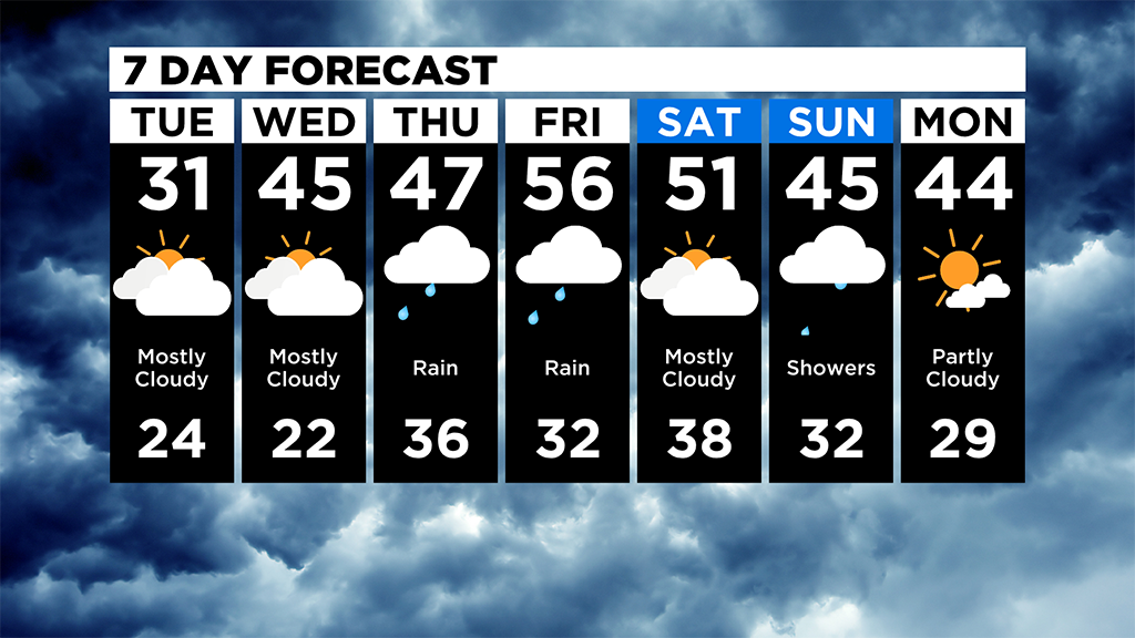
The rain chance now stretches into Saturday with temperatures slowly falling to more seasonal norms by the afternoon.
WEATHER LINKS:
Current Conditions | School Delays & Closings | Local Radar | Weather App | Photos
Stay up to date with the KDKA app, which you can download here.