Pittsburgh Weather: Overcast And Cold Conditions Expected On Thursday
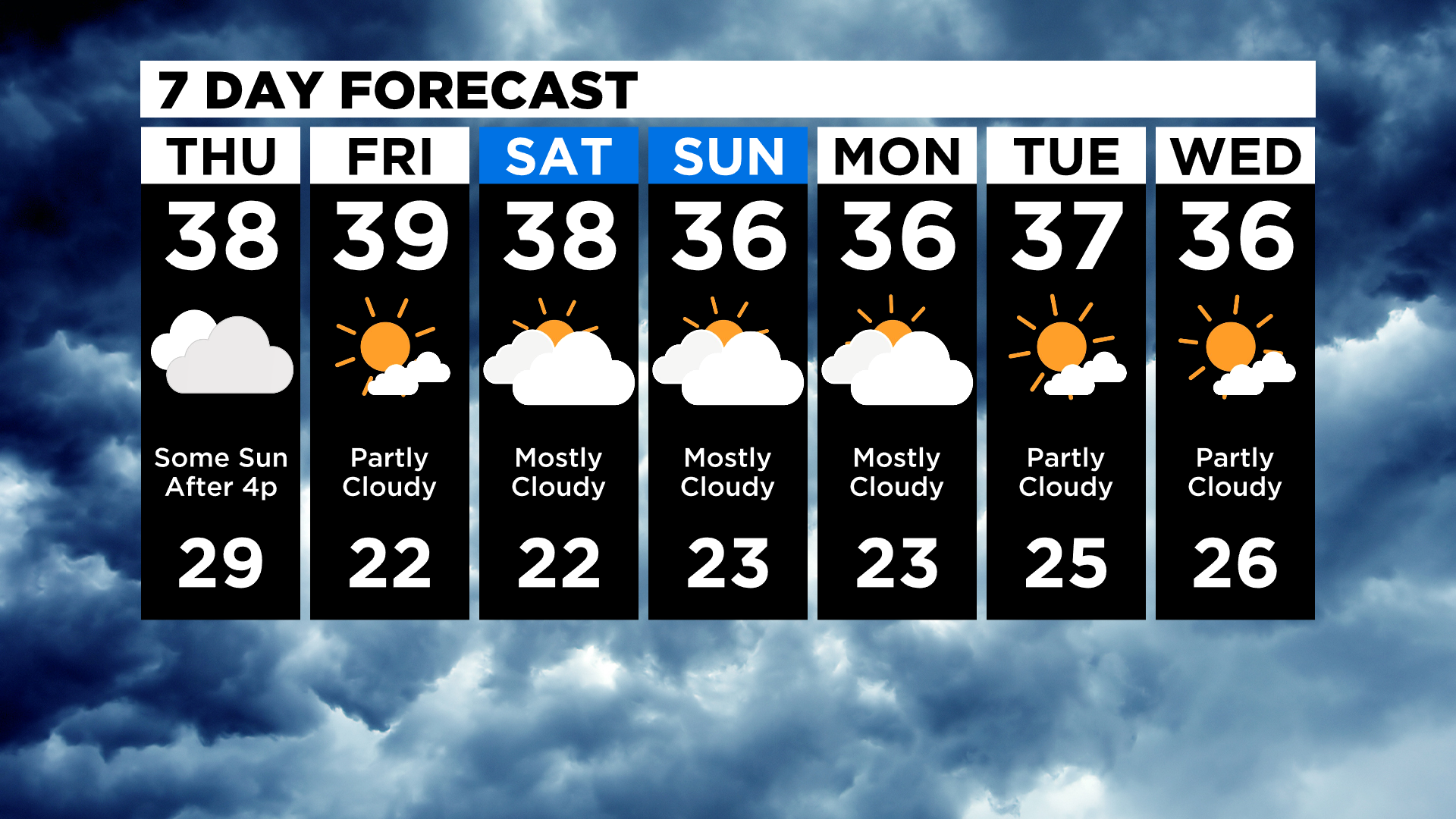
PITTSBURGH (KDKA) - Good morning, well the warm-up is going to have to wait at least another day as cloud cover sticks around through the day once again making it tough to see temperatures climbing out of the mid-30s again.
It does look like the sun breaks out late this afternoon but not in time to see temperatures really warm up.
The set-up that's been in place for the past four days has been interesting. The 540mb thickness line remains all the way down south of Virginia.
WEATHER LINKS:
Current Conditions | School Delays & Closings | Local Radar | Weather App | Photos
This is normally looked at as a good dividing line for snow vs rain. It is, however, only a guide and sometimes the atmosphere has little warm spots here or cold spots there that will screw up a forecast.
A perfect example is how far south the rain to snow line is yet we have mostly seen drizzle and mist over the past couple of days.
Take the picture here:
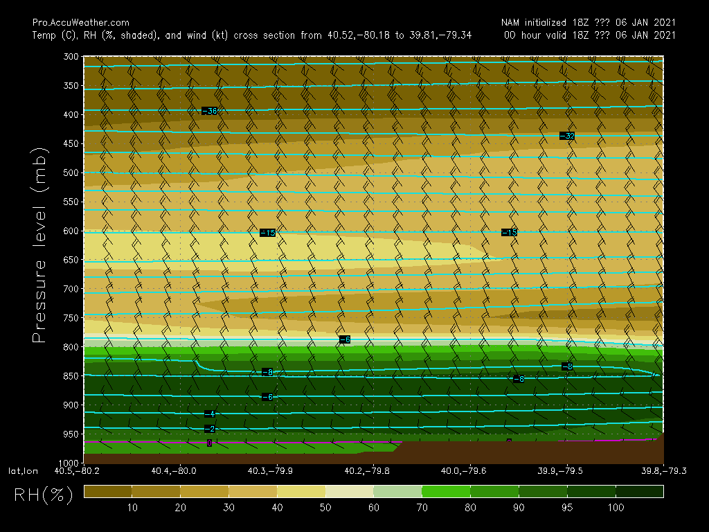
It is a slice of our atmosphere.
It starts on the left with Allegheny county and travels to Fayette County and the foothills of the Laurels on the right.
The light blue lines are lines of equal temperatures in the atmosphere. If you look close you can see the inversion at around 850mb where temperatures go from -6 to -8 and then back up to -6 degrees.
This is around 4,500 ft above the ground and it is also where our cloud layer starts. This is the inversion that continues to keep the clouds in place.
In a normal atmosphere on a sunny summer day, you see a warm layer at the surface, and then temperatures cool with height.
Those little warm spots are called temperature inversions and also cause thick cloud layers as warmer air rises, then cools. As it loses moisture due to cooling, you get a thick cloud layer and you can actually see how temperatures go up. Western Pennsylvania actually also has a couple of other things that help inversions develop including moisture coming in off of Lake Erie before the lake freezes over along with a favorable (or unfavorable if you like the sun) upslope from the northwest to the southeast.
So when cold winds blow in from the north, relatively warm water from the lake cools as it moves to the south. If winds are stronger and temperatures cold enough you get lake effect snow. If winds are light you get an inversion that brings thick clouds.
So when will this inversion break?
My hope is that it begins to break tonight and we see a mix of clouds and sun through the weekend.
Data supports this analysis but I caution that inversions are tricky and are not one of the easier things to forecast.
Heading into the weekend I have kept a conservative forecast, keeping highs in the upper 30s with lows in the mid to low 20s.
I have put in a chance for some drizzle on Saturday but besides that it looks like the next seven days have a good chance of being dry.
Stay up to date with the KDKA app, which you can download here.