Pittsburgh Weather: Warm-Up On The Way
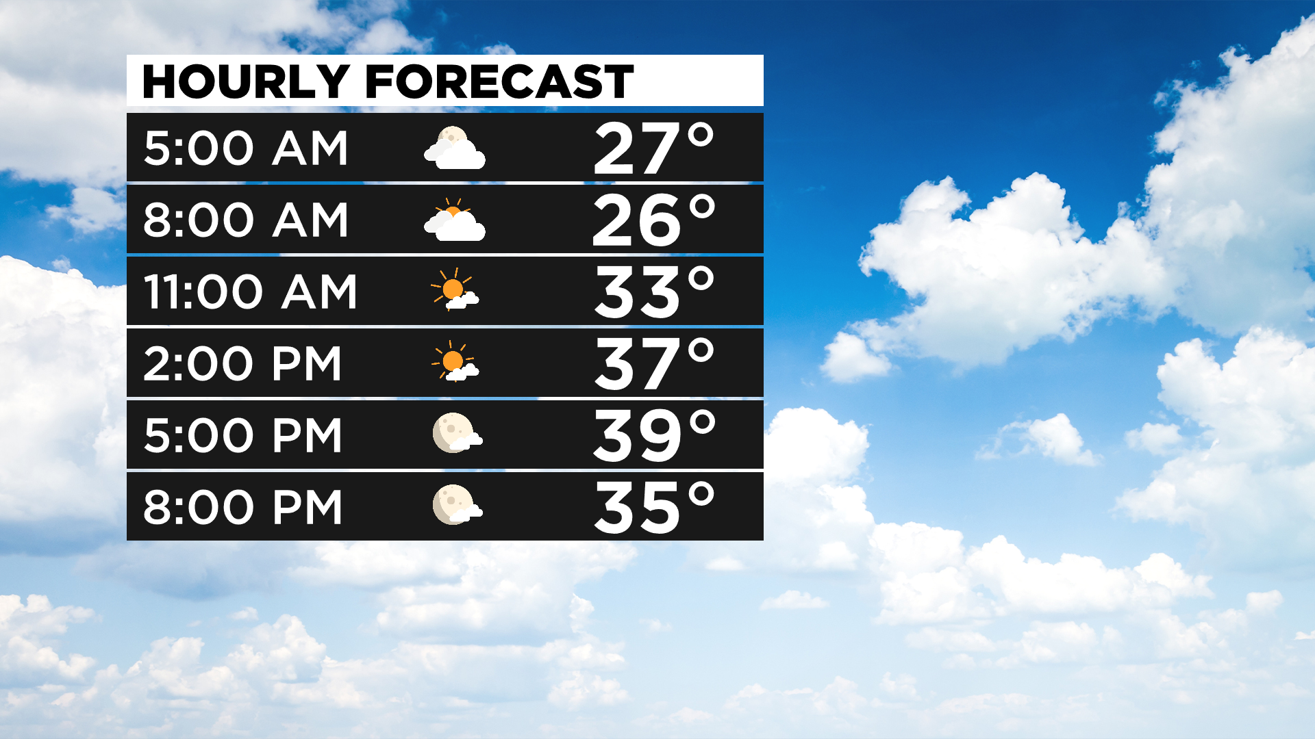
PITTSBURGH (KDKA) -- Good morning, it should be a sunny day for most of today with clouds staying north of I-80.
Yesterday's high temperature hit 39 degrees and we saw a mix of sun and clouds.
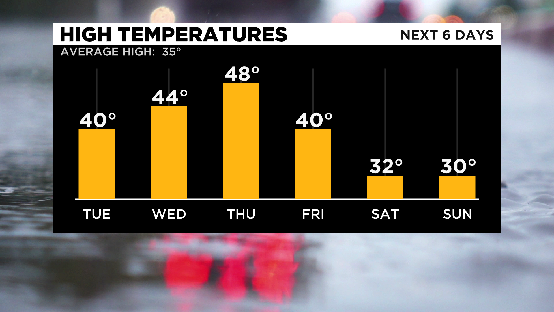
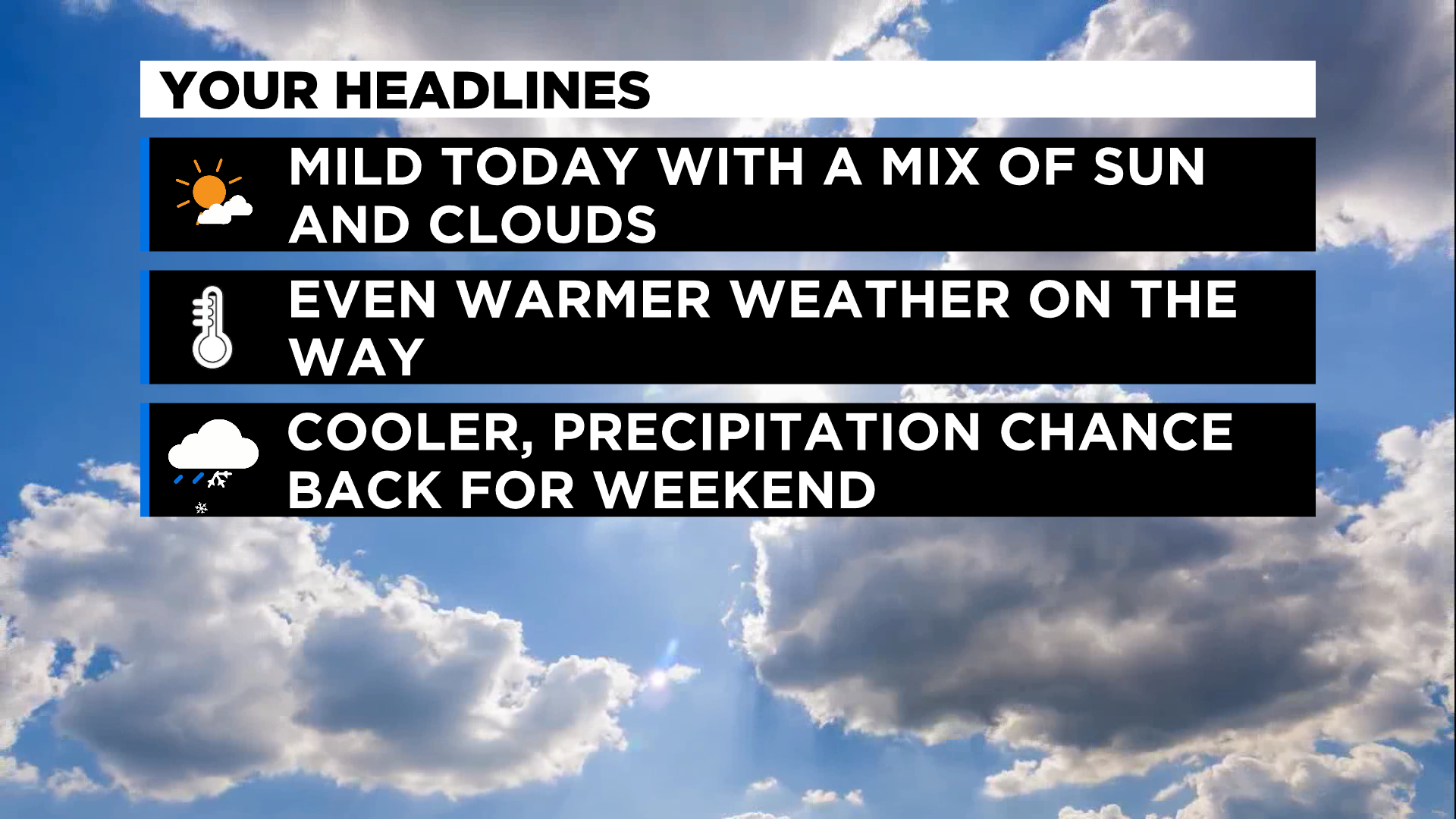
With the sunnier skies today and core temperatures warmer than yesterday, I am going to forecast highs back in the 40's today.
If we hit the 40 degree mark, it would be the first time to do so since the January 3.
Temperatures on Wednesday and Thursday will also likely hit the 40 degree mark.
The set-up today is similar to yesterday with a powerful upper low now moving into Quebec from the Hudson Bay.
Unlike yesterday it does not look like we will see the gravity waves we did yesterday that gave us off and on sunshine through the day.
Of note, yesterday was the sixth straight day of dry conditions at the Pittsburgh International Airport.
Some places did report brief and light snow in the morning.
It looks like the next shot at seeing precipitation comes on Friday.
It could be awhile before we see any significant precipitation in the area.
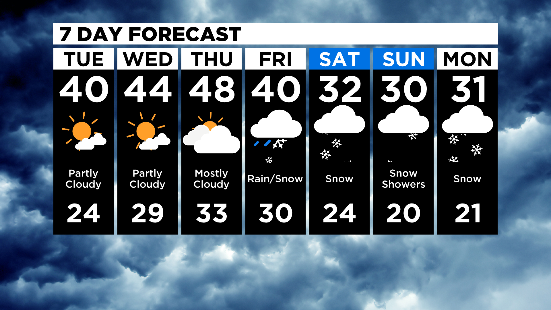
Looking out beyond a week, long range data hints at the next chance for a decent rain or snow occurring a week from this Friday.
WEATHER LINKS:
Current Conditions | School Delays & Closings | Local Radar | Weather App | Photos
Stay up to date with the KDKA app, which you can download here.