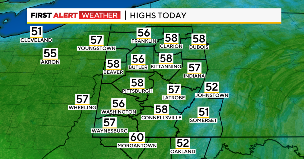
Pittsburgh Weather: Warm Thursday Gives Way To Colder Weekend
PITTSBURGH (KDKA) - Good morning!
We finally had the weather do what we expected it to do yesterday.
It's about time.
On Wednesday, we popped 43 degrees for the high, and highs today will likely be warmer than that.
WEATHER LINKS:
Current Conditions | School Delays & Closings | Local Radar | Weather App | Photos
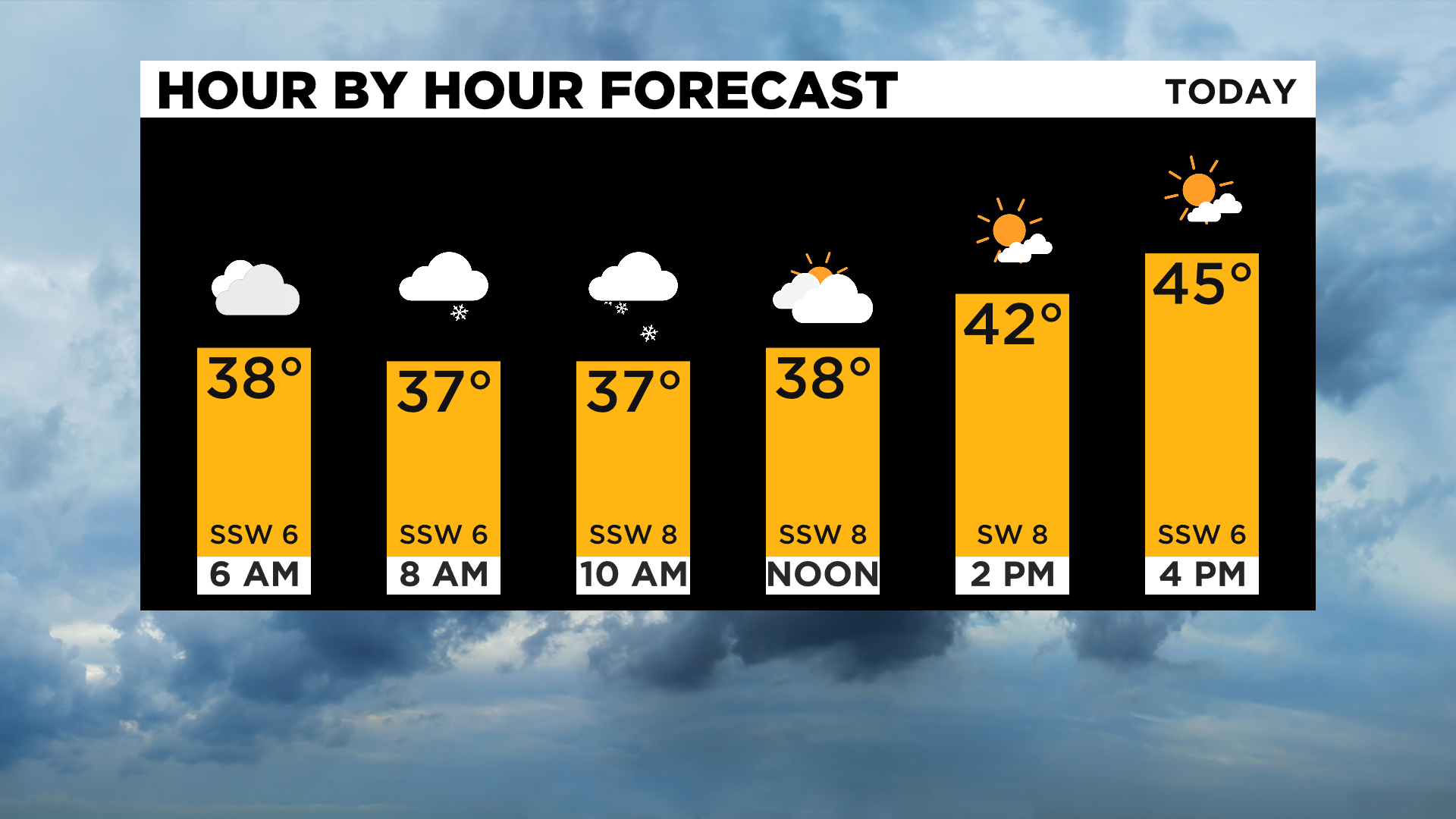
That's even with a rain and snow chance to start off the day with a couple of scattered snow showers and sprinkles around this morning.
Daily averages: High: 35, Low: 21
Sunrise: 7:42 Sunset: 5:18
You probably have a slightly better chance for seeing snow the farther north you are, but really with temperatures remaining over the freezing mark any snow you see will be gone almost as soon as it hits the ground.
Besides that, afternoon temperatures are set to soar once again today ahead of a big cool down arriving for the weekend.
How much cooler?
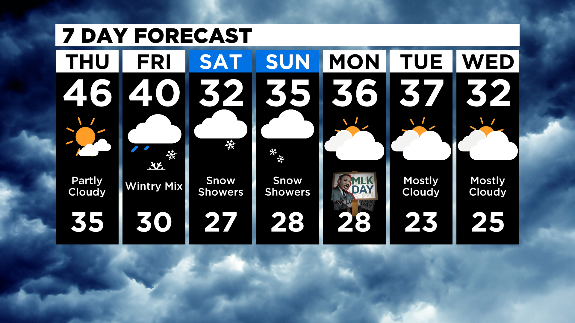
By Saturday we will see a stretch of maybe as long as a week with temperatures struggling to get back to the freezing mark.
It is going to be cold.
Just be ready for it after the second nice and mild day in a row happens today. I am forecasting a high of 46 degrees for Pittsburgh today.
The other thing we need to talk about is the timing of Friday's snow, rain, and possible sleet event.
The best news I can give right now is that it looks like most places will see temperatures right at or just above the freezing mark while it's raining/snowing/sleeting across the area. Temperatures on Friday will steadily fall behind the front so we may very well sewer a situation where the most dangerous of the weather is happening after it stops precipitating. The timing of the rain has also been pushed back, now arriving closer to noon.
This means we are back to mainly rain with snow and ice changes highest in elevated places like the Laurels.
Stay up to date with the KDKA app, which you can download here.