Pittsburgh Weather: Friday Starts Off Warm, Cold Temperatures And Snow Expected This Afternoon
PITTSBURGH (KDKA) - Good morning!
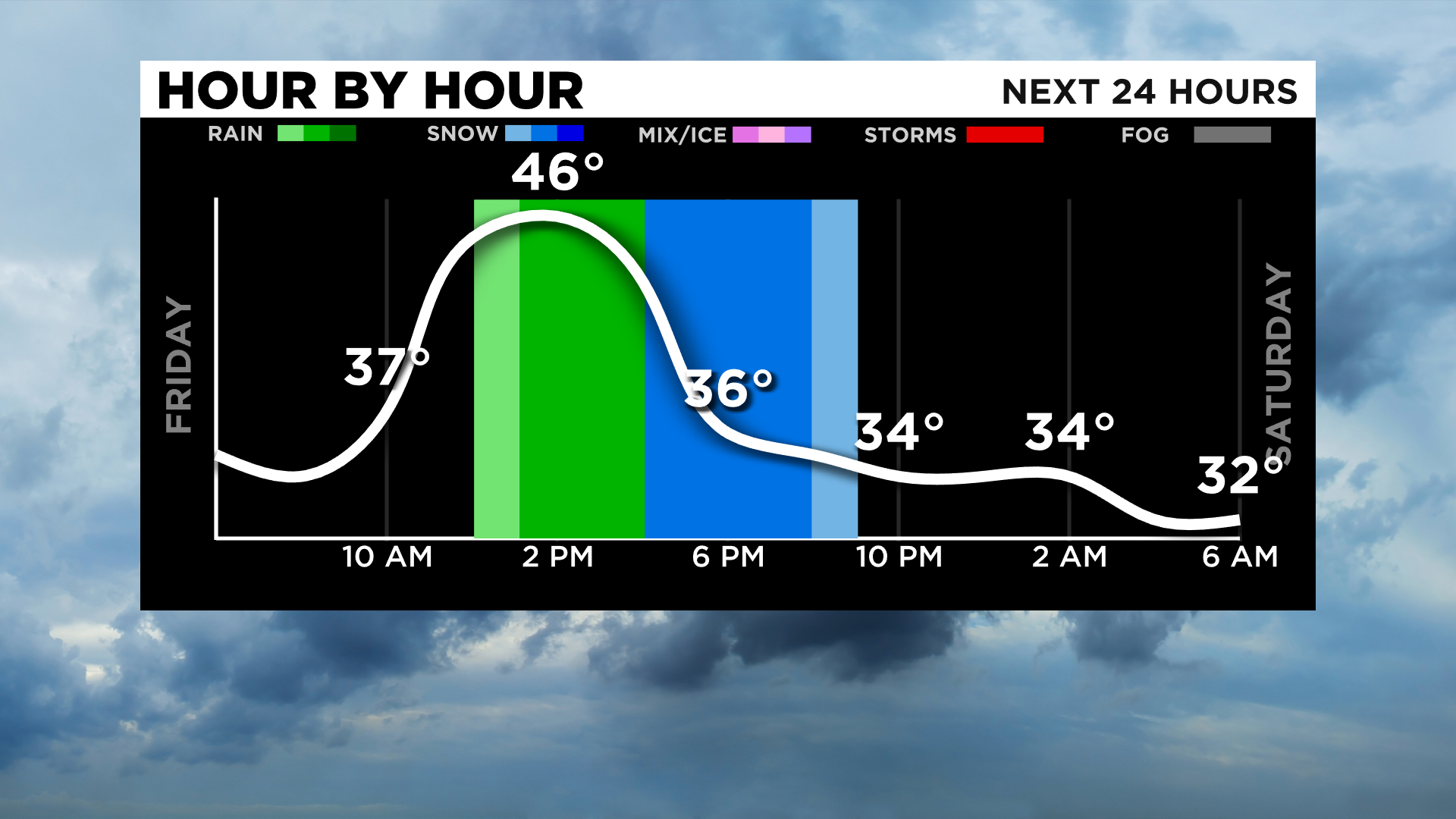
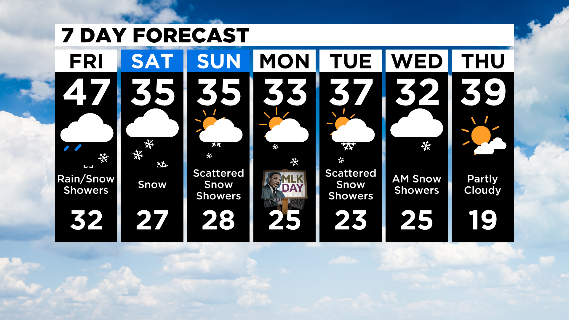
I hope you enjoyed the warmth over the past two days as temperatures will quickly be diving starting this afternoon. Technically we still get a day of warmth today, with highs likely near 40 degrees just ahead of expected rain and snow that arrives this afternoon.
At this point, with the later arrival of precipitation, it appears that sleet is out of the mix with most seeing just a mix of snow and rain. While I cannot rule out sleet completely, the chance for seeing any is pretty small it seems.
WEATHER LINKS:
Current Conditions | School Delays & Closings | Local Radar | Weather App | Photos
Yesterday's high temperature hit 45 degrees with surprisingly just a trace of snow and rain reported at the airport. I talked to John Shumway yesterday about what the chance for precipitation means and how we come up with what is let's say a 30 percent chance for rain.
It's complicated and one of the reasons we generally rely on words like isolated, scattered, and widespread rain during times of the day to more accurately detail what's happening outside your home.
So today's weather will start off with the same air mass in place that we saw yesterday with a deep flow of moisture rushing north just ahead of a fast-moving upper low that will roll by over the weekend.
I'd first like to start by saying that upper lows are notoriously tricky in when and where rain and snow are going to set up. The track of this upper low is set for the center of the system to roll right over us on Saturday night into Sunday morning. Winds ahead of the system will continue to be out of the south with northerly winds gusting in once the center of the system moves to our east.
For today that means highs will be back into the 40s for most of the day with temperatures falling pretty quickly after the initial round of rain this afternoon. That is due to a lowering of temperature heights or basically a cooling of the atmosphere. Expect cloudy skies through not only today but the entire weekend as this system rolls by.
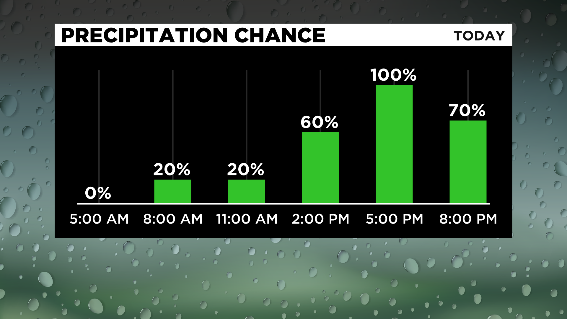
The good news is that rain and snow chances continue to be pushed back, with most places dry through 3:00 p.m. now.
The later the rain chance the better the chance we will be dealing with just rain and snow and that really looks like the case at this point. Little to no accumulation should be expected for everywhere but the Laurels and the snow belt (including parts of northern Armstrong and Indiana County) for today with accumulating snow possible on Saturday and Sunday.
At this point, any accumulations of snow will not be a lot.
Finally while highs today will likely reach back into the 40s, highs for the rest of the weekend into next week won't be as warm and should return to being more seasonal.
Stay up to date with the KDKA app, which you can download here.